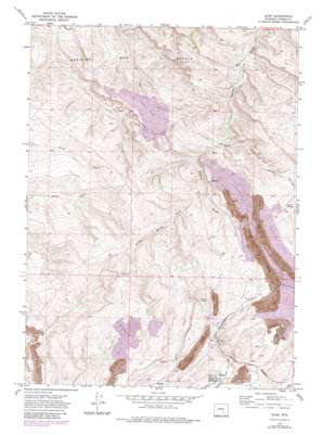
Elmo Topo Map Wyoming
To zoom in, hover over the map of Elmo
USGS Topo Quad 41106h5 - 1:24,000 scale
| Topo Map Name: | Elmo |
| USGS Topo Quad ID: | 41106h5 |
| Print Size: | ca. 21 1/4" wide x 27" high |
| Southeast Coordinates: | 41.875° N latitude / 106.5° W longitude |
| Map Center Coordinates: | 41.9375° N latitude / 106.5625° W longitude |
| U.S. State: | WY |
| Filename: | o41106h5.jpg |
| Download Map JPG Image: | Elmo topo map 1:24,000 scale |
| Map Type: | Topographic |
| Topo Series: | 7.5´ |
| Map Scale: | 1:24,000 |
| Source of Map Images: | United States Geological Survey (USGS) |
| Alternate Map Versions: |
Elmo WY 1971, updated 1975 Download PDF Buy paper map Elmo WY 1971, updated 1983 Download PDF Buy paper map Elmo WY 2012 Download PDF Buy paper map Elmo WY 2015 Download PDF Buy paper map |
1:24,000 Topo Quads surrounding Elmo
> Back to 41106e1 at 1:100,000 scale
> Back to 41106a1 at 1:250,000 scale
> Back to U.S. Topo Maps home
Elmo topo map: Gazetteer
Elmo: Dams
Antelope Dam elevation 2129m 6984′Elmo: Mines
Elmo Peacock Mine elevation 2114m 6935′Hanna and Dravo Mine elevation 2248m 7375′
Hanna Number One Strip Mine elevation 2145m 7037′
McMillen Mine elevation 2146m 7040′
Nugget Mine elevation 2138m 7014′
Red Mountain Mine elevation 2174m 7132′
Rosebud Pit Number Eight elevation 2167m 7109′
Rosebud Pit Number Five elevation 2214m 7263′
Rosebud Pit Number Three elevation 2146m 7040′
Rosebud Strip Mine elevation 2143m 7030′
Seminoe Number Two Mine elevation 2149m 7050′
Elmo: Populated Places
Elmo elevation 2096m 6876′Elmo: Ranges
Medicine Bow Breaks elevation 2045m 6709′Elmo: Reservoirs
Antelope Reservoir elevation 2129m 6984′Elmo: Springs
Barrel Spring elevation 2143m 7030′Elmo: Valleys
Barrel Springs Draw elevation 2066m 6778′Willow Spring Draw elevation 2106m 6909′
Elmo digital topo map on disk
Buy this Elmo topo map showing relief, roads, GPS coordinates and other geographical features, as a high-resolution digital map file on DVD:
Eastern Wyoming & Western South Dakota
Buy digital topo maps: Eastern Wyoming & Western South Dakota


