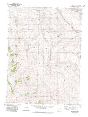
Smiley Draw Topo Map Wyoming
To zoom in, hover over the map of Smiley Draw
USGS Topo Quad 41107b5 - 1:24,000 scale
| Topo Map Name: | Smiley Draw |
| USGS Topo Quad ID: | 41107b5 |
| Print Size: | ca. 21 1/4" wide x 27" high |
| Southeast Coordinates: | 41.125° N latitude / 107.5° W longitude |
| Map Center Coordinates: | 41.1875° N latitude / 107.5625° W longitude |
| U.S. State: | WY |
| Filename: | o41107b5.jpg |
| Download Map JPG Image: | Smiley Draw topo map 1:24,000 scale |
| Map Type: | Topographic |
| Topo Series: | 7.5´ |
| Map Scale: | 1:24,000 |
| Source of Map Images: | United States Geological Survey (USGS) |
| Alternate Map Versions: |
Baggs NE WY 1975, updated 1978 Download PDF Buy paper map Smiley Draw WY 1982, updated 1983 Download PDF Buy paper map Smiley Draw WY 2012 Download PDF Buy paper map Smiley Draw WY 2015 Download PDF Buy paper map |
1:24,000 Topo Quads surrounding Smiley Draw
> Back to 41107a1 at 1:100,000 scale
> Back to 41106a1 at 1:250,000 scale
> Back to U.S. Topo Maps home
Smiley Draw topo map: Gazetteer
Smiley Draw: Basins
Wild Horse Basin elevation 2062m 6765′Smiley Draw: Cliffs
Deep Creek Rim elevation 2113m 6932′Smiley Draw: Springs
Big Spring elevation 2025m 6643′Smiley Spring elevation 2087m 6847′
Smiley Draw: Summits
Deep Creek Butte elevation 2045m 6709′Little Wild Horse Buttes elevation 2142m 7027′
Wild Horse Butte elevation 2216m 7270′
Smiley Draw: Valleys
Smiley Draw elevation 2018m 6620′Trough Spring Draw elevation 1965m 6446′
Smiley Draw digital topo map on disk
Buy this Smiley Draw topo map showing relief, roads, GPS coordinates and other geographical features, as a high-resolution digital map file on DVD:
Eastern Wyoming & Western South Dakota
Buy digital topo maps: Eastern Wyoming & Western South Dakota


