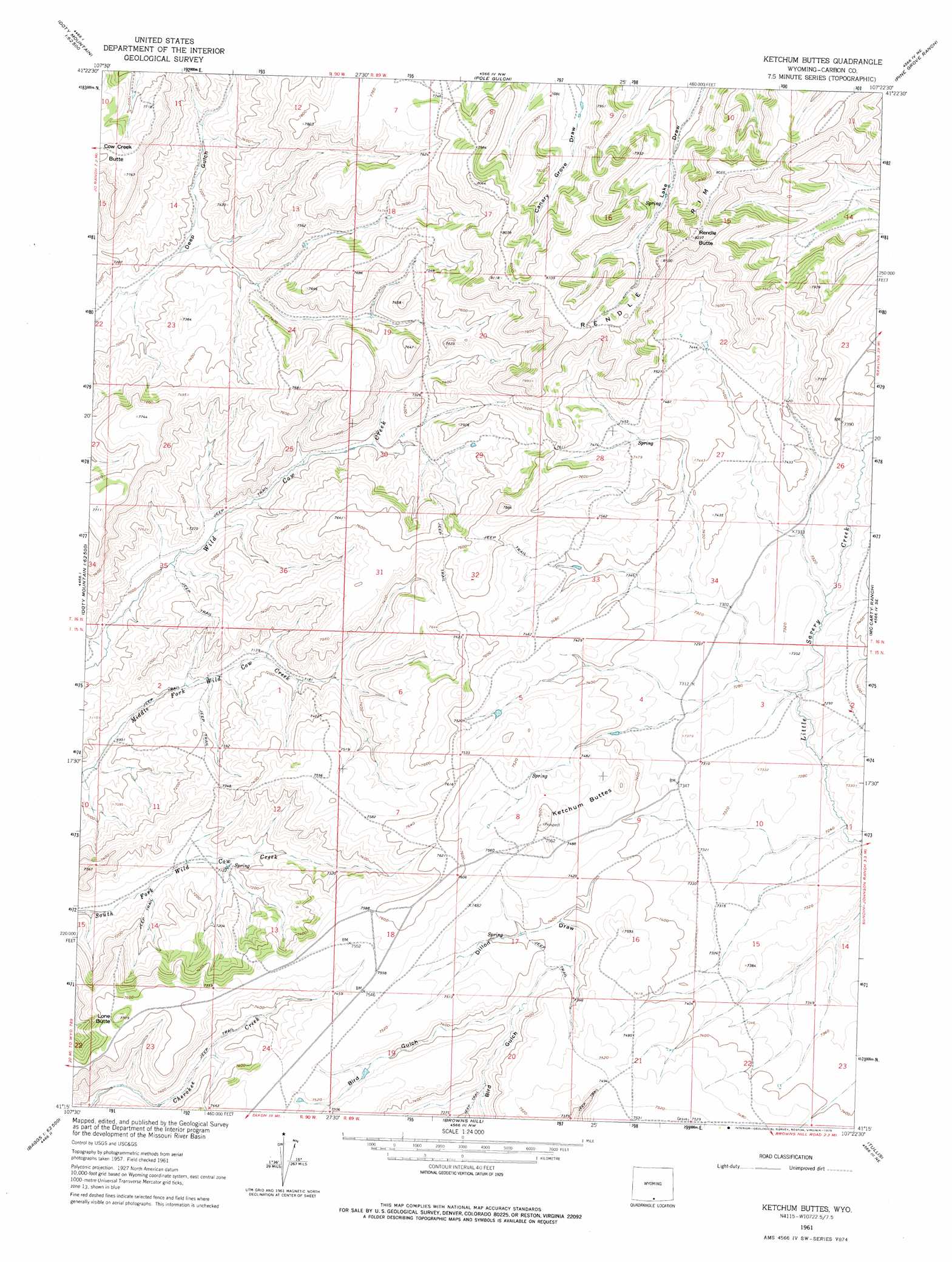
Ketchum Buttes Topo Map Wyoming
To zoom in, hover over the map of Ketchum Buttes
USGS Topo Quad 41107c4 - 1:24,000 scale
| Topo Map Name: | Ketchum Buttes |
| USGS Topo Quad ID: | 41107c4 |
| Print Size: | ca. 21 1/4" wide x 27" high |
| Southeast Coordinates: | 41.25° N latitude / 107.375° W longitude |
| Map Center Coordinates: | 41.3125° N latitude / 107.4375° W longitude |
| U.S. State: | WY |
| Filename: | o41107c4.jpg |
| Download Map JPG Image: | Ketchum Buttes topo map 1:24,000 scale |
| Map Type: | Topographic |
| Topo Series: | 7.5´ |
| Map Scale: | 1:24,000 |
| Source of Map Images: | United States Geological Survey (USGS) |
| Alternate Map Versions: |
Ketchum Buttes WY 1961, updated 1963 Download PDF Buy paper map Ketchum Buttes WY 1961, updated 1975 Download PDF Buy paper map Ketchum Buttes WY 2012 Download PDF Buy paper map Ketchum Buttes WY 2015 Download PDF Buy paper map |
1:24,000 Topo Quads surrounding Ketchum Buttes
Seaverson Reservoir |
Fillmore Ranch |
Bridge Pass |
La Marsh Creek West |
La Marsh Creek East |
Doty Mountain |
Sulphur Springs |
Pole Gulch |
Pine Grove Ranch |
Middlewood Hill |
Blue Gap |
Garden Gulch |
Ketchum Buttes |
Mccarty Ranch |
Divide Peak |
Peach Orchard Flat |
Smiley Draw |
Browns Hill |
Tullis |
Singer Peak |
Baggs |
Dixon |
Savery |
Grieve Reservoir |
Cottonwood Rim |
> Back to 41107a1 at 1:100,000 scale
> Back to 41106a1 at 1:250,000 scale
> Back to U.S. Topo Maps home
Ketchum Buttes topo map: Gazetteer
Ketchum Buttes: Cliffs
Rendle Rim elevation 2456m 8057′Ketchum Buttes: Mines
Cloudy Group Claims elevation 2252m 7388′Del Ore Number Six Mine elevation 2247m 7372′
Del Oro Number Two Mine elevation 2287m 7503′
Friday Claim Group Mine elevation 2252m 7388′
Ketchum Buttes Mine elevation 2287m 7503′
Siwash Claims elevation 2216m 7270′
Ketchum Buttes: Summits
Ketchum Buttes elevation 2289m 7509′Lone Butte elevation 2342m 7683′
Rendle Butte elevation 2507m 8225′
Ketchum Buttes: Valleys
Dillon Draw elevation 2228m 7309′Ketchum Buttes digital topo map on disk
Buy this Ketchum Buttes topo map showing relief, roads, GPS coordinates and other geographical features, as a high-resolution digital map file on DVD:
Eastern Wyoming & Western South Dakota
Buy digital topo maps: Eastern Wyoming & Western South Dakota