Creston Junction Topo Map Wyoming
To zoom in, hover over the map of Creston Junction
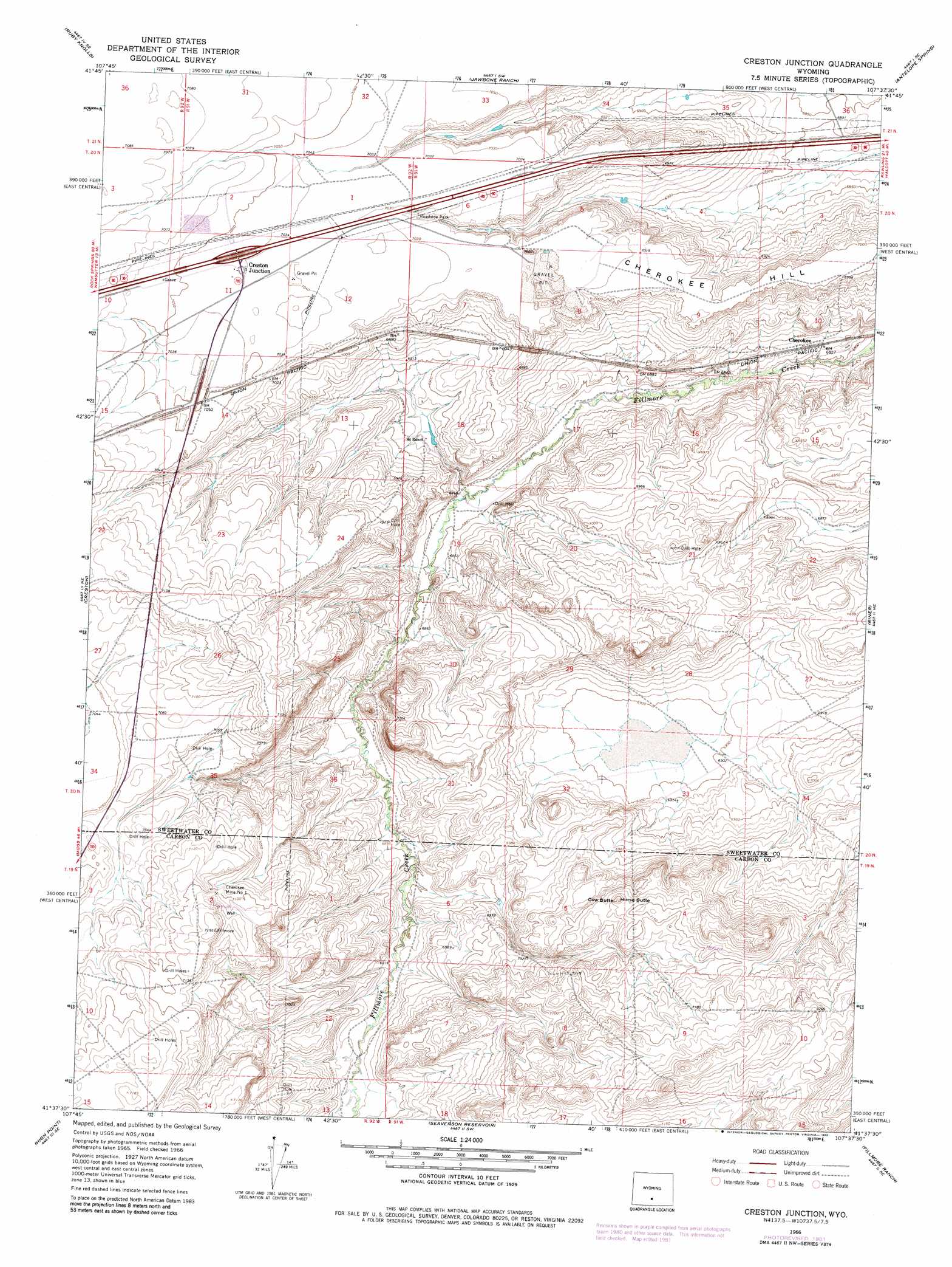
USGS Topo Quad 41107f6 - 1:24,000 scale
| Topo Map Name: | Creston Junction |
| USGS Topo Quad ID: | 41107f6 |
| Print Size: | ca. 21 1/4" wide x 27" high |
| Southeast Coordinates: | 41.625° N latitude / 107.625° W longitude |
| Map Center Coordinates: | 41.6875° N latitude / 107.6875° W longitude |
| U.S. State: | WY |
| Filename: | o41107f6.jpg |
| Download Map JPG Image: | Creston Junction topo map 1:24,000 scale |
| Map Type: | Topographic |
| Topo Series: | 7.5´ |
| Map Scale: | 1:24,000 |
| Source of Map Images: | United States Geological Survey (USGS) |
| Alternate Map Versions: |
Creston Junction WY 1966, updated 1969 Download PDF Buy paper map Creston Junction WY 1966, updated 1982 Download PDF Buy paper map Creston Junction WY 2012 Download PDF Buy paper map Creston Junction WY 2015 Download PDF Buy paper map |
1:24,000 Topo Quads surrounding Creston Junction
Hansen Lake |
Hansen Lake Ne |
Larsen Knoll |
Buck Draw |
Shamrock Hills |
Monument Lake |
Ruby Knolls |
Jawbone Ranch |
Antelope Spring |
Rawlins Peak Sw |
Wamsutter |
Creston |
Creston Junction |
Riner |
Separation Peak |
Eightmile Lake |
High Point |
Seaverson Reservoir |
Fillmore Ranch |
Bridge Pass |
Mexican Flats Nw |
Duck Lake |
Doty Mountain |
Sulphur Springs |
Pole Gulch |
> Back to 41107e1 at 1:100,000 scale
> Back to 41106a1 at 1:250,000 scale
> Back to U.S. Topo Maps home
Creston Junction topo map: Gazetteer
Creston Junction: Mines
Cherokee Mine elevation 2087m 6847′Cherokee Mine Number 1 elevation 2170m 7119′
Cherokee Project Number One Mine elevation 2113m 6932′
Cherokee Project Number Two Mine elevation 2136m 7007′
Creston Junction: Populated Places
Creston Junction elevation 2147m 7043′Creston Junction: Summits
Cherokee Hill elevation 2140m 7020′Cow Butte elevation 2181m 7155′
Horse Butte elevation 2178m 7145′
Creston Junction digital topo map on disk
Buy this Creston Junction topo map showing relief, roads, GPS coordinates and other geographical features, as a high-resolution digital map file on DVD:
Eastern Wyoming & Western South Dakota
Buy digital topo maps: Eastern Wyoming & Western South Dakota