Jawbone Ranch Topo Map Wyoming
To zoom in, hover over the map of Jawbone Ranch
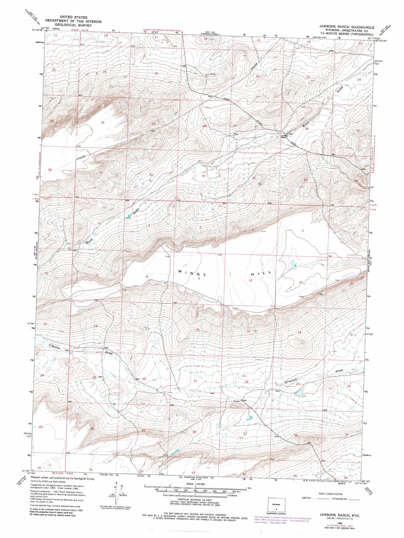
USGS Topo Quad 41107g6 - 1:24,000 scale
| Topo Map Name: | Jawbone Ranch |
| USGS Topo Quad ID: | 41107g6 |
| Print Size: | ca. 21 1/4" wide x 27" high |
| Southeast Coordinates: | 41.75° N latitude / 107.625° W longitude |
| Map Center Coordinates: | 41.8125° N latitude / 107.6875° W longitude |
| U.S. State: | WY |
| Filename: | o41107g6.jpg |
| Download Map JPG Image: | Jawbone Ranch topo map 1:24,000 scale |
| Map Type: | Topographic |
| Topo Series: | 7.5´ |
| Map Scale: | 1:24,000 |
| Source of Map Images: | United States Geological Survey (USGS) |
| Alternate Map Versions: |
Jawbone Ranch WY 1966, updated 1969 Download PDF Buy paper map Jawbone Ranch WY 1966, updated 1981 Download PDF Buy paper map Jawbone Ranch WY 2012 Download PDF Buy paper map Jawbone Ranch WY 2015 Download PDF Buy paper map |
1:24,000 Topo Quads surrounding Jawbone Ranch
Battle Spring |
Sooner Reservoir |
Chicken Spring |
Bull Spring |
Separation Rim |
Hansen Lake |
Hansen Lake Ne |
Larsen Knoll |
Buck Draw |
Shamrock Hills |
Monument Lake |
Ruby Knolls |
Jawbone Ranch |
Antelope Spring |
Rawlins Peak Sw |
Wamsutter |
Creston |
Creston Junction |
Riner |
Separation Peak |
Eightmile Lake |
High Point |
Seaverson Reservoir |
Fillmore Ranch |
Bridge Pass |
> Back to 41107e1 at 1:100,000 scale
> Back to 41106a1 at 1:250,000 scale
> Back to U.S. Topo Maps home
Jawbone Ranch digital topo map on disk
Buy this Jawbone Ranch topo map showing relief, roads, GPS coordinates and other geographical features, as a high-resolution digital map file on DVD:
Eastern Wyoming & Western South Dakota
Buy digital topo maps: Eastern Wyoming & Western South Dakota