Hansen Lake Topo Map Wyoming
To zoom in, hover over the map of Hansen Lake
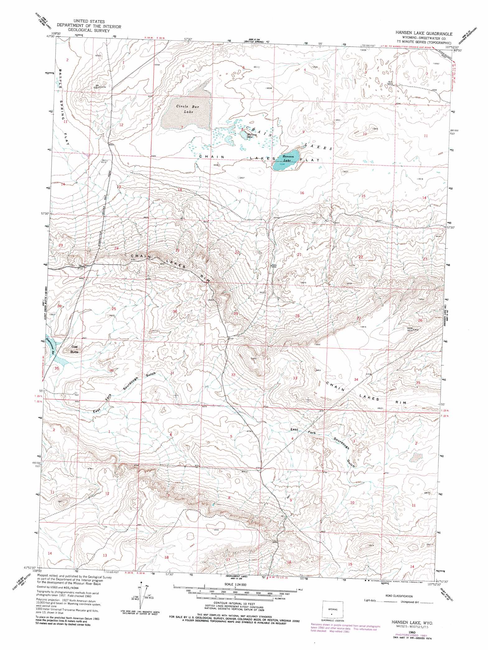
USGS Topo Quad 41107h8 - 1:24,000 scale
| Topo Map Name: | Hansen Lake |
| USGS Topo Quad ID: | 41107h8 |
| Print Size: | ca. 21 1/4" wide x 27" high |
| Southeast Coordinates: | 41.875° N latitude / 107.875° W longitude |
| Map Center Coordinates: | 41.9375° N latitude / 107.9375° W longitude |
| U.S. State: | WY |
| Filename: | o41107h8.jpg |
| Download Map JPG Image: | Hansen Lake topo map 1:24,000 scale |
| Map Type: | Topographic |
| Topo Series: | 7.5´ |
| Map Scale: | 1:24,000 |
| Source of Map Images: | United States Geological Survey (USGS) |
| Alternate Map Versions: |
Hansen Lake WY 1960, updated 1962 Download PDF Buy paper map Hansen Lake WY 1960, updated 1978 Download PDF Buy paper map Hansen Lake WY 1960, updated 1981 Download PDF Buy paper map Hansen Lake WY 2012 Download PDF Buy paper map Hansen Lake WY 2015 Download PDF Buy paper map |
1:24,000 Topo Quads surrounding Hansen Lake
Cyclone Draw |
Osborne Draw |
Antelope Reservoir |
Osborne Well |
Hadsell Spring |
Lost Creek Lake |
Eagles Nest Draw |
Battle Spring |
Sooner Reservoir |
Chicken Spring |
Lost Creek Butte Nw |
Lost Creek Butte |
Hansen Lake |
Hansen Lake Ne |
Larsen Knoll |
Lost Creek Butte Sw |
Dennison Cap |
Monument Lake |
Ruby Knolls |
Jawbone Ranch |
Red Desert Nw |
Red Desert |
Wamsutter |
Creston |
Creston Junction |
> Back to 41107e1 at 1:100,000 scale
> Back to 41106a1 at 1:250,000 scale
> Back to U.S. Topo Maps home
Hansen Lake topo map: Gazetteer
Hansen Lake: Cliffs
Chain Lakes Rim elevation 2081m 6827′Hansen Lake: Lakes
Circle Bar Lake elevation 1974m 6476′Hansen Lake elevation 1982m 6502′
McCann Lake elevation 1982m 6502′
Hansen Lake: Mines
Sourdough Butte Mine elevation 2023m 6637′Sourdough Butte Mine elevation 2023m 6637′
Hansen Lake: Summits
Coal Butte elevation 2040m 6692′Hansen Lake digital topo map on disk
Buy this Hansen Lake topo map showing relief, roads, GPS coordinates and other geographical features, as a high-resolution digital map file on DVD:
Eastern Wyoming & Western South Dakota
Buy digital topo maps: Eastern Wyoming & Western South Dakota