Erickson-Kent Ranch Topo Map Wyoming
To zoom in, hover over the map of Erickson-Kent Ranch
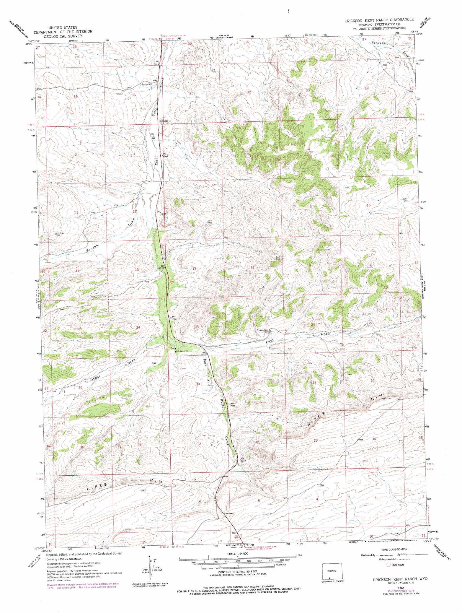
USGS Topo Quad 41108b7 - 1:24,000 scale
| Topo Map Name: | Erickson-Kent Ranch |
| USGS Topo Quad ID: | 41108b7 |
| Print Size: | ca. 21 1/4" wide x 27" high |
| Southeast Coordinates: | 41.125° N latitude / 108.75° W longitude |
| Map Center Coordinates: | 41.1875° N latitude / 108.8125° W longitude |
| U.S. State: | WY |
| Filename: | o41108b7.jpg |
| Download Map JPG Image: | Erickson-Kent Ranch topo map 1:24,000 scale |
| Map Type: | Topographic |
| Topo Series: | 7.5´ |
| Map Scale: | 1:24,000 |
| Source of Map Images: | United States Geological Survey (USGS) |
| Alternate Map Versions: |
Erickson-Kent Ranch WY 1963, updated 1966 Download PDF Buy paper map Erickson-Kent Ranch WY 1963, updated 1978 Download PDF Buy paper map Erickson-Kent Ranch WY 2012 Download PDF Buy paper map Erickson-Kent Ranch WY 2015 Download PDF Buy paper map |
1:24,000 Topo Quads surrounding Erickson-Kent Ranch
Lion Bluffs |
Camel Rock |
Cooper Ridge Ne |
Sand Butte Rim Nw |
Antelope Flats |
South Baxter |
Mud Springs Ranch |
Burley Draw |
Pine Butte |
Sand Butte Rim Se |
Titsworth Gap |
Potter Mountain |
Erickson-Kent Ranch |
Chicken Creek West |
Chicken Creek East |
Red Creek Ranch |
Four J Rim |
Scrivner Butte |
Chicken Creek Sw |
Chicken Creek Se |
Willow Creek Butte |
Beaver Basin |
Sparks |
Sugarloaf Butte |
Hiawatha |
> Back to 41108a1 at 1:100,000 scale
> Back to 41108a1 at 1:250,000 scale
> Back to U.S. Topo Maps home
Erickson-Kent Ranch topo map: Gazetteer
Erickson-Kent Ranch: Cliffs
Rifes Rim elevation 2358m 7736′Erickson-Kent Ranch: Valleys
Brooks Draw elevation 2132m 6994′East Draw elevation 2171m 7122′
West Draw elevation 2164m 7099′
Erickson-Kent Ranch digital topo map on disk
Buy this Erickson-Kent Ranch topo map showing relief, roads, GPS coordinates and other geographical features, as a high-resolution digital map file on DVD: