Antelope Flats Topo Map Wyoming
To zoom in, hover over the map of Antelope Flats
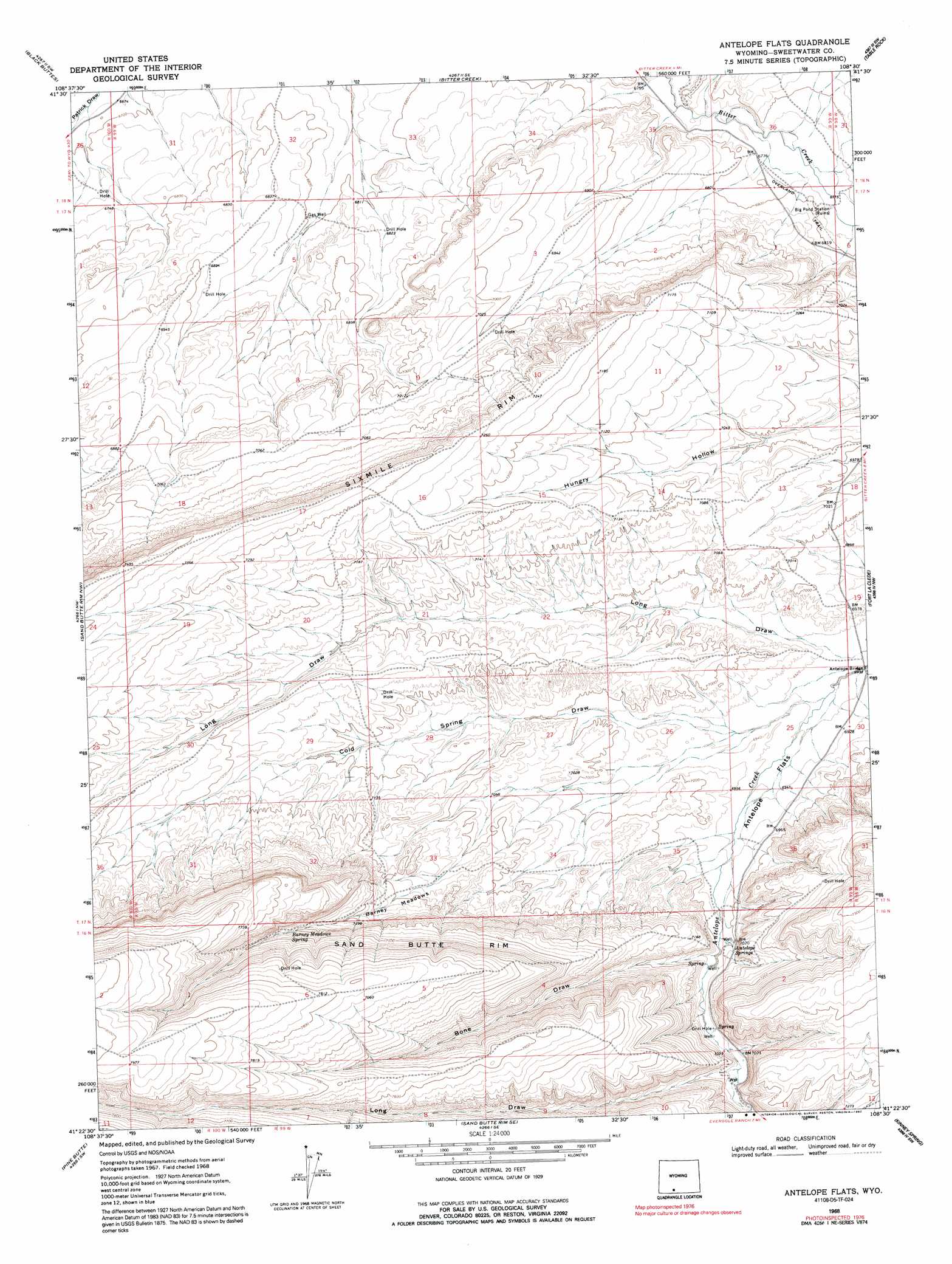
USGS Topo Quad 41108d5 - 1:24,000 scale
| Topo Map Name: | Antelope Flats |
| USGS Topo Quad ID: | 41108d5 |
| Print Size: | ca. 21 1/4" wide x 27" high |
| Southeast Coordinates: | 41.375° N latitude / 108.5° W longitude |
| Map Center Coordinates: | 41.4375° N latitude / 108.5625° W longitude |
| U.S. State: | WY |
| Filename: | o41108d5.jpg |
| Download Map JPG Image: | Antelope Flats topo map 1:24,000 scale |
| Map Type: | Topographic |
| Topo Series: | 7.5´ |
| Map Scale: | 1:24,000 |
| Source of Map Images: | United States Geological Survey (USGS) |
| Alternate Map Versions: |
Antelope Flats WY 1968, updated 1972 Download PDF Buy paper map Antelope Flats WY 1968, updated 1992 Download PDF Buy paper map Antelope Flats WY 2012 Download PDF Buy paper map Antelope Flats WY 2015 Download PDF Buy paper map |
1:24,000 Topo Quads surrounding Antelope Flats
Point Of Rocks |
Bitter Creek Nw |
Bitter Creek Ne |
Desert Springs |
Tipton |
Point Of Rocks Se |
Black Buttes |
Bitter Creek |
Table Rock |
J O Dugway |
Cooper Ridge Ne |
Sand Butte Rim Nw |
Antelope Flats |
Fort La Clede |
Fort La Clede Ne |
Burley Draw |
Pine Butte |
Sand Butte Rim Se |
Kinney Spring |
Manuel Gap |
Erickson-Kent Ranch |
Chicken Creek West |
Chicken Creek East |
Cow Creek Reservoir |
Monument Valley |
> Back to 41108a1 at 1:100,000 scale
> Back to 41108a1 at 1:250,000 scale
> Back to U.S. Topo Maps home
Antelope Flats topo map: Gazetteer
Antelope Flats: Bridges
Antelope Bridge elevation 2105m 6906′Antelope Flats: Cliffs
Sixmile Rim elevation 2250m 7381′Antelope Flats: Flats
Antelope Flats elevation 2115m 6938′Barney Meadows elevation 2207m 7240′
Antelope Flats: Springs
Antelope Springs elevation 2138m 7014′Barney Meadows Spring elevation 2258m 7408′
Antelope Flats: Valleys
Bone Draw elevation 2138m 7014′Cold Spring Draw elevation 2107m 6912′
Long Draw elevation 2152m 7060′
Antelope Flats digital topo map on disk
Buy this Antelope Flats topo map showing relief, roads, GPS coordinates and other geographical features, as a high-resolution digital map file on DVD: