Tipton Topo Map Wyoming
To zoom in, hover over the map of Tipton
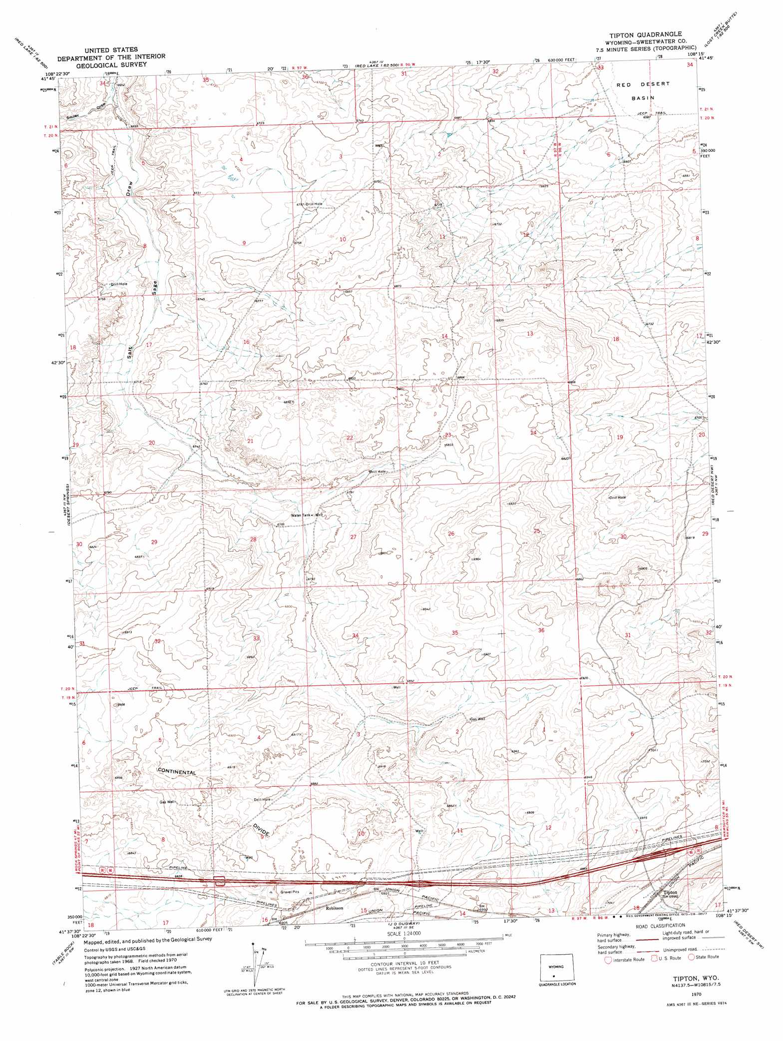
USGS Topo Quad 41108f3 - 1:24,000 scale
| Topo Map Name: | Tipton |
| USGS Topo Quad ID: | 41108f3 |
| Print Size: | ca. 21 1/4" wide x 27" high |
| Southeast Coordinates: | 41.625° N latitude / 108.25° W longitude |
| Map Center Coordinates: | 41.6875° N latitude / 108.3125° W longitude |
| U.S. State: | WY |
| Filename: | o41108f3.jpg |
| Download Map JPG Image: | Tipton topo map 1:24,000 scale |
| Map Type: | Topographic |
| Topo Series: | 7.5´ |
| Map Scale: | 1:24,000 |
| Source of Map Images: | United States Geological Survey (USGS) |
| Alternate Map Versions: |
Tipton WY 1970, updated 1973 Download PDF Buy paper map Tipton WY 2012 Download PDF Buy paper map Tipton WY 2015 Download PDF Buy paper map |
1:24,000 Topo Quads surrounding Tipton
Black Rock Flat East |
Red Lake |
Red Lake Ne |
Lost Creek Butte Nw |
Lost Creek Butte |
Twelvemile Well |
Red Lake Sw |
Red Lake Se |
Lost Creek Butte Sw |
Dennison Cap |
Bitter Creek Ne |
Desert Springs |
Tipton |
Red Desert Nw |
Red Desert |
Bitter Creek |
Table Rock |
J O Dugway |
Red Desert Sw |
Red Desert Se |
Antelope Flats |
Fort La Clede |
Fort La Clede Ne |
Haystack Flats |
Barrel Springs |
> Back to 41108e1 at 1:100,000 scale
> Back to 41108a1 at 1:250,000 scale
> Back to U.S. Topo Maps home
Tipton topo map: Gazetteer
Tipton: Populated Places
Robinson elevation 2107m 6912′Tipton elevation 2135m 7004′
Tipton: Valleys
Salt Sage Draw elevation 2029m 6656′Smiley Draw elevation 2029m 6656′
Tipton digital topo map on disk
Buy this Tipton topo map showing relief, roads, GPS coordinates and other geographical features, as a high-resolution digital map file on DVD: