Point Of Rocks Topo Map Wyoming
To zoom in, hover over the map of Point Of Rocks
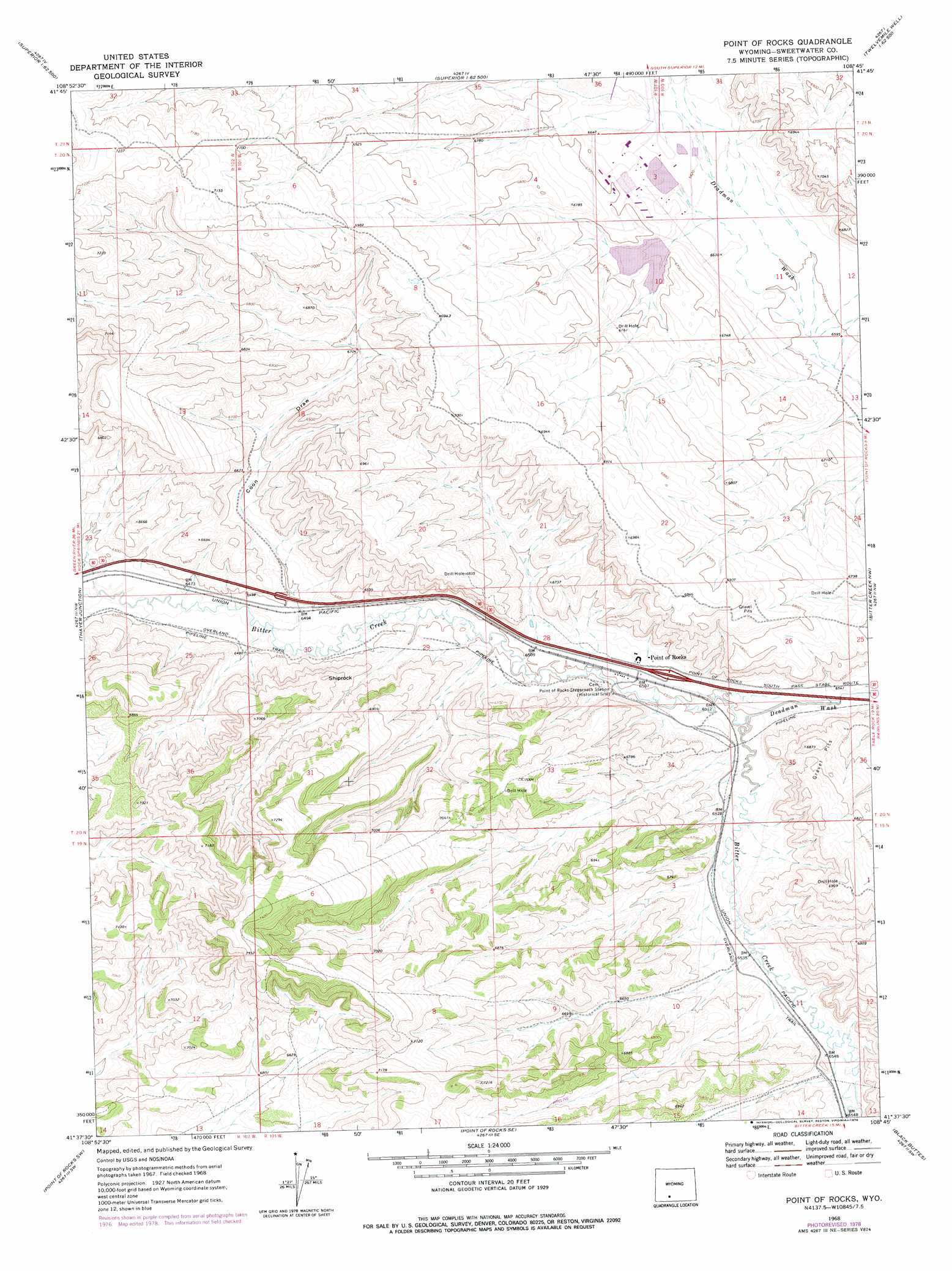
USGS Topo Quad 41108f7 - 1:24,000 scale
| Topo Map Name: | Point Of Rocks |
| USGS Topo Quad ID: | 41108f7 |
| Print Size: | ca. 21 1/4" wide x 27" high |
| Southeast Coordinates: | 41.625° N latitude / 108.75° W longitude |
| Map Center Coordinates: | 41.6875° N latitude / 108.8125° W longitude |
| U.S. State: | WY |
| Filename: | o41108f7.jpg |
| Download Map JPG Image: | Point Of Rocks topo map 1:24,000 scale |
| Map Type: | Topographic |
| Topo Series: | 7.5´ |
| Map Scale: | 1:24,000 |
| Source of Map Images: | United States Geological Survey (USGS) |
| Alternate Map Versions: |
Point Of Rocks WY 1968, updated 1972 Download PDF Buy paper map Point Of Rocks WY 1968, updated 1978 Download PDF Buy paper map Point of Rocks WY 2012 Download PDF Buy paper map Point of Rocks WY 2015 Download PDF Buy paper map |
1:24,000 Topo Quads surrounding Point Of Rocks
North Table Mountain |
Steamboat Mountain |
Black Rock North |
Black Rock Flat West |
Black Rock Flat East |
Deer Butte |
South Superior |
Black Rock South |
Tenmile Rim |
Twelvemile Well |
North Baxter |
Thayer Junction |
Point Of Rocks |
Bitter Creek Nw |
Bitter Creek Ne |
Baxter |
Point Of Rocks Sw |
Point Of Rocks Se |
Black Buttes |
Bitter Creek |
Lion Bluffs |
Camel Rock |
Cooper Ridge Ne |
Sand Butte Rim Nw |
Antelope Flats |
> Back to 41108e1 at 1:100,000 scale
> Back to 41108a1 at 1:250,000 scale
> Back to U.S. Topo Maps home
Point Of Rocks topo map: Gazetteer
Point Of Rocks: Dams
Jim Bridger Power Plant Surge Pond Dam elevation 2033m 6669′Point Of Rocks: Mines
Jim Bridger Mine elevation 2049m 6722′Lecite Hills Mine elevation 2018m 6620′
Point of Rocks Mine elevation 2062m 6765′
Point Of Rocks: Populated Places
Point of Rocks elevation 1990m 6528′Point Of Rocks: Reservoirs
Jim Bridger Reservoir elevation 2033m 6669′Point Of Rocks: Summits
Shiprock elevation 2073m 6801′Point Of Rocks: Valleys
Coon Draw elevation 1978m 6489′Deadman Wash elevation 1983m 6505′
Point Of Rocks digital topo map on disk
Buy this Point Of Rocks topo map showing relief, roads, GPS coordinates and other geographical features, as a high-resolution digital map file on DVD: