Halfway Hollow West Topo Map Wyoming
To zoom in, hover over the map of Halfway Hollow West
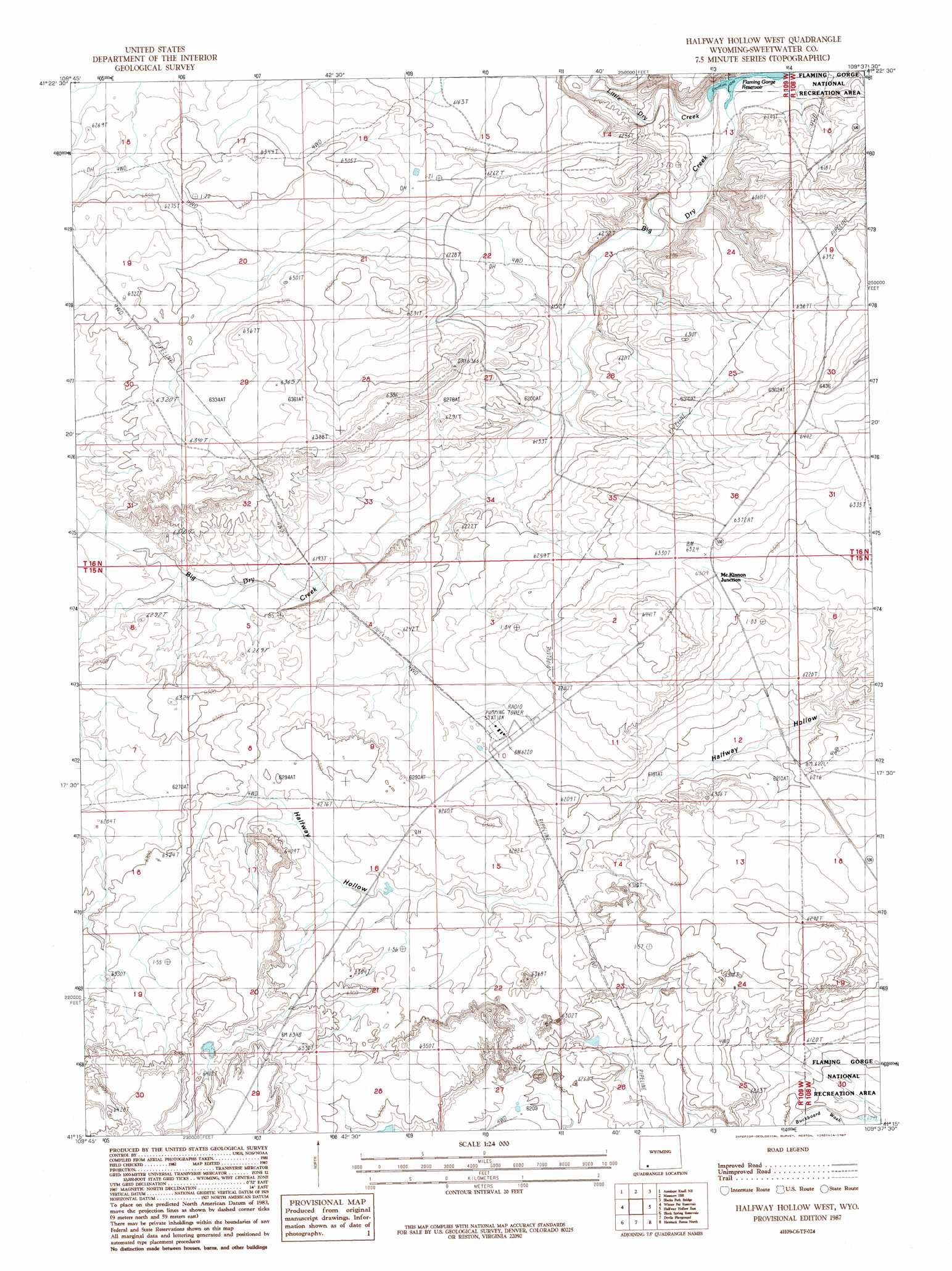
USGS Topo Quad 41109c6 - 1:24,000 scale
| Topo Map Name: | Halfway Hollow West |
| USGS Topo Quad ID: | 41109c6 |
| Print Size: | ca. 21 1/4" wide x 27" high |
| Southeast Coordinates: | 41.25° N latitude / 109.625° W longitude |
| Map Center Coordinates: | 41.3125° N latitude / 109.6875° W longitude |
| U.S. State: | WY |
| Filename: | o41109c6.jpg |
| Download Map JPG Image: | Halfway Hollow West topo map 1:24,000 scale |
| Map Type: | Topographic |
| Topo Series: | 7.5´ |
| Map Scale: | 1:24,000 |
| Source of Map Images: | United States Geological Survey (USGS) |
| Alternate Map Versions: |
Halfway Hollow West WY 1987, updated 1987 Download PDF Buy paper map Halfway Hollow West WY 1996, updated 2000 Download PDF Buy paper map Halfway Hollow West WY 2012 Download PDF Buy paper map Halfway Hollow West WY 2015 Download PDF Buy paper map |
| FStopo: | US Forest Service topo Halfway Hollow West is available: Download FStopo PDF Download FStopo TIF |
1:24,000 Topo Quads surrounding Halfway Hollow West
Granger |
Little America |
Bryan |
Peru |
Green River |
Antelope Knoll |
Antelope Knoll Ne |
Massacre Hill |
Blacks Fork Bridge |
Whalen Butte |
Needle Reservoir |
Winter Fat Reservoir |
Halfway Hollow West |
Halfway Hollow East |
Sage Creek Basin |
Horse Ranch |
Black Spring Reservoir |
Devils Playground |
Haystack Buttes North |
Sugarloaf Basin |
Mckinnon |
Antelope Wash |
Linwood Canyon |
Haystack Buttes South |
Minnies Gap |
> Back to 41109a1 at 1:100,000 scale
> Back to 41108a1 at 1:250,000 scale
> Back to U.S. Topo Maps home
Halfway Hollow West topo map: Gazetteer
Halfway Hollow West: Streams
Little Dry Creek elevation 1845m 6053′Halfway Hollow West digital topo map on disk
Buy this Halfway Hollow West topo map showing relief, roads, GPS coordinates and other geographical features, as a high-resolution digital map file on DVD: