Lion Bluffs Topo Map Wyoming
To zoom in, hover over the map of Lion Bluffs
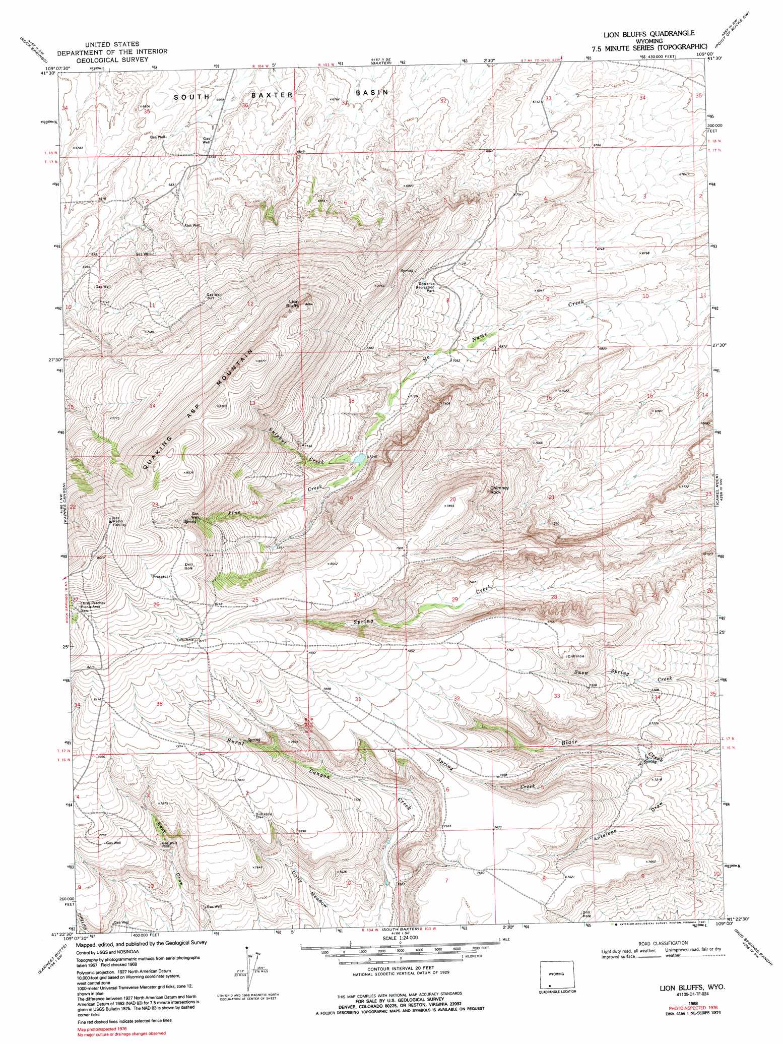
USGS Topo Quad 41109d1 - 1:24,000 scale
| Topo Map Name: | Lion Bluffs |
| USGS Topo Quad ID: | 41109d1 |
| Print Size: | ca. 21 1/4" wide x 27" high |
| Southeast Coordinates: | 41.375° N latitude / 109° W longitude |
| Map Center Coordinates: | 41.4375° N latitude / 109.0625° W longitude |
| U.S. State: | WY |
| Filename: | o41109d1.jpg |
| Download Map JPG Image: | Lion Bluffs topo map 1:24,000 scale |
| Map Type: | Topographic |
| Topo Series: | 7.5´ |
| Map Scale: | 1:24,000 |
| Source of Map Images: | United States Geological Survey (USGS) |
| Alternate Map Versions: |
Lion Bluffs WY 1968, updated 1972 Download PDF Buy paper map Lion Bluffs WY 1968, updated 1991 Download PDF Buy paper map Lion Bluffs WY 2012 Download PDF Buy paper map Lion Bluffs WY 2015 Download PDF Buy paper map |
1:24,000 Topo Quads surrounding Lion Bluffs
Pilot Butte |
Reliance |
North Baxter |
Thayer Junction |
Point Of Rocks |
Kanda |
Rock Springs |
Baxter |
Point Of Rocks Sw |
Point Of Rocks Se |
Wilkins Peak |
Kappes Canyon |
Lion Bluffs |
Camel Rock |
Cooper Ridge Ne |
Firehole Basin |
Earnest Butte |
South Baxter |
Mud Springs Ranch |
Burley Draw |
Big Ridge |
Maxon Ranch |
Titsworth Gap |
Potter Mountain |
Erickson-Kent Ranch |
> Back to 41109a1 at 1:100,000 scale
> Back to 41108a1 at 1:250,000 scale
> Back to U.S. Topo Maps home
Lion Bluffs topo map: Gazetteer
Lion Bluffs: Cliffs
Lion Bluffs elevation 2561m 8402′Lion Bluffs: Flats
Dolly Meadow elevation 2231m 7319′Dorrence Recreation Park elevation 2178m 7145′
Lion Bluffs: Mines
Aspen Mountain Mine elevation 2521m 8270′Lion Bluffs: Parks
Three Patches Picnic Area elevation 2552m 8372′Lion Bluffs: Populated Places
Sweeney Ranch elevation 2041m 6696′Lion Bluffs: Streams
Pine Creek elevation 2218m 7276′Spring Creek elevation 2160m 7086′
Sulphur Creek elevation 2211m 7253′
Lion Bluffs: Summits
Chimney Rock elevation 2328m 7637′Quaking Asp Mountain elevation 2594m 8510′
Table elevation 2342m 7683′
Lion Bluffs: Valleys
Circle elevation 2062m 6765′Lion Bluffs digital topo map on disk
Buy this Lion Bluffs topo map showing relief, roads, GPS coordinates and other geographical features, as a high-resolution digital map file on DVD: