Blacks Fork Bridge Topo Map Wyoming
To zoom in, hover over the map of Blacks Fork Bridge
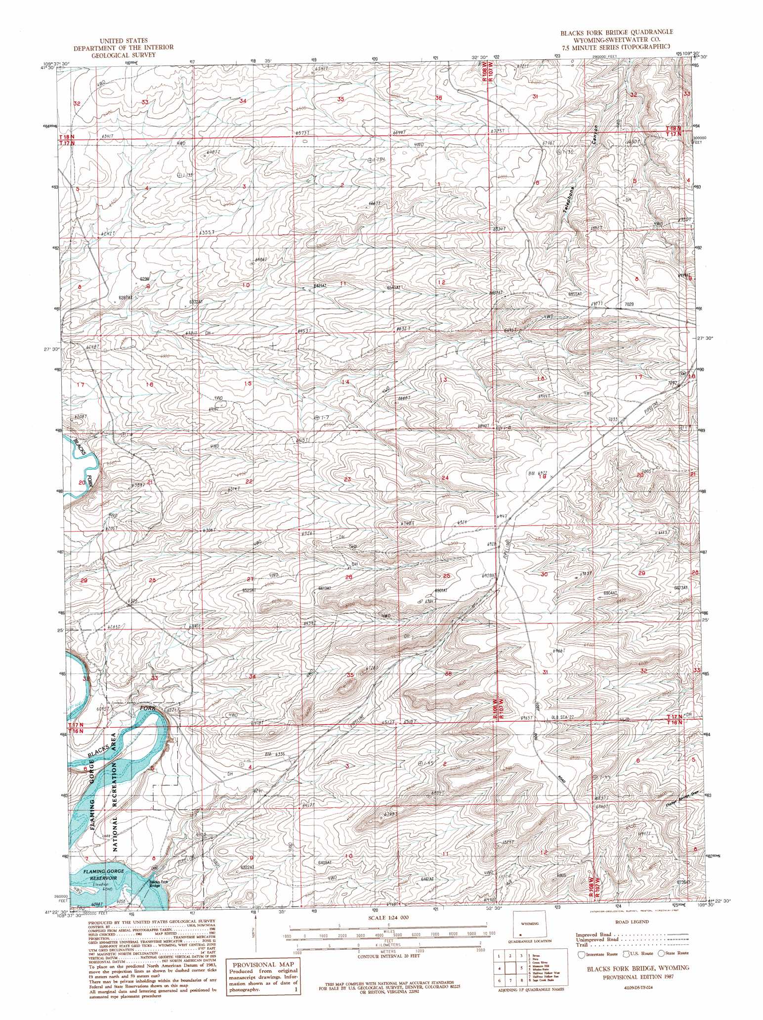
USGS Topo Quad 41109d5 - 1:24,000 scale
| Topo Map Name: | Blacks Fork Bridge |
| USGS Topo Quad ID: | 41109d5 |
| Print Size: | ca. 21 1/4" wide x 27" high |
| Southeast Coordinates: | 41.375° N latitude / 109.5° W longitude |
| Map Center Coordinates: | 41.4375° N latitude / 109.5625° W longitude |
| U.S. State: | WY |
| Filename: | o41109d5.jpg |
| Download Map JPG Image: | Blacks Fork Bridge topo map 1:24,000 scale |
| Map Type: | Topographic |
| Topo Series: | 7.5´ |
| Map Scale: | 1:24,000 |
| Source of Map Images: | United States Geological Survey (USGS) |
| Alternate Map Versions: |
Blacks Fork Bridge WY 1987, updated 1987 Download PDF Buy paper map Blacks Fork Bridge WY 1996, updated 1999 Download PDF Buy paper map Blacks Fork Bridge WY 2012 Download PDF Buy paper map Blacks Fork Bridge WY 2015 Download PDF Buy paper map |
| FStopo: | US Forest Service topo Blacks Fork Bridge is available: Download FStopo PDF Download FStopo TIF |
1:24,000 Topo Quads surrounding Blacks Fork Bridge
Blue Point |
Stevens Flat |
Austin Ranch |
Scott Spring |
Pilot Butte |
Little America |
Bryan |
Peru |
Green River |
Kanda |
Antelope Knoll Ne |
Massacre Hill |
Blacks Fork Bridge |
Whalen Butte |
Wilkins Peak |
Winter Fat Reservoir |
Halfway Hollow West |
Halfway Hollow East |
Sage Creek Basin |
Firehole Basin |
Black Spring Reservoir |
Devils Playground |
Haystack Buttes North |
Sugarloaf Basin |
Big Ridge |
> Back to 41109a1 at 1:100,000 scale
> Back to 41108a1 at 1:250,000 scale
> Back to U.S. Topo Maps home
Blacks Fork Bridge topo map: Gazetteer
Blacks Fork Bridge: Bridges
Blacks Fork Bridge elevation 1842m 6043′Blacks Fork Bridge: Streams
Big Dry Creek elevation 1842m 6043′Blacks Fork Bridge digital topo map on disk
Buy this Blacks Fork Bridge topo map showing relief, roads, GPS coordinates and other geographical features, as a high-resolution digital map file on DVD: