Antelope Knoll Topo Map Wyoming
To zoom in, hover over the map of Antelope Knoll
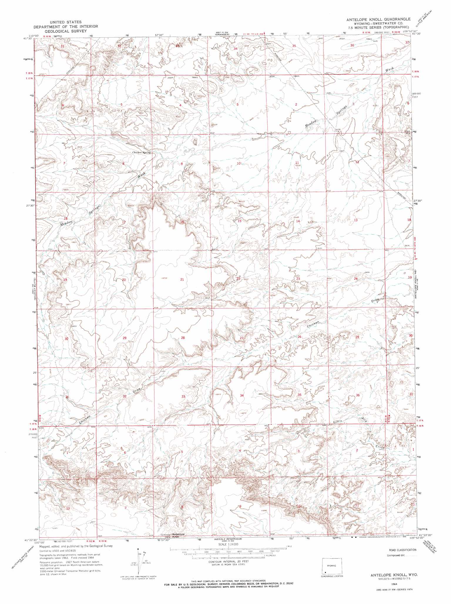
USGS Topo Quad 41109d8 - 1:24,000 scale
| Topo Map Name: | Antelope Knoll |
| USGS Topo Quad ID: | 41109d8 |
| Print Size: | ca. 21 1/4" wide x 27" high |
| Southeast Coordinates: | 41.375° N latitude / 109.875° W longitude |
| Map Center Coordinates: | 41.4375° N latitude / 109.9375° W longitude |
| U.S. State: | WY |
| Filename: | o41109d8.jpg |
| Download Map JPG Image: | Antelope Knoll topo map 1:24,000 scale |
| Map Type: | Topographic |
| Topo Series: | 7.5´ |
| Map Scale: | 1:24,000 |
| Source of Map Images: | United States Geological Survey (USGS) |
| Alternate Map Versions: |
Antelope Knoll WY 1964, updated 1968 Download PDF Buy paper map Antelope Knoll WY 2012 Download PDF Buy paper map Antelope Knoll WY 2015 Download PDF Buy paper map |
1:24,000 Topo Quads surrounding Antelope Knoll
Church Butte Nw |
Moxa |
Sevenmile Gulch |
Blue Point |
Stevens Flat |
Church Butte |
Verne |
Granger |
Little America |
Bryan |
Millersville |
Wildcat Butte |
Antelope Knoll |
Antelope Knoll Ne |
Massacre Hill |
Turtle Hill |
Butcher Knife Draw |
Needle Reservoir |
Winter Fat Reservoir |
Halfway Hollow West |
Reed Reservoir |
Soap Holes Reservoir |
Horse Ranch |
Black Spring Reservoir |
Devils Playground |
> Back to 41109a1 at 1:100,000 scale
> Back to 41108a1 at 1:250,000 scale
> Back to U.S. Topo Maps home
Antelope Knoll digital topo map on disk
Buy this Antelope Knoll topo map showing relief, roads, GPS coordinates and other geographical features, as a high-resolution digital map file on DVD: