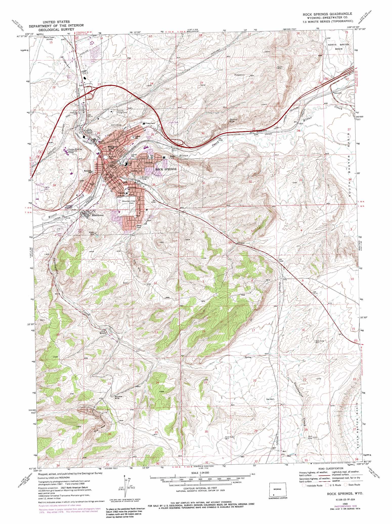
Rock Springs Topo Map Wyoming
To zoom in, hover over the map of Rock Springs
USGS Topo Quad 41109e2 - 1:24,000 scale
| Topo Map Name: | Rock Springs |
| USGS Topo Quad ID: | 41109e2 |
| Print Size: | ca. 21 1/4" wide x 27" high |
| Southeast Coordinates: | 41.5° N latitude / 109.125° W longitude |
| Map Center Coordinates: | 41.5625° N latitude / 109.1875° W longitude |
| U.S. State: | WY |
| Filename: | o41109e2.jpg |
| Download Map JPG Image: | Rock Springs topo map 1:24,000 scale |
| Map Type: | Topographic |
| Topo Series: | 7.5´ |
| Map Scale: | 1:24,000 |
| Source of Map Images: | United States Geological Survey (USGS) |
| Alternate Map Versions: |
Rock Springs WY 1968, updated 1972 Download PDF Buy paper map Rock Springs WY 1968, updated 1978 Download PDF Buy paper map Rock Springs WY 1968, updated 1985 Download PDF Buy paper map Rock Springs WY 2012 Download PDF Buy paper map Rock Springs WY 2015 Download PDF Buy paper map |
1:24,000 Topo Quads surrounding Rock Springs
Clay Buttes Sw |
Clay Buttes Se |
Boars Tusk Sw |
Deer Butte |
South Superior |
Scott Spring |
Pilot Butte |
Reliance |
North Baxter |
Thayer Junction |
Green River |
Kanda |
Rock Springs |
Baxter |
Point Of Rocks Sw |
Whalen Butte |
Wilkins Peak |
Kappes Canyon |
Lion Bluffs |
Camel Rock |
Sage Creek Basin |
Firehole Basin |
Earnest Butte |
South Baxter |
Mud Springs Ranch |
> Back to 41109e1 at 1:100,000 scale
> Back to 41108a1 at 1:250,000 scale
> Back to U.S. Topo Maps home
Rock Springs topo map: Gazetteer
Rock Springs: Airports
Skorup Memorial Hospital Heliport elevation 1968m 6456′Rock Springs: Mines
Rainbow Mine elevation 2038m 6686′Swanson Mine elevation 2012m 6601′
Rock Springs: Parks
Bunning Park elevation 1907m 6256′Rock Springs: Populated Places
Arrowhead Springs elevation 2064m 6771′Blairtown elevation 1906m 6253′
Quealy elevation 1947m 6387′
Rock Springs elevation 1947m 6387′
Rock Springs: Streams
Killpecker Creek elevation 1904m 6246′Sweetwater Creek elevation 1897m 6223′
Rock Springs digital topo map on disk
Buy this Rock Springs topo map showing relief, roads, GPS coordinates and other geographical features, as a high-resolution digital map file on DVD: