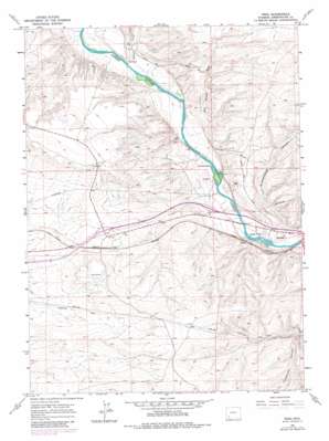
Peru Topo Map Wyoming
To zoom in, hover over the map of Peru
USGS Topo Quad 41109e5 - 1:24,000 scale
| Topo Map Name: | Peru |
| USGS Topo Quad ID: | 41109e5 |
| Print Size: | ca. 21 1/4" wide x 27" high |
| Southeast Coordinates: | 41.5° N latitude / 109.5° W longitude |
| Map Center Coordinates: | 41.5625° N latitude / 109.5625° W longitude |
| U.S. State: | WY |
| Filename: | o41109e5.jpg |
| Download Map JPG Image: | Peru topo map 1:24,000 scale |
| Map Type: | Topographic |
| Topo Series: | 7.5´ |
| Map Scale: | 1:24,000 |
| Source of Map Images: | United States Geological Survey (USGS) |
| Alternate Map Versions: |
Peru WY 1961, updated 1964 Download PDF Buy paper map Peru WY 1961, updated 1974 Download PDF Buy paper map Peru WY 1961, updated 1981 Download PDF Buy paper map Peru WY 2012 Download PDF Buy paper map Peru WY 2015 Download PDF Buy paper map |
1:24,000 Topo Quads surrounding Peru
> Back to 41109e1 at 1:100,000 scale
> Back to 41108a1 at 1:250,000 scale
> Back to U.S. Topo Maps home
Peru topo map: Gazetteer
Peru: Gaps
Fish Cut elevation 1918m 6292′Peru: Mines
Diamond Alkali Company-Butler Well Number One Mine elevation 1918m 6292′Green River Pit elevation 1883m 6177′
Peru: Populated Places
James Town elevation 1879m 6164′Riovista elevation 1880m 6167′
Peru: Streams
Alkali Creek elevation 1866m 6122′Peru: Valleys
Greasewood Canyon elevation 1861m 6105′Milk Ranch Wash elevation 1864m 6115′
Reiser Canyon elevation 1862m 6108′
Peru digital topo map on disk
Buy this Peru topo map showing relief, roads, GPS coordinates and other geographical features, as a high-resolution digital map file on DVD:


