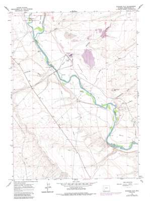
Stevens Flat Topo Map Wyoming
To zoom in, hover over the map of Stevens Flat
USGS Topo Quad 41109f6 - 1:24,000 scale
| Topo Map Name: | Stevens Flat |
| USGS Topo Quad ID: | 41109f6 |
| Print Size: | ca. 21 1/4" wide x 27" high |
| Southeast Coordinates: | 41.625° N latitude / 109.625° W longitude |
| Map Center Coordinates: | 41.6875° N latitude / 109.6875° W longitude |
| U.S. State: | WY |
| Filename: | o41109f6.jpg |
| Download Map JPG Image: | Stevens Flat topo map 1:24,000 scale |
| Map Type: | Topographic |
| Topo Series: | 7.5´ |
| Map Scale: | 1:24,000 |
| Source of Map Images: | United States Geological Survey (USGS) |
| Alternate Map Versions: |
Stevens Flat WY 1961, updated 1964 Download PDF Buy paper map Stevens Flat WY 1961, updated 1971 Download PDF Buy paper map Stevens Flat WY 1961, updated 1981 Download PDF Buy paper map Stevens Flat WY 1961, updated 1992 Download PDF Buy paper map Stevens Flat WY 2012 Download PDF Buy paper map Stevens Flat WY 2015 Download PDF Buy paper map |
1:24,000 Topo Quads surrounding Stevens Flat
> Back to 41109e1 at 1:100,000 scale
> Back to 41108a1 at 1:250,000 scale
> Back to U.S. Topo Maps home
Stevens Flat topo map: Gazetteer
Stevens Flat: Dams
Stevens Draw Dam elevation 1927m 6322′Stevens Flat: Flats
Manns Flat elevation 1883m 6177′Stevens Flat elevation 1894m 6213′
Stevens Flat: Mines
Big Island Mine elevation 1895m 6217′Stauffer Trona Mine elevation 1888m 6194′
Stevens Flat: Reservoirs
Stevens Draw Reservoir elevation 1927m 6322′Stevens Flat: Streams
Chris Wash elevation 1882m 6174′Fill Wash elevation 1878m 6161′
Stevens Flat: Summits
Monument Hill elevation 1953m 6407′Stevens Flat: Valleys
Demming Draw elevation 1893m 6210′Manns Draw elevation 1872m 6141′
Stevens Draw elevation 1900m 6233′
Twentyfive Draw elevation 1887m 6190′
Water Gap Wash elevation 1891m 6204′
Stevens Flat digital topo map on disk
Buy this Stevens Flat topo map showing relief, roads, GPS coordinates and other geographical features, as a high-resolution digital map file on DVD:


