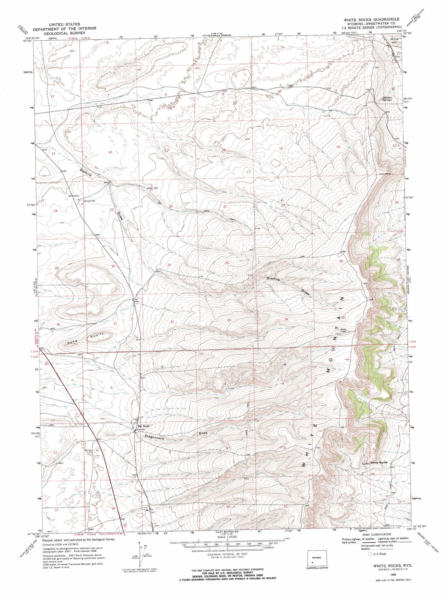
White Rocks Topo Map Wyoming
To zoom in, hover over the map of White Rocks
USGS Topo Quad 41109h3 - 1:24,000 scale
| Topo Map Name: | White Rocks |
| USGS Topo Quad ID: | 41109h3 |
| Print Size: | ca. 21 1/4" wide x 27" high |
| Southeast Coordinates: | 41.875° N latitude / 109.25° W longitude |
| Map Center Coordinates: | 41.9375° N latitude / 109.3125° W longitude |
| U.S. State: | WY |
| Filename: | o41109h3.jpg |
| Download Map JPG Image: | White Rocks topo map 1:24,000 scale |
| Map Type: | Topographic |
| Topo Series: | 7.5´ |
| Map Scale: | 1:24,000 |
| Source of Map Images: | United States Geological Survey (USGS) |
| Alternate Map Versions: |
White Rocks WY 1968, updated 1971 Download PDF Buy paper map White Rocks WY 1968, updated 1971 Download PDF Buy paper map White Rocks WY 2012 Download PDF Buy paper map White Rocks WY 2015 Download PDF Buy paper map |
1:24,000 Topo Quads surrounding White Rocks
Fourmile Knoll |
Eden Reservoir West |
Eden Reservoir East |
Tule Butte |
North Packsaddle Canyon |
Simpson Gulch Se |
Farson |
Fifteenmile Spring |
Ox Yoke Springs |
Essex Mountain |
Pittman Well |
Clay Buttes |
White Rocks |
Boars Tusk |
North Table Mountain |
Chrisman Ranch |
Clay Buttes Sw |
Clay Buttes Se |
Boars Tusk Sw |
Deer Butte |
Austin Ranch |
Scott Spring |
Pilot Butte |
Reliance |
North Baxter |
> Back to 41109e1 at 1:100,000 scale
> Back to 41108a1 at 1:250,000 scale
> Back to U.S. Topo Maps home
White Rocks topo map: Gazetteer
White Rocks: Cliffs
White Rocks elevation 2164m 7099′White Rocks: Summits
Sand Knolls elevation 2156m 7073′White Rocks digital topo map on disk
Buy this White Rocks topo map showing relief, roads, GPS coordinates and other geographical features, as a high-resolution digital map file on DVD: