Leavitt Bench Topo Map Wyoming
To zoom in, hover over the map of Leavitt Bench
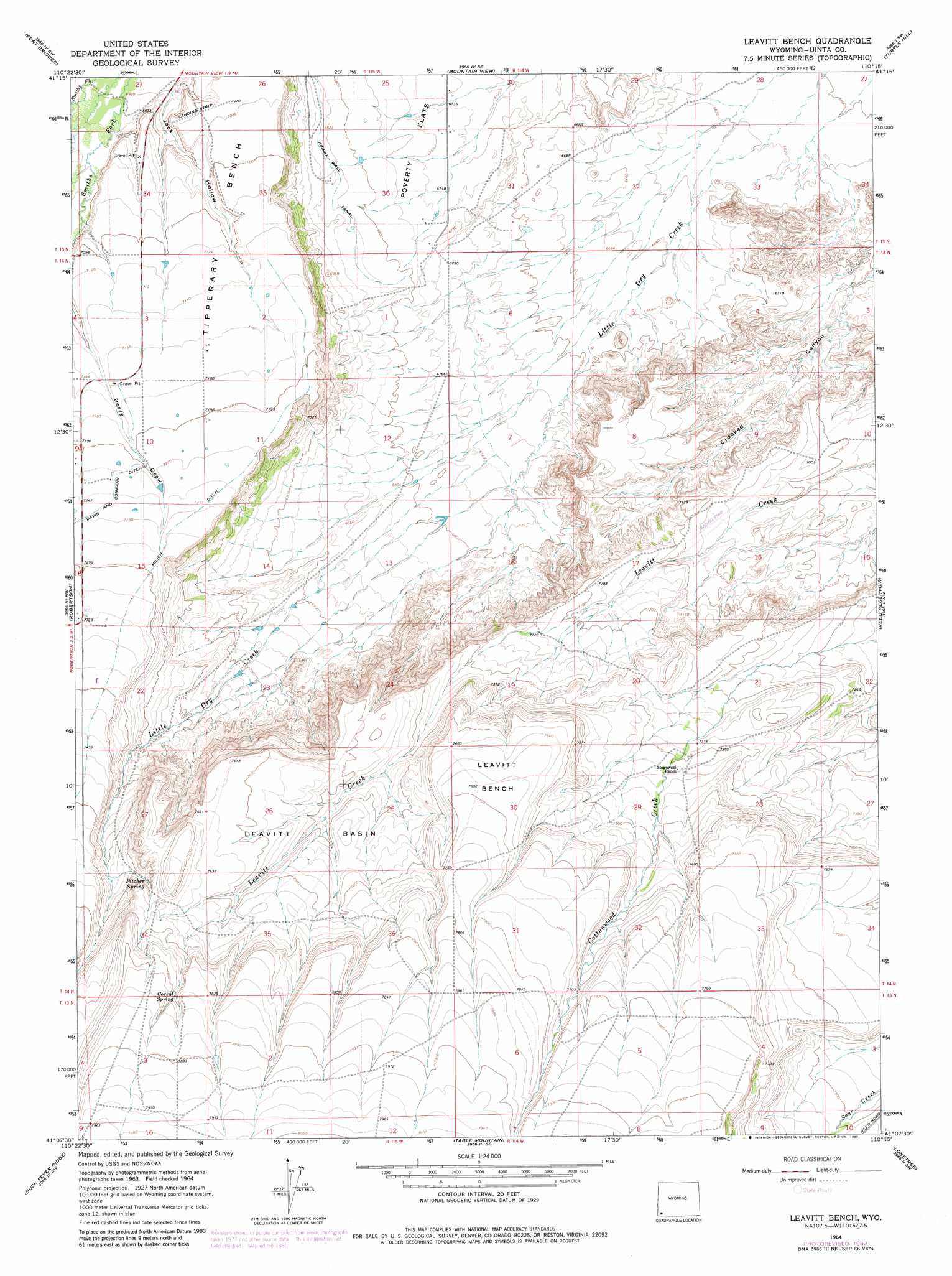
USGS Topo Quad 41110b3 - 1:24,000 scale
| Topo Map Name: | Leavitt Bench |
| USGS Topo Quad ID: | 41110b3 |
| Print Size: | ca. 21 1/4" wide x 27" high |
| Southeast Coordinates: | 41.125° N latitude / 110.25° W longitude |
| Map Center Coordinates: | 41.1875° N latitude / 110.3125° W longitude |
| U.S. State: | WY |
| Filename: | o41110b3.jpg |
| Download Map JPG Image: | Leavitt Bench topo map 1:24,000 scale |
| Map Type: | Topographic |
| Topo Series: | 7.5´ |
| Map Scale: | 1:24,000 |
| Source of Map Images: | United States Geological Survey (USGS) |
| Alternate Map Versions: |
Leavitt Bench WY 1964, updated 1968 Download PDF Buy paper map Leavitt Bench WY 1964, updated 1980 Download PDF Buy paper map Leavitt Bench WY 2012 Download PDF Buy paper map Leavitt Bench WY 2015 Download PDF Buy paper map |
1:24,000 Topo Quads surrounding Leavitt Bench
Bridger |
Carter |
Austin Reservoir |
Millersville |
Wildcat Butte |
Leroy |
Fort Bridger |
Mountain View |
Turtle Hill |
Butcher Knife Draw |
Hague Creek |
Robertson |
Leavitt Bench |
Reed Reservoir |
Soap Holes Reservoir |
Meeks Cabin Reservoir |
Buck Fever Ridge |
Table Mountain |
Lonetree |
Burntfork |
Lyman Lake |
Bridger Lake |
Gilbert Peak Ne |
Hole In The Rock |
Hoop Lake |
> Back to 41110a1 at 1:100,000 scale
> Back to 41110a1 at 1:250,000 scale
> Back to U.S. Topo Maps home
Leavitt Bench topo map: Gazetteer
Leavitt Bench: Basins
Leavitt Basin elevation 2288m 7506′Leavitt Bench: Benches
Tipperary Bench elevation 2190m 7185′Leavitt Bench: Canals
Milich Ditch elevation 2221m 7286′Leavitt Bench: Flats
Poverty Flats elevation 2056m 6745′Leavitt Bench: Springs
Corral Spring elevation 2376m 7795′Pitcher Spring elevation 2299m 7542′
Leavitt Bench: Summits
Leavitt Bench elevation 2344m 7690′Leavitt Bench: Valleys
Jack Hollow elevation 2110m 6922′Leavitt Bench digital topo map on disk
Buy this Leavitt Bench topo map showing relief, roads, GPS coordinates and other geographical features, as a high-resolution digital map file on DVD: