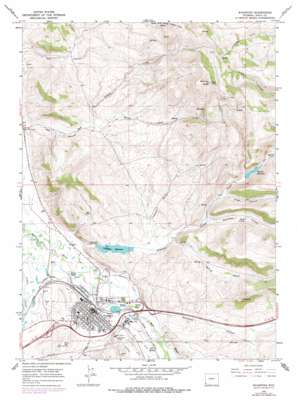
Evanston Topo Map Wyoming
To zoom in, hover over the map of Evanston
USGS Topo Quad 41110c8 - 1:24,000 scale
| Topo Map Name: | Evanston |
| USGS Topo Quad ID: | 41110c8 |
| Print Size: | ca. 21 1/4" wide x 27" high |
| Southeast Coordinates: | 41.25° N latitude / 110.875° W longitude |
| Map Center Coordinates: | 41.3125° N latitude / 110.9375° W longitude |
| U.S. State: | WY |
| Filename: | o41110c8.jpg |
| Download Map JPG Image: | Evanston topo map 1:24,000 scale |
| Map Type: | Topographic |
| Topo Series: | 7.5´ |
| Map Scale: | 1:24,000 |
| Source of Map Images: | United States Geological Survey (USGS) |
| Alternate Map Versions: |
Evanston WY 1965, updated 1968 Download PDF Buy paper map Evanston WY 1965, updated 1979 Download PDF Buy paper map Evanston WY 1965, updated 1979 Download PDF Buy paper map Evanston WY 2012 Download PDF Buy paper map Evanston WY 2015 Download PDF Buy paper map |
1:24,000 Topo Quads surrounding Evanston
> Back to 41110a1 at 1:100,000 scale
> Back to 41110a1 at 1:250,000 scale
> Back to U.S. Topo Maps home
Evanston topo map: Gazetteer
Evanston: Canals
City Ditch elevation 2115m 6938′Old City Ditch elevation 2096m 6876′
Evanston: Dams
Crompton Dam elevation 2101m 6893′Painter Dam elevation 2216m 7270′
Evanston: Flats
Hamblin Park elevation 2059m 6755′Evanston: Lakes
Lake Louise elevation 2084m 6837′Evanston: Mines
Almy Number Five Mine elevation 2083m 6833′Almy Number Forty-one Mine elevation 2016m 6614′
Almy Number Four Mine elevation 2141m 7024′
Almy Number One Mine elevation 2023m 6637′
Almy Number Thirty-one Mine elevation 2031m 6663′
Almy Number Three Mine elevation 2061m 6761′
Almy Number Two Mine elevation 2030m 6660′
Evanston: Populated Places
Evanston elevation 2057m 6748′Evanston: Reservoirs
Crompton Reservoir elevation 2101m 6893′Crompton Reservoir elevation 2055m 6742′
Painter Reservoir elevation 2118m 6948′
Evanston: Springs
Foote Spring elevation 2112m 6929′Evanston: Streams
Pleasant Valley Creek elevation 2042m 6699′Willow Creek elevation 2056m 6745′
Evanston: Summits
Burnt Hill elevation 2141m 7024′Medicine Butte elevation 2621m 8599′
Evanston: Valleys
Duncomb Hollow elevation 2067m 6781′Limekiln Gulch elevation 2060m 6758′
Long Hollow elevation 2098m 6883′
Red Canyon elevation 2020m 6627′
Robinson Hollow elevation 2079m 6820′
Spring Hollow elevation 2067m 6781′
Evanston digital topo map on disk
Buy this Evanston topo map showing relief, roads, GPS coordinates and other geographical features, as a high-resolution digital map file on DVD:


