Little Round Mountain Topo Map Wyoming
To zoom in, hover over the map of Little Round Mountain
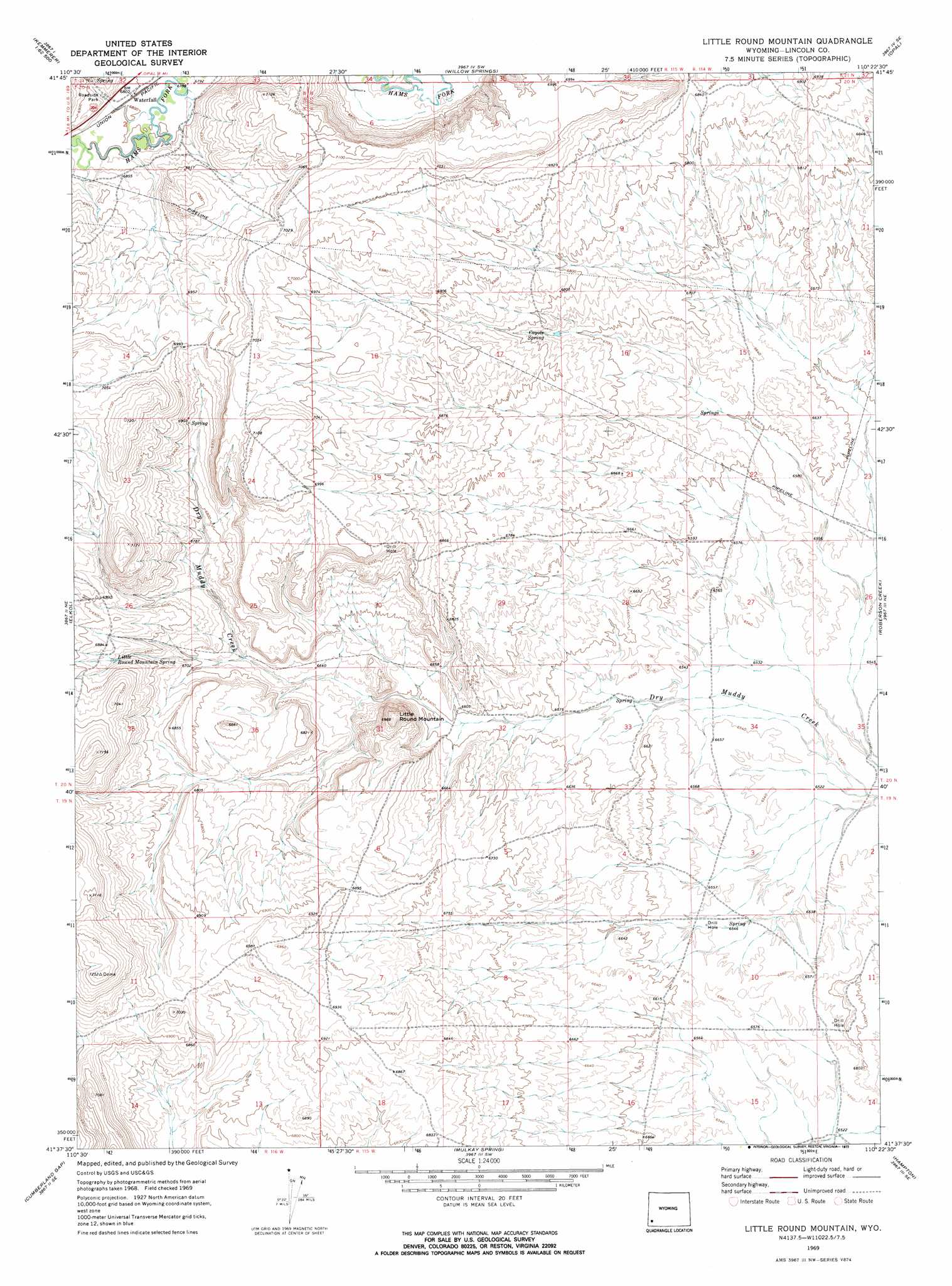
USGS Topo Quad 41110f4 - 1:24,000 scale
| Topo Map Name: | Little Round Mountain |
| USGS Topo Quad ID: | 41110f4 |
| Print Size: | ca. 21 1/4" wide x 27" high |
| Southeast Coordinates: | 41.625° N latitude / 110.375° W longitude |
| Map Center Coordinates: | 41.6875° N latitude / 110.4375° W longitude |
| U.S. State: | WY |
| Filename: | o41110f4.jpg |
| Download Map JPG Image: | Little Round Mountain topo map 1:24,000 scale |
| Map Type: | Topographic |
| Topo Series: | 7.5´ |
| Map Scale: | 1:24,000 |
| Source of Map Images: | United States Geological Survey (USGS) |
| Alternate Map Versions: |
Little Round Mountain WY 1969, updated 1973 Download PDF Buy paper map Little Round Mountain WY 1969, updated 1973 Download PDF Buy paper map Little Round Mountain WY 2012 Download PDF Buy paper map Little Round Mountain WY 2015 Download PDF Buy paper map |
1:24,000 Topo Quads surrounding Little Round Mountain
Kemmerer Reservoir |
Sublet |
Round Mountain |
Graham Reservoir |
Shute Creek Lake |
Fossil |
Kemmerer |
Willow Springs |
Opal |
Cow Hollow Creek |
Warfield Creek |
Elkol |
Little Round Mountain |
Roberson Creek |
Church Butte Nw |
Elkol Sw |
Cumberland Gap |
Mulkay Spring |
Hampton |
Church Butte |
Meadow Draw |
Bridger |
Carter |
Austin Reservoir |
Millersville |
> Back to 41110e1 at 1:100,000 scale
> Back to 41110a1 at 1:250,000 scale
> Back to U.S. Topo Maps home
Little Round Mountain topo map: Gazetteer
Little Round Mountain: Springs
Coyote Spring elevation 2053m 6735′Little Round Mountain Spring elevation 2082m 6830′
Little Round Mountain: Summits
Little Round Mountain elevation 2108m 6916′Little Round Mountain digital topo map on disk
Buy this Little Round Mountain topo map showing relief, roads, GPS coordinates and other geographical features, as a high-resolution digital map file on DVD: