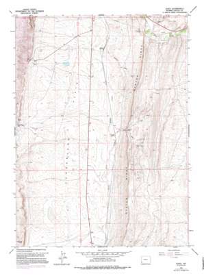
Elkol Topo Map Wyoming
To zoom in, hover over the map of Elkol
USGS Topo Quad 41110f5 - 1:24,000 scale
| Topo Map Name: | Elkol |
| USGS Topo Quad ID: | 41110f5 |
| Print Size: | ca. 21 1/4" wide x 27" high |
| Southeast Coordinates: | 41.625° N latitude / 110.5° W longitude |
| Map Center Coordinates: | 41.6875° N latitude / 110.5625° W longitude |
| U.S. State: | WY |
| Filename: | o41110f5.jpg |
| Download Map JPG Image: | Elkol topo map 1:24,000 scale |
| Map Type: | Topographic |
| Topo Series: | 7.5´ |
| Map Scale: | 1:24,000 |
| Source of Map Images: | United States Geological Survey (USGS) |
| Alternate Map Versions: |
Elkol WY 1962, updated 1965 Download PDF Buy paper map Elkol WY 1962, updated 1974 Download PDF Buy paper map Elkol WY 1962, updated 1979 Download PDF Buy paper map Elkol WY 1962, updated 1995 Download PDF Buy paper map Elkol WY 2012 Download PDF Buy paper map Elkol WY 2015 Download PDF Buy paper map |
1:24,000 Topo Quads surrounding Elkol
> Back to 41110e1 at 1:100,000 scale
> Back to 41110a1 at 1:250,000 scale
> Back to U.S. Topo Maps home
Elkol topo map: Gazetteer
Elkol: Cliffs
Crockers Point elevation 2126m 6975′Skull Point elevation 2142m 7027′
Elkol: Dams
Molinar Dam elevation 2095m 6873′Elkol: Gaps
Blazon Gap elevation 2062m 6765′Elkol: Mines
Biazon Mine elevation 2103m 6899′Blazon Mine elevation 2100m 6889′
Brilliant Number Eight Mine elevation 2025m 6643′
Brilliant Number Eight Mine elevation 2025m 6643′
Cumberland Number Three Mine elevation 2144m 7034′
Cumberland Number Three Mine elevation 2144m 7034′
Fitzpatrick Mine elevation 2081m 6827′
Glencoe Mine elevation 2136m 7007′
Lincoln Star Mine elevation 2107m 6912′
Pacific Coal Company Mine elevation 2093m 6866′
Radiant Mine elevation 2085m 6840′
Sudden Number One Mine elevation 2097m 6879′
Elkol: Populated Places
Blazon Junction elevation 2057m 6748′Elkol elevation 2106m 6909′
Elkol: Reservoirs
Molinar Reservoir elevation 2095m 6873′Skull Point Reservoir elevation 2094m 6870′
Elkol: Valleys
Oakley Draw elevation 2087m 6847′Elkol digital topo map on disk
Buy this Elkol topo map showing relief, roads, GPS coordinates and other geographical features, as a high-resolution digital map file on DVD:


