Warfield Creek Topo Map Wyoming
To zoom in, hover over the map of Warfield Creek
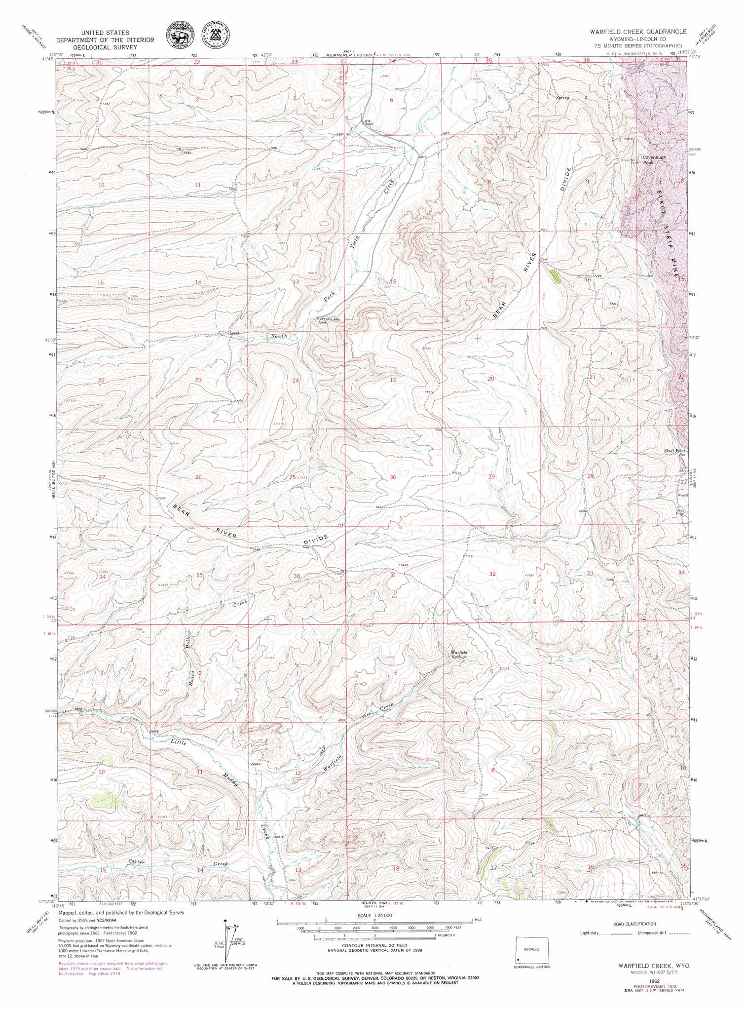
USGS Topo Quad 41110f6 - 1:24,000 scale
| Topo Map Name: | Warfield Creek |
| USGS Topo Quad ID: | 41110f6 |
| Print Size: | ca. 21 1/4" wide x 27" high |
| Southeast Coordinates: | 41.625° N latitude / 110.625° W longitude |
| Map Center Coordinates: | 41.6875° N latitude / 110.6875° W longitude |
| U.S. State: | WY |
| Filename: | o41110f6.jpg |
| Download Map JPG Image: | Warfield Creek topo map 1:24,000 scale |
| Map Type: | Topographic |
| Topo Series: | 7.5´ |
| Map Scale: | 1:24,000 |
| Source of Map Images: | United States Geological Survey (USGS) |
| Alternate Map Versions: |
Warfield Creek WY 1962, updated 1965 Download PDF Buy paper map Warfield Creek WY 1962, updated 1979 Download PDF Buy paper map Warfield Creek WY 2012 Download PDF Buy paper map Warfield Creek WY 2015 Download PDF Buy paper map |
1:24,000 Topo Quads surrounding Warfield Creek
Beckwith |
The Rock Slide |
Kemmerer Reservoir |
Sublet |
Round Mountain |
Sage |
Nugget |
Fossil |
Kemmerer |
Willow Springs |
Windy Point |
Bell Butte Ne |
Warfield Creek |
Elkol |
Little Round Mountain |
Sawtooth Mountain |
Bell Butte |
Elkol Sw |
Cumberland Gap |
Mulkay Spring |
Three Forks |
Little Dee Creek |
Meadow Draw |
Bridger |
Carter |
> Back to 41110e1 at 1:100,000 scale
> Back to 41110a1 at 1:250,000 scale
> Back to U.S. Topo Maps home
Warfield Creek topo map: Gazetteer
Warfield Creek: Dams
Fmc Dam elevation 2185m 7168′Richey Dam elevation 2094m 6870′
Warfield Creek: Reservoirs
Fmc Reservoir elevation 2185m 7168′Richey Reservoir elevation 2094m 6870′
Warfield Creek: Springs
Warfield Springs elevation 2187m 7175′Warfield Creek: Streams
Carter Creek elevation 2072m 6797′Heard Hollow Creek elevation 2094m 6870′
Warfield Creek elevation 2085m 6840′
Warfield Creek: Summits
Cavanaugh Peak elevation 2349m 7706′Warfield Creek digital topo map on disk
Buy this Warfield Creek topo map showing relief, roads, GPS coordinates and other geographical features, as a high-resolution digital map file on DVD: