Nugget Topo Map Wyoming
To zoom in, hover over the map of Nugget
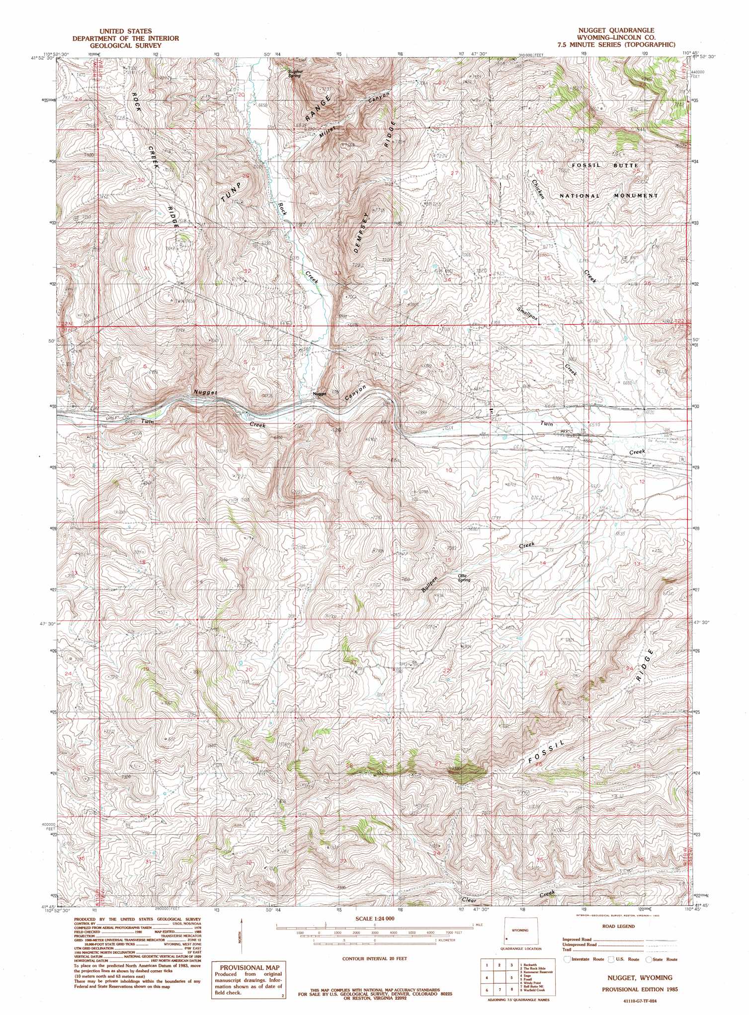
USGS Topo Quad 41110g7 - 1:24,000 scale
| Topo Map Name: | Nugget |
| USGS Topo Quad ID: | 41110g7 |
| Print Size: | ca. 21 1/4" wide x 27" high |
| Southeast Coordinates: | 41.75° N latitude / 110.75° W longitude |
| Map Center Coordinates: | 41.8125° N latitude / 110.8125° W longitude |
| U.S. State: | WY |
| Filename: | o41110g7.jpg |
| Download Map JPG Image: | Nugget topo map 1:24,000 scale |
| Map Type: | Topographic |
| Topo Series: | 7.5´ |
| Map Scale: | 1:24,000 |
| Source of Map Images: | United States Geological Survey (USGS) |
| Alternate Map Versions: |
Nugget WY 1985, updated 1985 Download PDF Buy paper map Nugget WY 2012 Download PDF Buy paper map Nugget WY 2015 Download PDF Buy paper map |
1:24,000 Topo Quads surrounding Nugget
Boundary Ridge |
Cokeville |
Sublette Canyon |
Wilkinson Creek |
South Fork Mountain |
South Lake |
Beckwith |
The Rock Slide |
Kemmerer Reservoir |
Sublet |
Leefe |
Sage |
Nugget |
Fossil |
Kemmerer |
Rex Peak |
Windy Point |
Bell Butte Ne |
Warfield Creek |
Elkol |
Woodruff Narrows |
Sawtooth Mountain |
Bell Butte |
Elkol Sw |
Cumberland Gap |
> Back to 41110e1 at 1:100,000 scale
> Back to 41110a1 at 1:250,000 scale
> Back to U.S. Topo Maps home
Nugget topo map: Gazetteer
Nugget: Parks
Fossil Butte National Monument elevation 2123m 6965′Nugget: Ridges
Fossil Ridge elevation 2317m 7601′Nugget: Springs
Ollie Spring elevation 2067m 6781′Nugget: Streams
Bullpen Creek elevation 2014m 6607′Chicken Creek elevation 2016m 6614′
Rock Creek elevation 1984m 6509′
Smallpox Creek elevation 2012m 6601′
Nugget: Valleys
Millet Canyon elevation 2035m 6676′Nugget digital topo map on disk
Buy this Nugget topo map showing relief, roads, GPS coordinates and other geographical features, as a high-resolution digital map file on DVD: