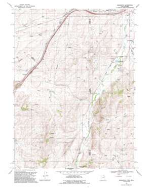
Wahsatch Topo Map Utah
To zoom in, hover over the map of Wahsatch
USGS Topo Quad 41111b1 - 1:24,000 scale
| Topo Map Name: | Wahsatch |
| USGS Topo Quad ID: | 41111b1 |
| Print Size: | ca. 21 1/4" wide x 27" high |
| Southeast Coordinates: | 41.125° N latitude / 111° W longitude |
| Map Center Coordinates: | 41.1875° N latitude / 111.0625° W longitude |
| U.S. States: | UT, WY |
| Filename: | o41111b1.jpg |
| Download Map JPG Image: | Wahsatch topo map 1:24,000 scale |
| Map Type: | Topographic |
| Topo Series: | 7.5´ |
| Map Scale: | 1:24,000 |
| Source of Map Images: | United States Geological Survey (USGS) |
| Alternate Map Versions: |
Wahsatch UT 1968, updated 1970 Download PDF Buy paper map Wahsatch UT 1968, updated 1971 Download PDF Buy paper map Wahsatch UT 1991, updated 1991 Download PDF Buy paper map Wahsatch UT 2010 Download PDF Buy paper map Wahsatch UT 2014 Download PDF Buy paper map |
1:24,000 Topo Quads surrounding Wahsatch
> Back to 41111a1 at 1:100,000 scale
> Back to 41110a1 at 1:250,000 scale
> Back to U.S. Topo Maps home
Wahsatch topo map: Gazetteer
Wahsatch: Cliffs
The Needles elevation 2248m 7375′Wahsatch: Populated Places
Wahsatch elevation 2080m 6824′Wahsatch: Reservoirs
Barker Reservoir elevation 2138m 7014′Wahsatch: Streams
Coyote Creek elevation 2102m 6896′Coyote Creek elevation 2102m 6896′
Sage Creek elevation 2114m 6935′
Shearing Corral Creek elevation 2059m 6755′
Suttons Creek elevation 2055m 6742′
Willow Creek elevation 2111m 6925′
Wahsatch: Trails
Emigrant Trail elevation 2120m 6955′Pony Express and Overland Stage Route elevation 2056m 6745′
Wahsatch: Valleys
Burton Hollow elevation 2069m 6788′Sage Creek Draw elevation 2112m 6929′
Sulphur Hollow elevation 2068m 6784′
Wahsatch digital topo map on disk
Buy this Wahsatch topo map showing relief, roads, GPS coordinates and other geographical features, as a high-resolution digital map file on DVD:


