Shearing Corral Topo Map Utah
To zoom in, hover over the map of Shearing Corral
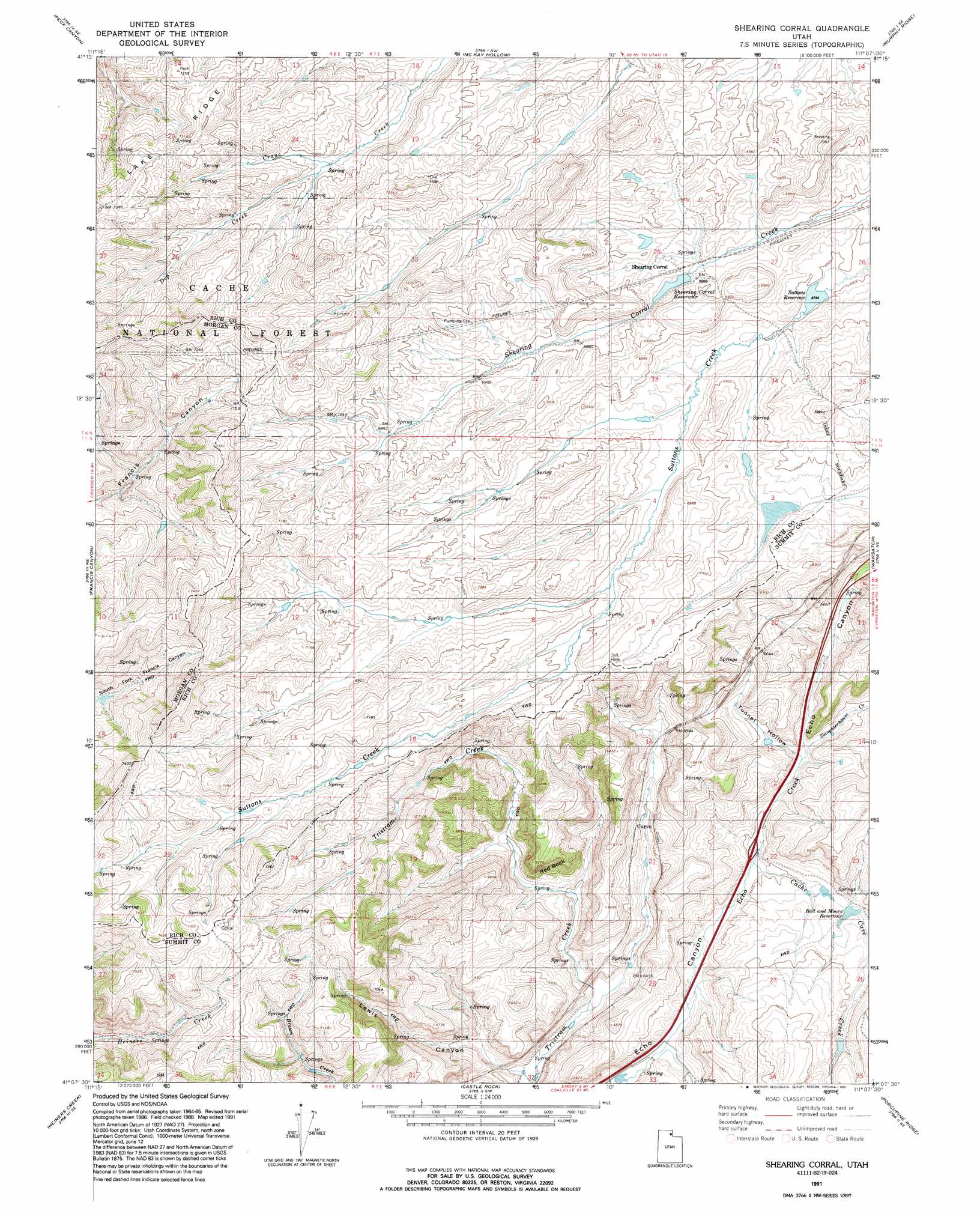
USGS Topo Quad 41111b2 - 1:24,000 scale
| Topo Map Name: | Shearing Corral |
| USGS Topo Quad ID: | 41111b2 |
| Print Size: | ca. 21 1/4" wide x 27" high |
| Southeast Coordinates: | 41.125° N latitude / 111.125° W longitude |
| Map Center Coordinates: | 41.1875° N latitude / 111.1875° W longitude |
| U.S. State: | UT |
| Filename: | o41111b2.jpg |
| Download Map JPG Image: | Shearing Corral topo map 1:24,000 scale |
| Map Type: | Topographic |
| Topo Series: | 7.5´ |
| Map Scale: | 1:24,000 |
| Source of Map Images: | United States Geological Survey (USGS) |
| Alternate Map Versions: |
Shearing Corral UT 1968, updated 1970 Download PDF Buy paper map Shearing Corral UT 1968, updated 1986 Download PDF Buy paper map Shearing Corral UT 1991, updated 1991 Download PDF Buy paper map Shearing Corral UT 1998, updated 2001 Download PDF Buy paper map Shearing Corral UT 2011 Download PDF Buy paper map Shearing Corral UT 2014 Download PDF Buy paper map |
| FStopo: | US Forest Service topo Shearing Corral is available: Download FStopo PDF Download FStopo TIF |
1:24,000 Topo Quads surrounding Shearing Corral
Dairy Ridge |
Meachum Ridge |
Neponset Reservoir Nw |
Neponset Reservoir Ne |
Three Forks |
Horse Ridge |
Peck Canyon |
Mckay Hollow |
Murphy Ridge |
Evanston |
Lost Creek Dam |
Francis Canyon |
Shearing Corral |
Wahsatch |
Millis |
Henefer |
Heiners Creek |
Castle Rock |
Porcupine Ridge |
Myers Reservoir |
Coalville |
Turner Hollow |
Upton |
Red Hole |
Seven Tree Flat |
> Back to 41111a1 at 1:100,000 scale
> Back to 41110a1 at 1:250,000 scale
> Back to U.S. Topo Maps home
Shearing Corral topo map: Gazetteer
Shearing Corral: Reservoirs
Ball and Moore Reservoir elevation 1963m 6440′Shearing Corral Reservoir elevation 2089m 6853′
Suttons Reservoir elevation 2073m 6801′
Shearing Corral: Springs
Heiners Springs elevation 2145m 7037′Heiners Springs elevation 2154m 7066′
Shearing Corral: Streams
Cache Cave Creek elevation 1945m 6381′Dip Creek elevation 2123m 6965′
Slaughterhouse Creek elevation 1965m 6446′
Shearing Corral: Summits
Red Rock elevation 1991m 6532′Shearing Corral: Valleys
Lewis Canyon elevation 1919m 6295′Tunnel Hollow elevation 1965m 6446′
Shearing Corral digital topo map on disk
Buy this Shearing Corral topo map showing relief, roads, GPS coordinates and other geographical features, as a high-resolution digital map file on DVD: