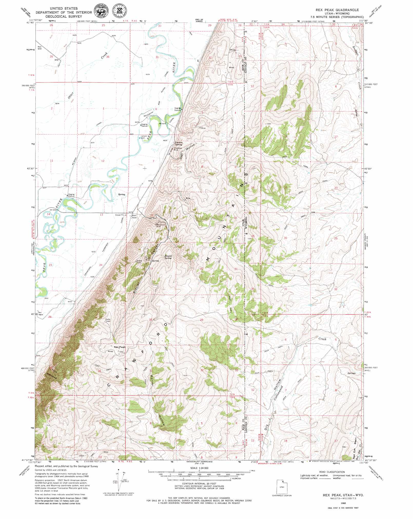
Rex Peak Topo Map Utah
To zoom in, hover over the map of Rex Peak
USGS Topo Quad 41111f1 - 1:24,000 scale
| Topo Map Name: | Rex Peak |
| USGS Topo Quad ID: | 41111f1 |
| Print Size: | ca. 21 1/4" wide x 27" high |
| Southeast Coordinates: | 41.625° N latitude / 111° W longitude |
| Map Center Coordinates: | 41.6875° N latitude / 111.0625° W longitude |
| U.S. States: | UT, WY |
| Filename: | o41111f1.jpg |
| Download Map JPG Image: | Rex Peak topo map 1:24,000 scale |
| Map Type: | Topographic |
| Topo Series: | 7.5´ |
| Map Scale: | 1:24,000 |
| Source of Map Images: | United States Geological Survey (USGS) |
| Alternate Map Versions: |
Rex Peak UT 1968, updated 1970 Download PDF Buy paper map Rex Peak UT 1968, updated 1980 Download PDF Buy paper map Rex Peak UT 2011 Download PDF Buy paper map Rex Peak UT 2014 Download PDF Buy paper map |
1:24,000 Topo Quads surrounding Rex Peak
Bear Lake South |
Sheeppen Creek |
South Lake |
Beckwith |
The Rock Slide |
Laketown |
Sage Creek |
Leefe |
Sage |
Nugget |
Old Canyon |
Randolph |
Rex Peak |
Windy Point |
Bell Butte Ne |
Birch Creek Reservoirs |
Woodruff |
Woodruff Narrows |
Sawtooth Mountain |
Bell Butte |
Meachum Ridge |
Neponset Reservoir Nw |
Neponset Reservoir Ne |
Three Forks |
Little Dee Creek |
> Back to 41111e1 at 1:100,000 scale
> Back to 41110a1 at 1:250,000 scale
> Back to U.S. Topo Maps home
Rex Peak topo map: Gazetteer
Rex Peak: Canals
McMinn Canal elevation 1901m 6236′Rex Canal elevation 1900m 6233′
Rex Peak: Dams
Larson Dam elevation 1897m 6223′Rex Peak: Mines
Benjamin Mine elevation 2056m 6745′Cherokee Mine elevation 1935m 6348′
Frank Mine elevation 2157m 7076′
Rex Peak: Ranges
Crawford Mountains elevation 2279m 7477′Rex Peak: Springs
Brazier Spring elevation 2092m 6863′Larson Spring elevation 1903m 6243′
Rex Peak: Streams
Spring Creek elevation 1958m 6423′Rex Peak: Summits
Rex Peak elevation 2424m 7952′Rex Peak: Valleys
Brazier Canyon elevation 1931m 6335′Coal Hollow elevation 1918m 6292′
Twin Hollows elevation 1921m 6302′
Rex Peak digital topo map on disk
Buy this Rex Peak topo map showing relief, roads, GPS coordinates and other geographical features, as a high-resolution digital map file on DVD: