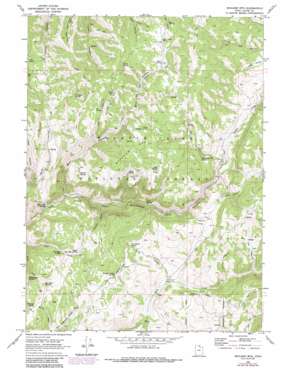
Boulder Mountain Topo Map Utah
To zoom in, hover over the map of Boulder Mountain
USGS Topo Quad 41111f5 - 1:24,000 scale
| Topo Map Name: | Boulder Mountain |
| USGS Topo Quad ID: | 41111f5 |
| Print Size: | ca. 21 1/4" wide x 27" high |
| Southeast Coordinates: | 41.625° N latitude / 111.5° W longitude |
| Map Center Coordinates: | 41.6875° N latitude / 111.5625° W longitude |
| U.S. State: | UT |
| Filename: | o41111f5.jpg |
| Download Map JPG Image: | Boulder Mountain topo map 1:24,000 scale |
| Map Type: | Topographic |
| Topo Series: | 7.5´ |
| Map Scale: | 1:24,000 |
| Source of Map Images: | United States Geological Survey (USGS) |
| Alternate Map Versions: |
Boulter Mts UT 1949 Download PDF Buy paper map Boulder Mtn UT 1969, updated 1973 Download PDF Buy paper map Boulder Mtn UT 1969, updated 1973 Download PDF Buy paper map Boulder Mtn UT 1969, updated 1986 Download PDF Buy paper map Boulder Mountain UT 1998, updated 2001 Download PDF Buy paper map Boulder Mountain UT 2011 Download PDF Buy paper map Boulder Mountain UT 2014 Download PDF Buy paper map |
| FStopo: | US Forest Service topo Boulder Mountain is available: Download FStopo PDF Download FStopo TIF |
1:24,000 Topo Quads surrounding Boulder Mountain
> Back to 41111e1 at 1:100,000 scale
> Back to 41110a1 at 1:250,000 scale
> Back to U.S. Topo Maps home
Boulder Mountain topo map: Gazetteer
Boulder Mountain: Flats
Squaw Flat elevation 2042m 6699′Boulder Mountain: Mines
Lucky Star Mine elevation 2219m 7280′Boulder Mountain: Springs
Bear Spring elevation 2173m 7129′Boar Hole Spring elevation 1995m 6545′
Box Spring elevation 2094m 6870′
Bronco Spring elevation 2265m 7431′
Cabin Spring elevation 2169m 7116′
Coldwater Spring elevation 2176m 7139′
Dog Spring elevation 2258m 7408′
Elk Spring elevation 2167m 7109′
Gray Cliff Spring elevation 1730m 5675′
Humming Bird Spring elevation 2083m 6833′
Lime Spring elevation 1855m 6085′
Marie Spring elevation 2302m 7552′
Mosslander Spring elevation 1950m 6397′
Mud Spring elevation 2234m 7329′
North Boulder Spring elevation 2217m 7273′
Pine Spring elevation 2084m 6837′
Pleasant Valley Spring elevation 2010m 6594′
Pole Hollow Spring elevation 1975m 6479′
Sheep Creek Spring elevation 2216m 7270′
Sidehill Spring elevation 2040m 6692′
Sow Hole Spring elevation 1977m 6486′
Upper Sow Hole Spring elevation 2039m 6689′
Warrens Spring elevation 2049m 6722′
Boulder Mountain: Streams
Saddle Creek elevation 1943m 6374′Sheep Creek elevation 1742m 5715′
Boulder Mountain: Summits
Boulder Mountain elevation 2305m 7562′Boulder Mountain: Valleys
Bear Hollow elevation 1747m 5731′Big Peavine elevation 1983m 6505′
Cabin Hollow elevation 1782m 5846′
Dip Hollow elevation 1943m 6374′
Elk Hollow elevation 1947m 6387′
Little Peavine elevation 1913m 6276′
Munson Hollow elevation 1761m 5777′
Pleasant Valley elevation 1991m 6532′
Pole Hollow elevation 1830m 6003′
Seep Hollow elevation 1839m 6033′
Warrens Hollow elevation 1916m 6286′
Boulder Mountain digital topo map on disk
Buy this Boulder Mountain topo map showing relief, roads, GPS coordinates and other geographical features, as a high-resolution digital map file on DVD:


