Wellsville Topo Map Utah
To zoom in, hover over the map of Wellsville
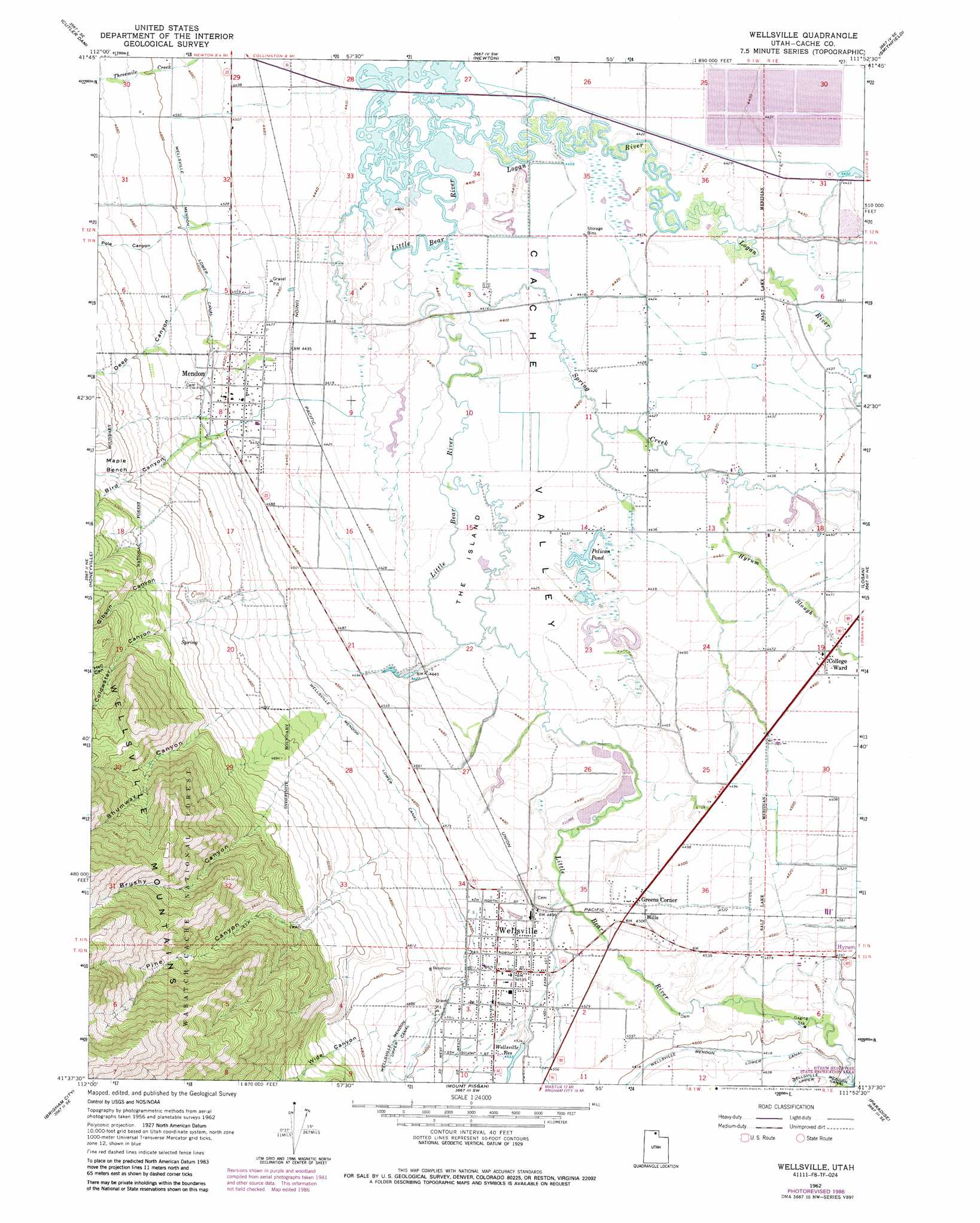
USGS Topo Quad 41111f8 - 1:24,000 scale
| Topo Map Name: | Wellsville |
| USGS Topo Quad ID: | 41111f8 |
| Print Size: | ca. 21 1/4" wide x 27" high |
| Southeast Coordinates: | 41.625° N latitude / 111.875° W longitude |
| Map Center Coordinates: | 41.6875° N latitude / 111.9375° W longitude |
| U.S. State: | UT |
| Filename: | o41111f8.jpg |
| Download Map JPG Image: | Wellsville topo map 1:24,000 scale |
| Map Type: | Topographic |
| Topo Series: | 7.5´ |
| Map Scale: | 1:24,000 |
| Source of Map Images: | United States Geological Survey (USGS) |
| Alternate Map Versions: |
Wellsville UT 1962, updated 1963 Download PDF Buy paper map Wellsville UT 1962, updated 1971 Download PDF Buy paper map Wellsville UT 1962, updated 1986 Download PDF Buy paper map Wellsville UT 1998, updated 2001 Download PDF Buy paper map Wellsville UT 2011 Download PDF Buy paper map Wellsville UT 2014 Download PDF Buy paper map |
| FStopo: | US Forest Service topo Wellsville is available: Download FStopo PDF Download FStopo TIF |
1:24,000 Topo Quads surrounding Wellsville
Portage |
Clarkston |
Trenton |
Richmond |
Naomi Peak |
Riverside |
Cutler Dam |
Newton |
Smithfield |
Mount Elmer |
Tremonton |
Honeyville |
Wellsville |
Logan |
Logan Peak |
Bear River City |
Brigham City |
Mount Pisgah |
Paradise |
Porcupine Reservoir |
Whistler Canal |
Willard |
Mantua |
James Peak |
Sharp Mountain |
> Back to 41111e1 at 1:100,000 scale
> Back to 41110a1 at 1:250,000 scale
> Back to U.S. Topo Maps home
Wellsville topo map: Gazetteer
Wellsville: Benches
Maple Bench elevation 1565m 5134′Wellsville: Flats
The Island elevation 1348m 4422′Wellsville: Lakes
Pelican Pond elevation 1351m 4432′Wellsville: Populated Places
College Ward elevation 1370m 4494′Greens Corner elevation 1375m 4511′
Mendon elevation 1370m 4494′
Wellsville elevation 1386m 4547′
Wellsville: Post Offices
Wellsville Post Office elevation 1385m 4543′Wellsville: Ranges
Wellsville Mountains elevation 2141m 7024′Wellsville: Reservoirs
Wellsville Reservoir elevation 1379m 4524′Wellsville: Streams
Hyrum Slough elevation 1351m 4432′Little Logan River elevation 1354m 4442′
Logan River elevation 1345m 4412′
Spring Creek elevation 1345m 4412′
Wellsville: Valleys
Bird Canyon elevation 1441m 4727′Brushy Canyon elevation 1631m 5351′
Coldwater Canyon elevation 1518m 4980′
Deep Canyon elevation 1415m 4642′
Gibson Canyon elevation 1541m 5055′
Hell Canyon elevation 1707m 5600′
Pine Canyon elevation 1525m 5003′
Pole Canyon elevation 1407m 4616′
Shumway Canyon elevation 1535m 5036′
Thimbleberry Canyon elevation 1518m 4980′
Wide Canyon elevation 1452m 4763′
Wellsville digital topo map on disk
Buy this Wellsville topo map showing relief, roads, GPS coordinates and other geographical features, as a high-resolution digital map file on DVD: