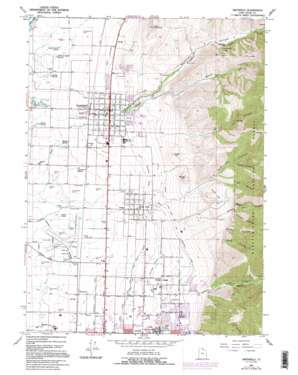
Smithfield Topo Map Utah
To zoom in, hover over the map of Smithfield
USGS Topo Quad 41111g7 - 1:24,000 scale
| Topo Map Name: | Smithfield |
| USGS Topo Quad ID: | 41111g7 |
| Print Size: | ca. 21 1/4" wide x 27" high |
| Southeast Coordinates: | 41.75° N latitude / 111.75° W longitude |
| Map Center Coordinates: | 41.8125° N latitude / 111.8125° W longitude |
| U.S. State: | UT |
| Filename: | o41111g7.jpg |
| Download Map JPG Image: | Smithfield topo map 1:24,000 scale |
| Map Type: | Topographic |
| Topo Series: | 7.5´ |
| Map Scale: | 1:24,000 |
| Source of Map Images: | United States Geological Survey (USGS) |
| Alternate Map Versions: |
Smithfield UT 1964, updated 1966 Download PDF Buy paper map Smithfield UT 1964, updated 1973 Download PDF Buy paper map Smithfield UT 1964, updated 1986 Download PDF Buy paper map Smithfield UT 1964, updated 1995 Download PDF Buy paper map Smithfield UT 1998, updated 2001 Download PDF Buy paper map Smithfield UT 2011 Download PDF Buy paper map Smithfield UT 2014 Download PDF Buy paper map |
| FStopo: | US Forest Service topo Smithfield is available: Download FStopo PDF Download FStopo TIF |
1:24,000 Topo Quads surrounding Smithfield
> Back to 41111e1 at 1:100,000 scale
> Back to 41110a1 at 1:250,000 scale
> Back to U.S. Topo Maps home
Smithfield topo map: Gazetteer
Smithfield: Airports
Logan Regional Hospital Heliport elevation 1403m 4603′Logan-Cache Airport elevation 1355m 4445′
Smithfield: Canals
Logan and Hyde Park Canal elevation 1389m 4557′Logan Hyde Park and Smithfield Canal elevation 1470m 4822′
Logan North Field Canal elevation 1387m 4550′
Logan Northern Canal elevation 1408m 4619′
Logan Northwest Field Canal elevation 1370m 4494′
Smithfield: Lakes
Cooks Pond elevation 1354m 4442′Smithfield: Parks
Mack Park elevation 1428m 4685′Smithfield Picnic Area elevation 1665m 5462′
Smithfield: Populated Places
Cardon elevation 1379m 4524′Greenville elevation 1361m 4465′
Hyde Park elevation 1383m 4537′
North Logan elevation 1430m 4691′
Smithfield elevation 1403m 4603′
White Horse Village elevation 1623m 5324′
Smithfield: Post Offices
Hyde Park Post Office elevation 1379m 4524′Smithfield: Springs
Blue Spring elevation 1354m 4442′Chambers Spring elevation 1364m 4475′
Corbett Spring elevation 1354m 4442′
Gittins Spring elevation 1356m 4448′
Hopkins Spring elevation 1364m 4475′
Joseph Smith Spring elevation 1360m 4461′
William Smith Spring elevation 1362m 4468′
Smithfield: Summits
Castle Rock elevation 1917m 6289′Crow Mountain elevation 1681m 5515′
Long Hill elevation 1580m 5183′
Round Hill elevation 1642m 5387′
Three Hill elevation 1727m 5666′
Smithfield: Valleys
Beef Hollow elevation 1573m 5160′Birch Canyon elevation 1449m 4753′
Bogus Hollow elevation 1567m 5141′
Dry Canyon elevation 1561m 5121′
Dry Hollow elevation 1656m 5433′
Green Canyon elevation 1519m 4983′
Hyde Park Canyon elevation 1561m 5121′
Mahogany Hollow elevation 1623m 5324′
Reeder Hollow elevation 1695m 5561′
Smithfield Canyon elevation 1412m 4632′
Sysnath Hollow elevation 1670m 5479′
Thurston Hollow elevation 1813m 5948′
Smithfield digital topo map on disk
Buy this Smithfield topo map showing relief, roads, GPS coordinates and other geographical features, as a high-resolution digital map file on DVD:


