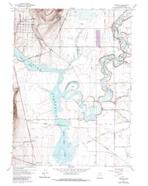
Newton Topo Map Utah
To zoom in, hover over the map of Newton
USGS Topo Quad 41111g8 - 1:24,000 scale
| Topo Map Name: | Newton |
| USGS Topo Quad ID: | 41111g8 |
| Print Size: | ca. 21 1/4" wide x 27" high |
| Southeast Coordinates: | 41.75° N latitude / 111.875° W longitude |
| Map Center Coordinates: | 41.8125° N latitude / 111.9375° W longitude |
| U.S. State: | UT |
| Filename: | o41111g8.jpg |
| Download Map JPG Image: | Newton topo map 1:24,000 scale |
| Map Type: | Topographic |
| Topo Series: | 7.5´ |
| Map Scale: | 1:24,000 |
| Source of Map Images: | United States Geological Survey (USGS) |
| Alternate Map Versions: |
Newton UT 1964, updated 1966 Download PDF Buy paper map Newton UT 1964, updated 1975 Download PDF Buy paper map Newton UT 1964, updated 1986 Download PDF Buy paper map Newton UT 2010 Download PDF Buy paper map Newton UT 2014 Download PDF Buy paper map |
1:24,000 Topo Quads surrounding Newton
> Back to 41111e1 at 1:100,000 scale
> Back to 41110a1 at 1:250,000 scale
> Back to U.S. Topo Maps home
Newton topo map: Gazetteer
Newton: Bends
Horseshoe Bend elevation 1344m 4409′Newton: Canals
North Logan Benson Canal elevation 1351m 4432′South Logan Benson Canal elevation 1351m 4432′
Newton: Flats
The Barrens elevation 1346m 4416′Newton: Guts
Swift Slough elevation 1347m 4419′Newton: Islands
The Island elevation 1345m 4412′Newton: Populated Places
Amalga elevation 1353m 4438′Ballard Junction elevation 1357m 4452′
Benson elevation 1350m 4429′
Newton elevation 1382m 4534′
Petersboro elevation 1364m 4475′
Quigley Crossing elevation 1382m 4534′
Riverside elevation 1349m 4425′
Newton: Streams
Blue Spring Creek elevation 1345m 4412′Clay Slough elevation 1345m 4412′
Fourmile Creek elevation 1344m 4409′
Hopkins Slough elevation 1345m 4412′
Newton Creek elevation 1344m 4409′
Summit Creek elevation 1345m 4412′
Threemile Creek elevation 1345m 4412′
Newton: Summits
The Point elevation 1411m 4629′Newton: Valleys
Cache Valley elevation 1344m 4409′Newton digital topo map on disk
Buy this Newton topo map showing relief, roads, GPS coordinates and other geographical features, as a high-resolution digital map file on DVD:


