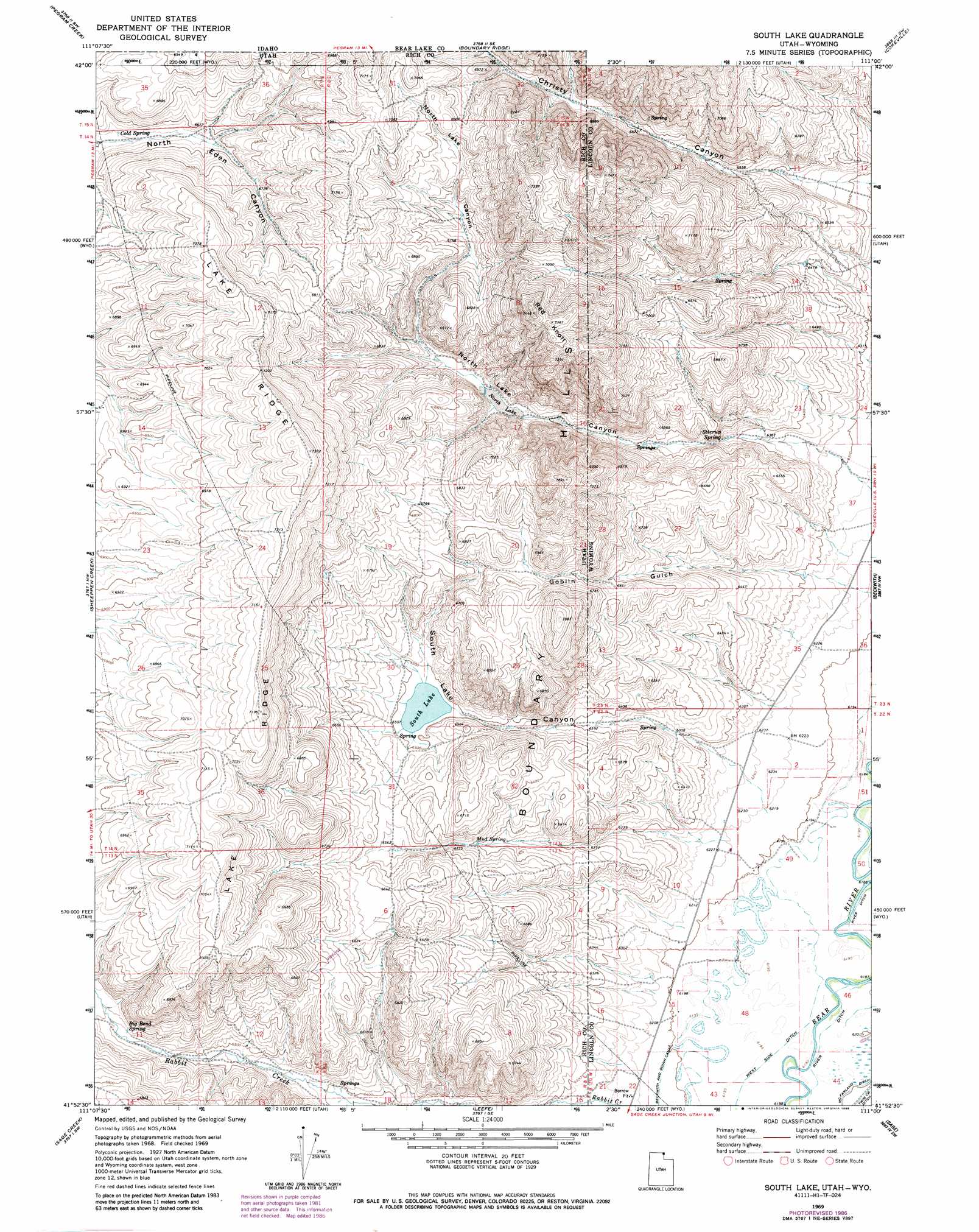
South Lake Topo Map Utah
To zoom in, hover over the map of South Lake
USGS Topo Quad 41111h1 - 1:24,000 scale
| Topo Map Name: | South Lake |
| USGS Topo Quad ID: | 41111h1 |
| Print Size: | ca. 21 1/4" wide x 27" high |
| Southeast Coordinates: | 41.875° N latitude / 111° W longitude |
| Map Center Coordinates: | 41.9375° N latitude / 111.0625° W longitude |
| U.S. States: | UT, WY |
| Filename: | o41111h1.jpg |
| Download Map JPG Image: | South Lake topo map 1:24,000 scale |
| Map Type: | Topographic |
| Topo Series: | 7.5´ |
| Map Scale: | 1:24,000 |
| Source of Map Images: | United States Geological Survey (USGS) |
| Alternate Map Versions: |
South Lake UT 1969, updated 1973 Download PDF Buy paper map South Lake UT 1969, updated 1986 Download PDF Buy paper map South Lake UT 2010 Download PDF Buy paper map South Lake UT 2014 Download PDF Buy paper map |
1:24,000 Topo Quads surrounding South Lake
Dingle |
Pegram |
Border |
Marse |
Nugent Park |
Bear Lake North |
Pegram Creek |
Boundary Ridge |
Cokeville |
Sublette Canyon |
Bear Lake South |
Sheeppen Creek |
South Lake |
Beckwith |
The Rock Slide |
Laketown |
Sage Creek |
Leefe |
Sage |
Nugget |
Old Canyon |
Randolph |
Rex Peak |
Windy Point |
Bell Butte Ne |
> Back to 41111e1 at 1:100,000 scale
> Back to 41110a1 at 1:250,000 scale
> Back to U.S. Topo Maps home
South Lake topo map: Gazetteer
South Lake: Canals
Beckwith and Quinn Canal elevation 1893m 6210′River Ditch elevation 1889m 6197′
South Lake: Lakes
North Lake elevation 2015m 6610′South Lake elevation 1979m 6492′
South Lake: Mines
San Francisco Chemical Company Number Four Mine elevation 1888m 6194′South Lake: Ranges
Boundary Hills elevation 2116m 6942′South Lake: Ridges
Lake Ridge elevation 2244m 7362′South Lake: Springs
Big Bend Spring elevation 1999m 6558′Cold Spring elevation 2019m 6624′
Mud Spring elevation 1979m 6492′
Stirrup Spring elevation 1956m 6417′
South Lake: Streams
Christy Creek elevation 2069m 6788′South Lake: Summits
Red Knoll elevation 2252m 7388′Red Knoll elevation 2252m 7388′
South Lake: Valleys
Christy Canyon elevation 1952m 6404′Goblin Gulch elevation 1906m 6253′
Goblin Gulch elevation 1904m 6246′
North Lake Canyon elevation 1923m 6309′
North Lake Canyon elevation 1922m 6305′
South Lake Canyon elevation 1911m 6269′
South Lake Canyon elevation 1904m 6246′
South Lake digital topo map on disk
Buy this South Lake topo map showing relief, roads, GPS coordinates and other geographical features, as a high-resolution digital map file on DVD: