Carrington Island Ne Topo Map Utah
To zoom in, hover over the map of Carrington Island Ne
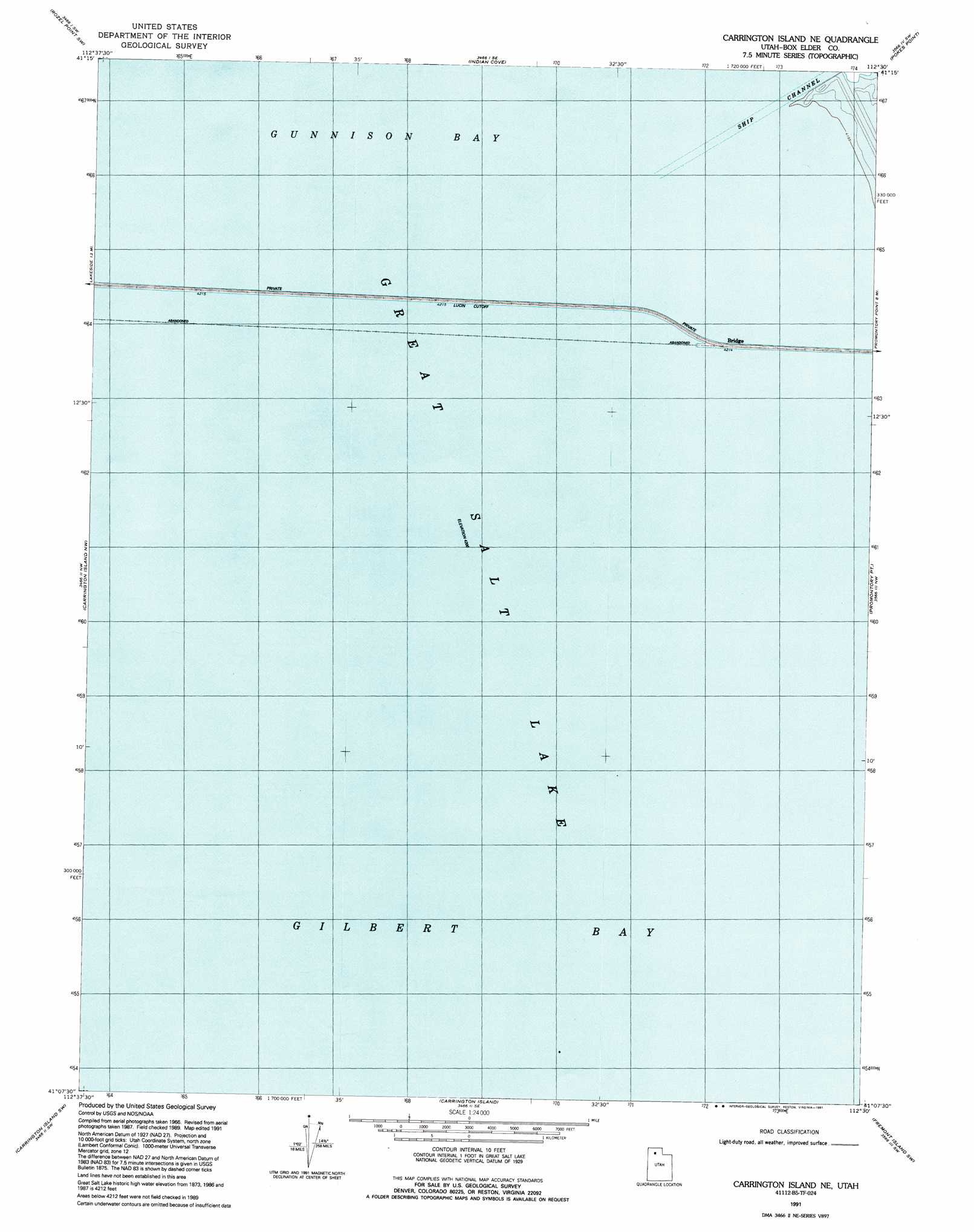
USGS Topo Quad 41112b5 - 1:24,000 scale
| Topo Map Name: | Carrington Island Ne |
| USGS Topo Quad ID: | 41112b5 |
| Print Size: | ca. 21 1/4" wide x 27" high |
| Southeast Coordinates: | 41.125° N latitude / 112.5° W longitude |
| Map Center Coordinates: | 41.1875° N latitude / 112.5625° W longitude |
| U.S. State: | UT |
| Filename: | o41112b5.jpg |
| Download Map JPG Image: | Carrington Island Ne topo map 1:24,000 scale |
| Map Type: | Topographic |
| Topo Series: | 7.5´ |
| Map Scale: | 1:24,000 |
| Source of Map Images: | United States Geological Survey (USGS) |
| Alternate Map Versions: |
Carrington Island NE UT 1969, updated 1972 Download PDF Buy paper map Carrington Island NE UT 1991, updated 1991 Download PDF Buy paper map Carrington Island NE UT 2011 Download PDF Buy paper map Carrington Island NE UT 2014 Download PDF Buy paper map |
1:24,000 Topo Quads surrounding Carrington Island Ne
Gunnison Island Ne |
Rozel Point |
Messix Peak |
East Promontory |
Mouth Of Bear River |
Gunnison Island |
Rozel Point Sw |
Indian Cove |
Pokes Point |
Willard Spur |
Lakeside |
Carrington Island Nw |
Carrington Island Ne |
Promontory Point |
Fremont Island |
Deardens Knoll |
Carrington Island Sw |
Carrington Island |
Fremont Island Sw |
Buffalo Point |
Craner Peak |
Badger Island Nw |
Badger Island |
Plug Peak Nw |
Plug Peak Ne |
> Back to 41112a1 at 1:100,000 scale
> Back to 41112a1 at 1:250,000 scale
> Back to U.S. Topo Maps home
Carrington Island Ne topo map: Gazetteer
Carrington Island Ne: Channels
Ship Channel elevation 1281m 4202′Carrington Island Ne digital topo map on disk
Buy this Carrington Island Ne topo map showing relief, roads, GPS coordinates and other geographical features, as a high-resolution digital map file on DVD: