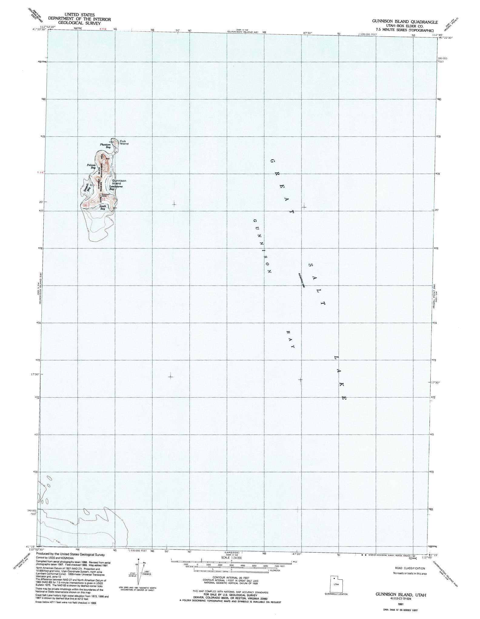
Gunnison Island Topo Map Utah
To zoom in, hover over the map of Gunnison Island
USGS Topo Quad 41112c7 - 1:24,000 scale
| Topo Map Name: | Gunnison Island |
| USGS Topo Quad ID: | 41112c7 |
| Print Size: | ca. 21 1/4" wide x 27" high |
| Southeast Coordinates: | 41.25° N latitude / 112.75° W longitude |
| Map Center Coordinates: | 41.3125° N latitude / 112.8125° W longitude |
| U.S. State: | UT |
| Filename: | o41112c7.jpg |
| Download Map JPG Image: | Gunnison Island topo map 1:24,000 scale |
| Map Type: | Topographic |
| Topo Series: | 7.5´ |
| Map Scale: | 1:24,000 |
| Source of Map Images: | United States Geological Survey (USGS) |
| Alternate Map Versions: |
Gunnison Island UT 1969, updated 1972 Download PDF Buy paper map Gunnison Island UT 1991, updated 1991 Download PDF Buy paper map Gunnison Island UT 2011 Download PDF Buy paper map Gunnison Island UT 2014 Download PDF Buy paper map |
1:24,000 Topo Quads surrounding Gunnison Island
Crocodile Mountain Se |
Spring Bay Sw |
Coyote Point |
Rozel |
Golden Spike Monument |
Dolphin Island West |
Dolphin Island East |
Gunnison Island Ne |
Rozel Point |
Messix Peak |
Hogup Ridge North |
Gunnison Island Sw |
Gunnison Island |
Rozel Point Sw |
Indian Cove |
Hogup Ridge South |
Strongs Knob |
Lakeside |
Carrington Island Nw |
Carrington Island Ne |
Round Mountain |
Sally Mountain |
Deardens Knoll |
Carrington Island Sw |
Carrington Island |
> Back to 41112a1 at 1:100,000 scale
> Back to 41112a1 at 1:250,000 scale
> Back to U.S. Topo Maps home
Gunnison Island topo map: Gazetteer
Gunnison Island: Bays
Lambourne Bay elevation 1281m 4202′Pelican Bay elevation 1281m 4202′
Phantom Bay elevation 1281m 4202′
Seagull Bay elevation 1281m 4202′
South Bay elevation 1281m 4202′
Gunnison Island: Islands
Cub Island elevation 1308m 4291′Gunnison Island elevation 1330m 4363′
Gunnison Island: Parks
Gunnison Island State Wildlife Management Area elevation 1328m 4356′Gunnison Island digital topo map on disk
Buy this Gunnison Island topo map showing relief, roads, GPS coordinates and other geographical features, as a high-resolution digital map file on DVD: