Pilot Peak Topo Map Nevada
To zoom in, hover over the map of Pilot Peak
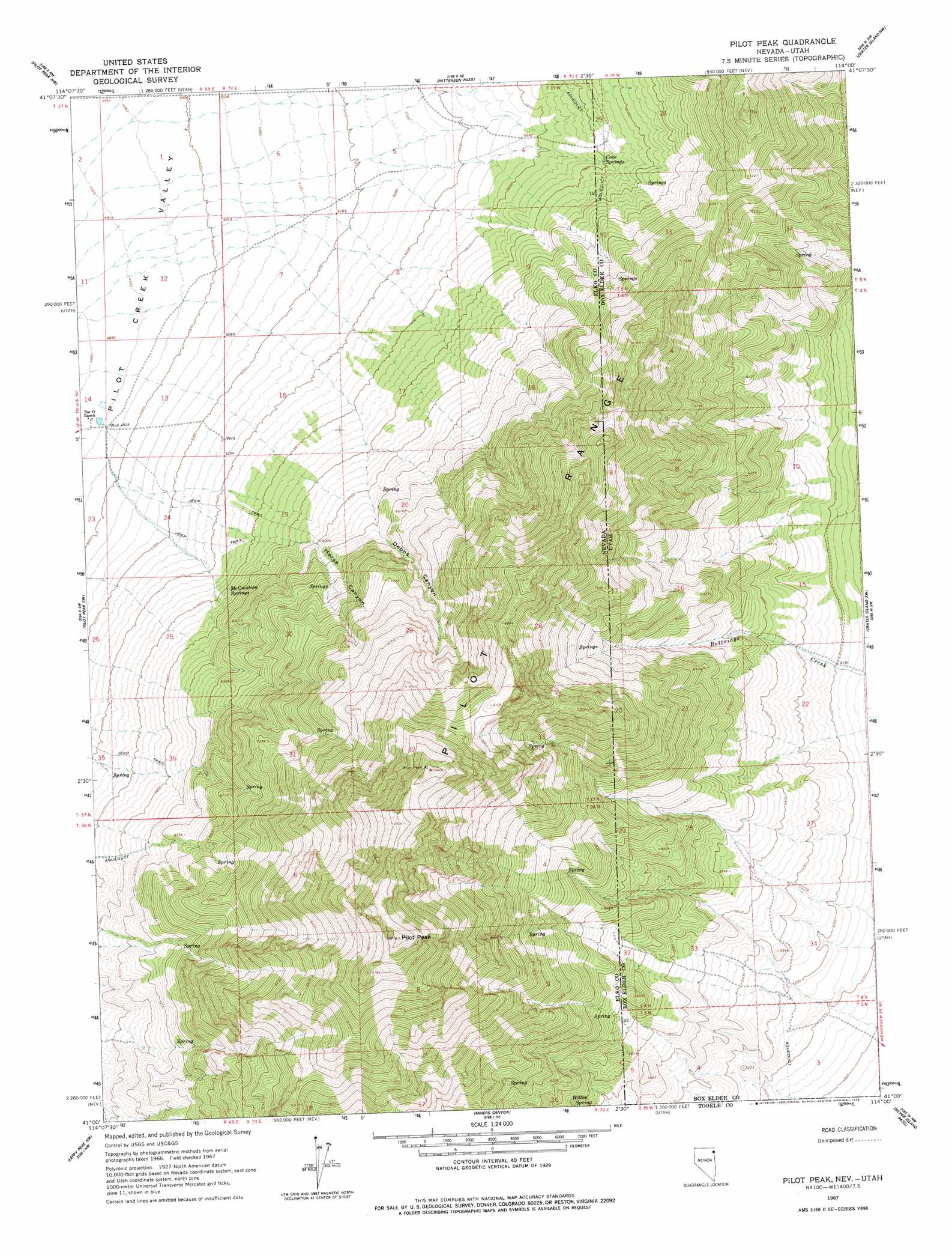
USGS Topo Quad 41114a1 - 1:24,000 scale
| Topo Map Name: | Pilot Peak |
| USGS Topo Quad ID: | 41114a1 |
| Print Size: | ca. 21 1/4" wide x 27" high |
| Southeast Coordinates: | 41° N latitude / 114° W longitude |
| Map Center Coordinates: | 41.0625° N latitude / 114.0625° W longitude |
| U.S. States: | NV, UT |
| Filename: | o41114a1.jpg |
| Download Map JPG Image: | Pilot Peak topo map 1:24,000 scale |
| Map Type: | Topographic |
| Topo Series: | 7.5´ |
| Map Scale: | 1:24,000 |
| Source of Map Images: | United States Geological Survey (USGS) |
| Alternate Map Versions: |
Pilot Peak NV 1967, updated 1971 Download PDF Buy paper map Pilot Peak NV 1967, updated 1978 Download PDF Buy paper map Pilot Peak NV 2011 Download PDF Buy paper map Pilot Peak NV 2012 Download PDF Buy paper map Pilot Peak NV 2014 Download PDF Buy paper map |
1:24,000 Topo Quads surrounding Pilot Peak
Montello Canyon |
Montello |
Tecoma |
Lucin |
Pigeon Mountain |
Loray |
Pilot Peak Nw |
Patterson Pass |
Crater Island Nw |
Lemay Island |
Cobre Se |
Pilot Peak Sw |
Pilot Peak |
Crater Island Sw |
Crater Island |
Silver Zone Pass |
Leppy Peak Nw |
Miners Canyon |
Silver Island Pass |
Graham Peak |
West Morris Basin |
Pilot |
Leppy Peak |
Tetzlaff Peak |
Bonneville Racetrack |
> Back to 41114a1 at 1:100,000 scale
> Back to 41114a1 at 1:250,000 scale
> Back to U.S. Topo Maps home
Pilot Peak topo map: Gazetteer
Pilot Peak: Airports
Pilot Creek Ranches Airport elevation 1513m 4963′Pilot Peak: Ranges
Pilot Range elevation 2491m 8172′Pilot Peak: Springs
Cove Springs elevation 1768m 5800′McCuistion Springs elevation 1707m 5600′
Willow Spring elevation 1751m 5744′
Pilot Peak: Streams
McDonald Creek elevation 1503m 4931′Pilot Peak: Summits
Pilot Peak elevation 3235m 10613′Pilot Peak: Valleys
Debbs Canyon elevation 1760m 5774′Horse Canyon elevation 1696m 5564′
Pilot Peak digital topo map on disk
Buy this Pilot Peak topo map showing relief, roads, GPS coordinates and other geographical features, as a high-resolution digital map file on DVD: