Cobre Se Topo Map Nevada
To zoom in, hover over the map of Cobre Se
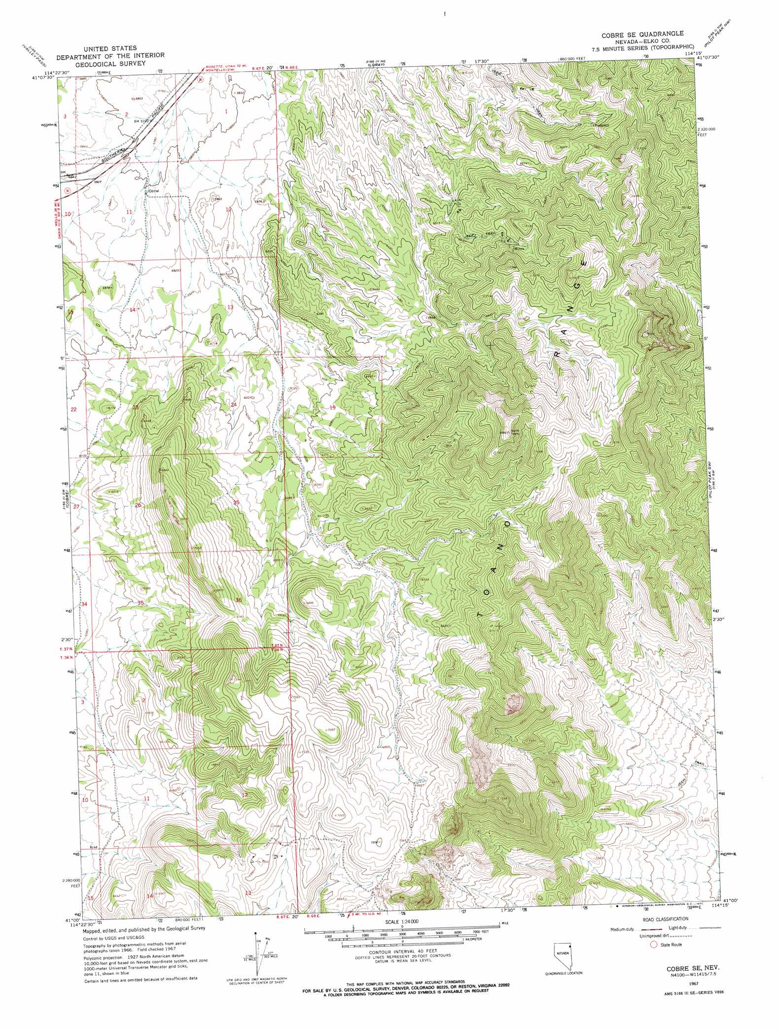
USGS Topo Quad 41114a3 - 1:24,000 scale
| Topo Map Name: | Cobre Se |
| USGS Topo Quad ID: | 41114a3 |
| Print Size: | ca. 21 1/4" wide x 27" high |
| Southeast Coordinates: | 41° N latitude / 114.25° W longitude |
| Map Center Coordinates: | 41.0625° N latitude / 114.3125° W longitude |
| U.S. State: | NV |
| Filename: | o41114a3.jpg |
| Download Map JPG Image: | Cobre Se topo map 1:24,000 scale |
| Map Type: | Topographic |
| Topo Series: | 7.5´ |
| Map Scale: | 1:24,000 |
| Source of Map Images: | United States Geological Survey (USGS) |
| Alternate Map Versions: |
Cobre SE NV 1967, updated 1971 Download PDF Buy paper map Cobre SE NV 2012 Download PDF Buy paper map Cobre SE NV 2014 Download PDF Buy paper map |
1:24,000 Topo Quads surrounding Cobre Se
Wine Cup Ranch Se |
Ninemile Mountain Sw |
Montello Canyon |
Montello |
Tecoma |
Pequop |
Valley Pass |
Loray |
Pilot Peak Nw |
Patterson Pass |
Pequop Summit |
Cobre |
Cobre Se |
Pilot Peak Sw |
Pilot Peak |
Independence Valley Ne |
Hardy Creek |
Silver Zone Pass |
Leppy Peak Nw |
Miners Canyon |
Independence Valley Se |
Shafter |
West Morris Basin |
Pilot |
Leppy Peak |
> Back to 41114a1 at 1:100,000 scale
> Back to 41114a1 at 1:250,000 scale
> Back to U.S. Topo Maps home
Cobre Se topo map: Gazetteer
Cobre Se: Mines
Lost Hope Mine elevation 1955m 6414′Cobre Se: Ranges
Toano Range elevation 2412m 7913′Cobre Se: Reservoirs
Loray Reservoir elevation 1812m 5944′Cobre Se: Springs
Granite Springs elevation 1930m 6332′Cobre Se digital topo map on disk
Buy this Cobre Se topo map showing relief, roads, GPS coordinates and other geographical features, as a high-resolution digital map file on DVD: