Pequop Summit Topo Map Nevada
To zoom in, hover over the map of Pequop Summit
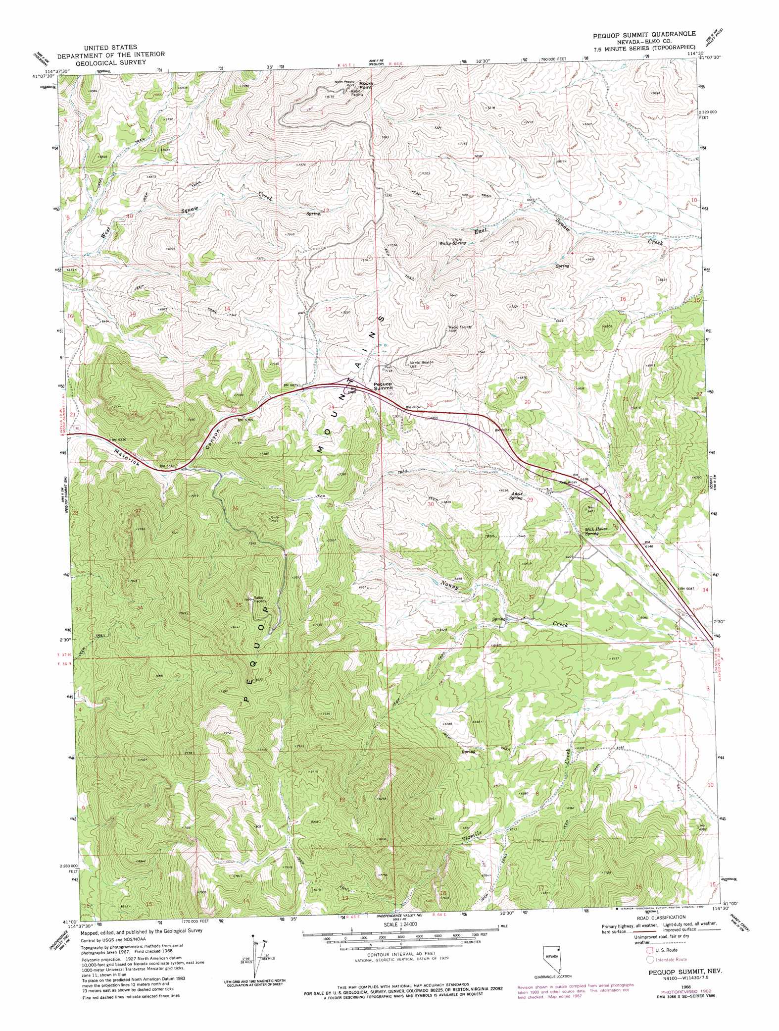
USGS Topo Quad 41114a5 - 1:24,000 scale
| Topo Map Name: | Pequop Summit |
| USGS Topo Quad ID: | 41114a5 |
| Print Size: | ca. 21 1/4" wide x 27" high |
| Southeast Coordinates: | 41° N latitude / 114.5° W longitude |
| Map Center Coordinates: | 41.0625° N latitude / 114.5625° W longitude |
| U.S. State: | NV |
| Filename: | o41114a5.jpg |
| Download Map JPG Image: | Pequop Summit topo map 1:24,000 scale |
| Map Type: | Topographic |
| Topo Series: | 7.5´ |
| Map Scale: | 1:24,000 |
| Source of Map Images: | United States Geological Survey (USGS) |
| Alternate Map Versions: |
Pequop Summit NV 1968, updated 1971 Download PDF Buy paper map Pequop Summit NV 1968, updated 1978 Download PDF Buy paper map Pequop Summit NV 1968, updated 1983 Download PDF Buy paper map Pequop Summit NV 2012 Download PDF Buy paper map Pequop Summit NV 2014 Download PDF Buy paper map |
1:24,000 Topo Quads surrounding Pequop Summit
Melandco |
Wine Cup Ranch Sw |
Wine Cup Ranch Se |
Ninemile Mountain Sw |
Montello Canyon |
Wells Peak |
Holborn |
Pequop |
Valley Pass |
Loray |
Moor Summit |
Pequop Summit Sw |
Pequop Summit |
Cobre |
Cobre Se |
Snow Water Lake Ne |
Independence Valley Nw |
Independence Valley Ne |
Hardy Creek |
Silver Zone Pass |
Ventosa |
Independence Valley Sw |
Independence Valley Se |
Shafter |
West Morris Basin |
> Back to 41114a1 at 1:100,000 scale
> Back to 41114a1 at 1:250,000 scale
> Back to U.S. Topo Maps home
Pequop Summit topo map: Gazetteer
Pequop Summit: Crossings
Pequop Interchange elevation 1919m 6295′Summit Interchange elevation 2119m 6952′
Pequop Summit: Gaps
Pequop Summit elevation 2135m 7004′Pequop Summit: Springs
Adele Spring elevation 1954m 6410′Milk House Spring elevation 1888m 6194′
Summit Spring elevation 2169m 7116′
Wally Spring elevation 2100m 6889′
Pequop Summit: Streams
North Fork East Squaw Creek elevation 2020m 6627′North Fork Squaw Creek elevation 2024m 6640′
Pierces Creek elevation 1923m 6309′
South Fork East Squaw Creek elevation 1994m 6541′
Pequop Summit: Summits
Rocky Point elevation 2504m 8215′Pequop Summit: Valleys
South Fork Maverick Canyon elevation 1992m 6535′Pequop Summit digital topo map on disk
Buy this Pequop Summit topo map showing relief, roads, GPS coordinates and other geographical features, as a high-resolution digital map file on DVD: