Pequop Summit Sw Topo Map Nevada
To zoom in, hover over the map of Pequop Summit Sw
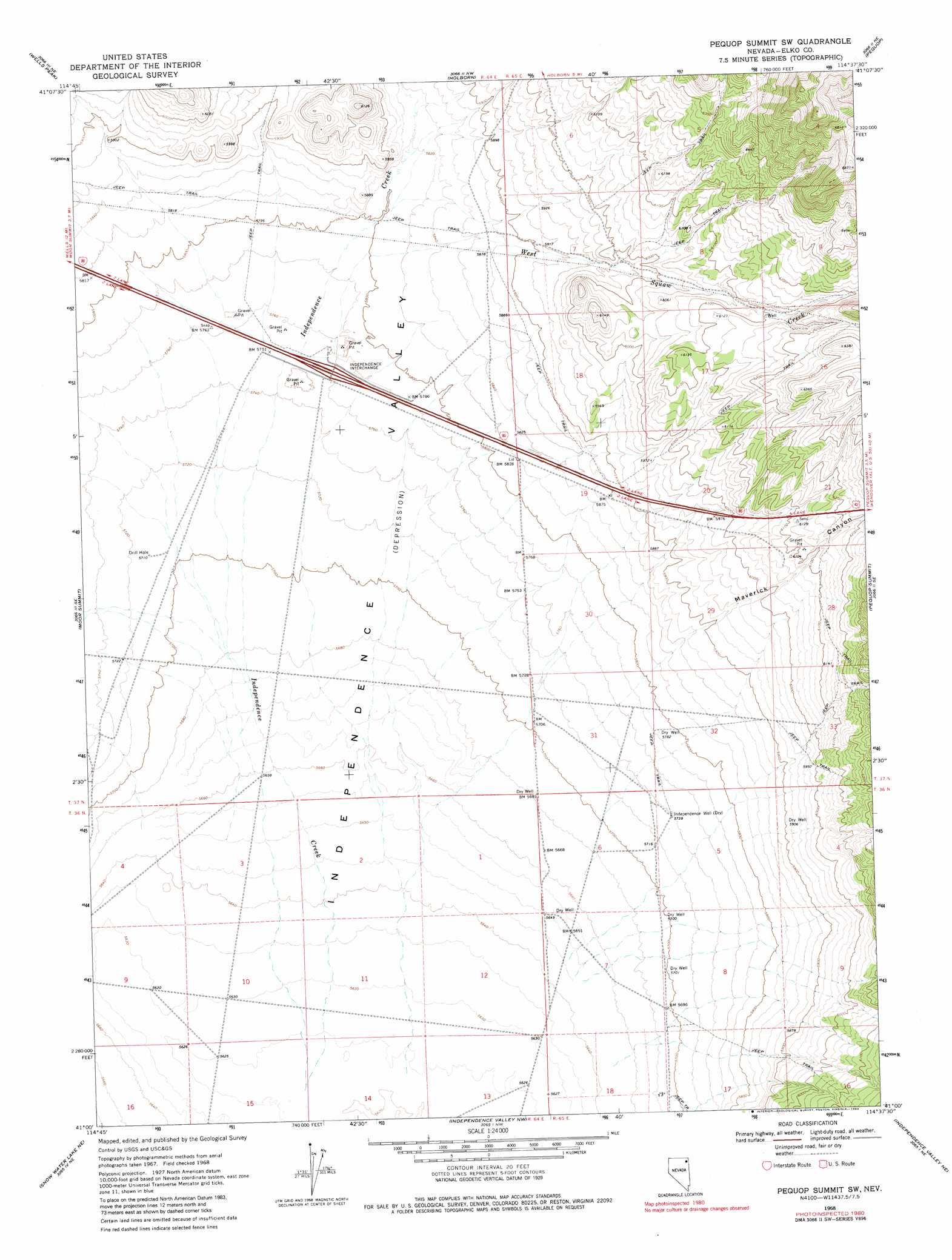
USGS Topo Quad 41114a6 - 1:24,000 scale
| Topo Map Name: | Pequop Summit Sw |
| USGS Topo Quad ID: | 41114a6 |
| Print Size: | ca. 21 1/4" wide x 27" high |
| Southeast Coordinates: | 41° N latitude / 114.625° W longitude |
| Map Center Coordinates: | 41.0625° N latitude / 114.6875° W longitude |
| U.S. State: | NV |
| Filename: | o41114a6.jpg |
| Download Map JPG Image: | Pequop Summit Sw topo map 1:24,000 scale |
| Map Type: | Topographic |
| Topo Series: | 7.5´ |
| Map Scale: | 1:24,000 |
| Source of Map Images: | United States Geological Survey (USGS) |
| Alternate Map Versions: |
Pequop Summit SW NV 1968, updated 1971 Download PDF Buy paper map Pequop Summit SW NV 1968, updated 1983 Download PDF Buy paper map Pequop Summit SW NV 2012 Download PDF Buy paper map Pequop Summit SW NV 2014 Download PDF Buy paper map |
1:24,000 Topo Quads surrounding Pequop Summit Sw
Summer Camp |
Melandco |
Wine Cup Ranch Sw |
Wine Cup Ranch Se |
Ninemile Mountain Sw |
Oxley Peak |
Wells Peak |
Holborn |
Pequop |
Valley Pass |
Wells |
Moor Summit |
Pequop Summit Sw |
Pequop Summit |
Cobre |
Tobar |
Snow Water Lake Ne |
Independence Valley Nw |
Independence Valley Ne |
Hardy Creek |
Snow Water Lake |
Ventosa |
Independence Valley Sw |
Independence Valley Se |
Shafter |
> Back to 41114a1 at 1:100,000 scale
> Back to 41114a1 at 1:250,000 scale
> Back to U.S. Topo Maps home
Pequop Summit Sw topo map: Gazetteer
Pequop Summit Sw: Crossings
Independence Interchange elevation 1757m 5764′Pequop Summit Sw: Streams
West Squaw Creek elevation 1753m 5751′Pequop Summit Sw: Valleys
Maverick Canyon elevation 1749m 5738′Pequop Summit Sw: Wells
Independence Well elevation 1750m 5741′Pequop Summit Sw digital topo map on disk
Buy this Pequop Summit Sw topo map showing relief, roads, GPS coordinates and other geographical features, as a high-resolution digital map file on DVD: