Pilot Peak Nw Topo Map Nevada
To zoom in, hover over the map of Pilot Peak Nw
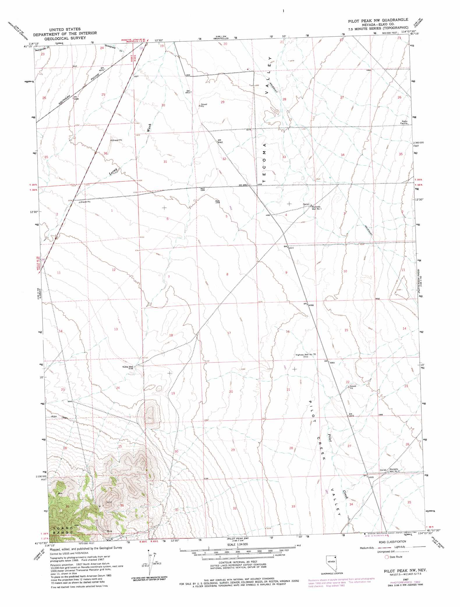
USGS Topo Quad 41114b2 - 1:24,000 scale
| Topo Map Name: | Pilot Peak Nw |
| USGS Topo Quad ID: | 41114b2 |
| Print Size: | ca. 21 1/4" wide x 27" high |
| Southeast Coordinates: | 41.125° N latitude / 114.125° W longitude |
| Map Center Coordinates: | 41.1875° N latitude / 114.1875° W longitude |
| U.S. State: | NV |
| Filename: | o41114b2.jpg |
| Download Map JPG Image: | Pilot Peak Nw topo map 1:24,000 scale |
| Map Type: | Topographic |
| Topo Series: | 7.5´ |
| Map Scale: | 1:24,000 |
| Source of Map Images: | United States Geological Survey (USGS) |
| Alternate Map Versions: |
Pilot Peak NW NV 1967, updated 1971 Download PDF Buy paper map Pilot Peak NW NV 1967, updated 1983 Download PDF Buy paper map Pilot Peak NW NV 2012 Download PDF Buy paper map Pilot Peak NW NV 2014 Download PDF Buy paper map |
1:24,000 Topo Quads surrounding Pilot Peak Nw
Ninemile Mountain |
Ninemile Mountain Ne |
Twelvemile Ranch |
Jackson Spring |
Lucin Nw |
Ninemile Mountain Sw |
Montello Canyon |
Montello |
Tecoma |
Lucin |
Valley Pass |
Loray |
Pilot Peak Nw |
Patterson Pass |
Crater Island Nw |
Cobre |
Cobre Se |
Pilot Peak Sw |
Pilot Peak |
Crater Island Sw |
Hardy Creek |
Silver Zone Pass |
Leppy Peak Nw |
Miners Canyon |
Silver Island Pass |
> Back to 41114a1 at 1:100,000 scale
> Back to 41114a1 at 1:250,000 scale
> Back to U.S. Topo Maps home
Pilot Peak Nw topo map: Gazetteer
Pilot Peak Nw: Populated Places
Bauvard (historical) elevation 1531m 5022′Pilot Peak Nw: Post Offices
Bauvard Post Office (historical) elevation 1531m 5022′Pilot Peak Nw: Streams
Immigrant Creek elevation 1505m 4937′Pilot Peak Nw: Wells
Highway Well Number Seventy-eight elevation 1515m 4970′Montello Well Number One elevation 1511m 4957′
Montello Well Number Two elevation 1509m 4950′
Noble Well elevation 1571m 5154′
Pilot Peak Nw digital topo map on disk
Buy this Pilot Peak Nw topo map showing relief, roads, GPS coordinates and other geographical features, as a high-resolution digital map file on DVD: