Loray Topo Map Nevada
To zoom in, hover over the map of Loray
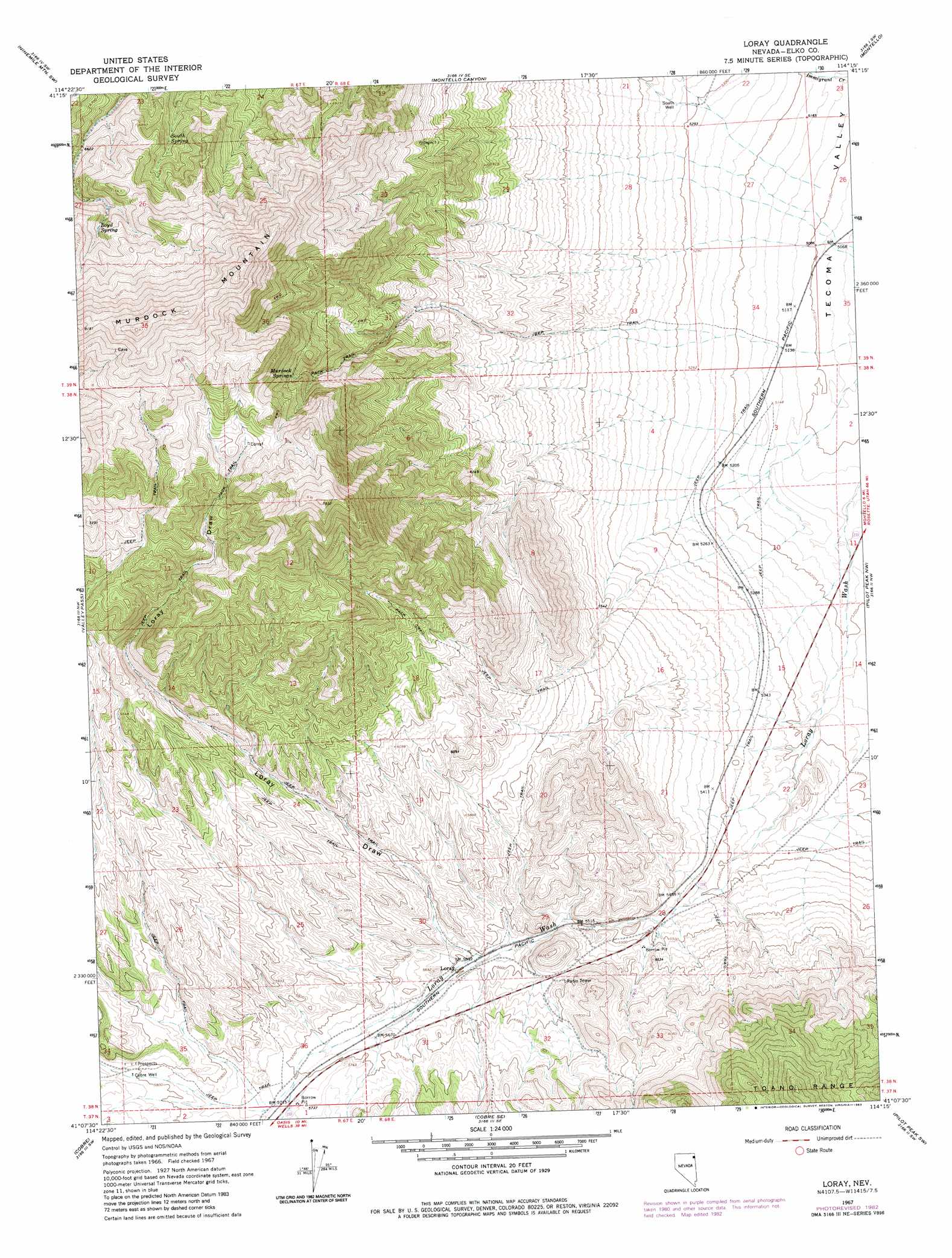
USGS Topo Quad 41114b3 - 1:24,000 scale
| Topo Map Name: | Loray |
| USGS Topo Quad ID: | 41114b3 |
| Print Size: | ca. 21 1/4" wide x 27" high |
| Southeast Coordinates: | 41.125° N latitude / 114.25° W longitude |
| Map Center Coordinates: | 41.1875° N latitude / 114.3125° W longitude |
| U.S. State: | NV |
| Filename: | o41114b3.jpg |
| Download Map JPG Image: | Loray topo map 1:24,000 scale |
| Map Type: | Topographic |
| Topo Series: | 7.5´ |
| Map Scale: | 1:24,000 |
| Source of Map Images: | United States Geological Survey (USGS) |
| Alternate Map Versions: |
Loray NV 1967, updated 1971 Download PDF Buy paper map Loray NV 1967, updated 1983 Download PDF Buy paper map Loray NV 2012 Download PDF Buy paper map Loray NV 2014 Download PDF Buy paper map |
1:24,000 Topo Quads surrounding Loray
Wine Cup Ranch Ne |
Ninemile Mountain |
Ninemile Mountain Ne |
Twelvemile Ranch |
Jackson Spring |
Wine Cup Ranch Se |
Ninemile Mountain Sw |
Montello Canyon |
Montello |
Tecoma |
Pequop |
Valley Pass |
Loray |
Pilot Peak Nw |
Patterson Pass |
Pequop Summit |
Cobre |
Cobre Se |
Pilot Peak Sw |
Pilot Peak |
Independence Valley Ne |
Hardy Creek |
Silver Zone Pass |
Leppy Peak Nw |
Miners Canyon |
> Back to 41114a1 at 1:100,000 scale
> Back to 41114a1 at 1:250,000 scale
> Back to U.S. Topo Maps home
Loray topo map: Gazetteer
Loray: Gaps
North Pass elevation 1690m 5544′Loray: Mines
Cobrecite Mine elevation 1803m 5915′Loray: Populated Places
Loray elevation 1708m 5603′Loray: Springs
Boyd Spring elevation 2125m 6971′Murdock Springs elevation 2050m 6725′
South Spring elevation 2018m 6620′
Loray: Summits
Murdock Mountain elevation 2532m 8307′Loray: Valleys
Loray Draw elevation 1702m 5583′Loray: Wells
Cobre Well elevation 1771m 5810′South Well elevation 1623m 5324′
Loray digital topo map on disk
Buy this Loray topo map showing relief, roads, GPS coordinates and other geographical features, as a high-resolution digital map file on DVD: