Wine Cup Ranch Ne Topo Map Nevada
To zoom in, hover over the map of Wine Cup Ranch Ne
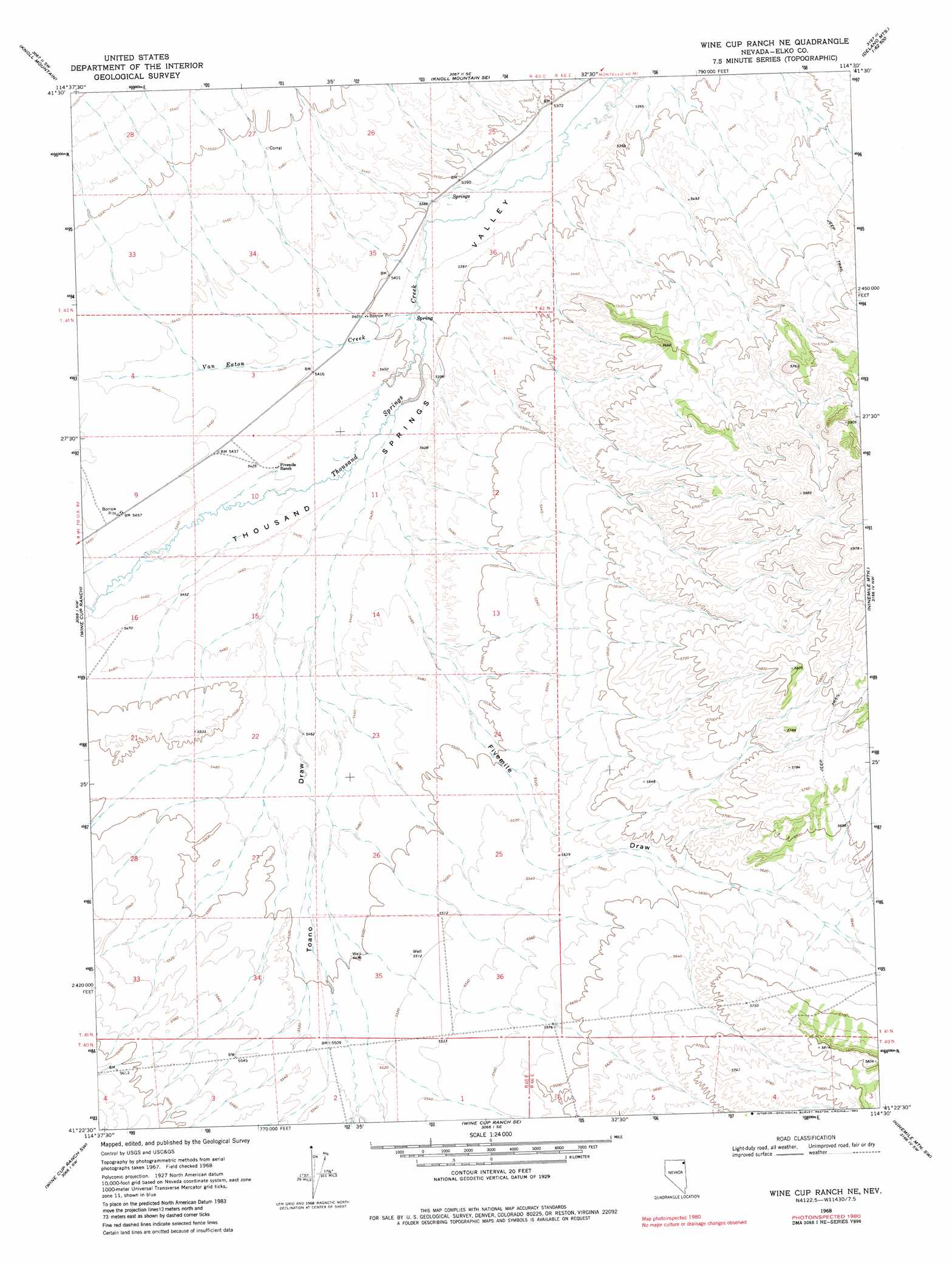
USGS Topo Quad 41114d5 - 1:24,000 scale
| Topo Map Name: | Wine Cup Ranch Ne |
| USGS Topo Quad ID: | 41114d5 |
| Print Size: | ca. 21 1/4" wide x 27" high |
| Southeast Coordinates: | 41.375° N latitude / 114.5° W longitude |
| Map Center Coordinates: | 41.4375° N latitude / 114.5625° W longitude |
| U.S. State: | NV |
| Filename: | o41114d5.jpg |
| Download Map JPG Image: | Wine Cup Ranch Ne topo map 1:24,000 scale |
| Map Type: | Topographic |
| Topo Series: | 7.5´ |
| Map Scale: | 1:24,000 |
| Source of Map Images: | United States Geological Survey (USGS) |
| Alternate Map Versions: |
Wine Cup Ranch NE NV 1968, updated 1978 Download PDF Buy paper map Wine Cup Ranch NE NV 1968, updated 1982 Download PDF Buy paper map Wine Cup Ranch NE NV 2012 Download PDF Buy paper map Wine Cup Ranch NE NV 2014 Download PDF Buy paper map |
1:24,000 Topo Quads surrounding Wine Cup Ranch Ne
Henry |
Blanchard Mountain |
Texas Spring |
Emigrant Springs |
Dry Canyon |
Harris Canyon |
Knoll Mountain |
Knoll Mountain Se |
Chicken Springs |
Delano Peak |
Wilkins |
Wine Cup Ranch |
Wine Cup Ranch Ne |
Ninemile Mountain |
Ninemile Mountain Ne |
Melandco |
Wine Cup Ranch Sw |
Wine Cup Ranch Se |
Ninemile Mountain Sw |
Montello Canyon |
Wells Peak |
Holborn |
Pequop |
Valley Pass |
Loray |
> Back to 41114a1 at 1:100,000 scale
> Back to 41114a1 at 1:250,000 scale
> Back to U.S. Topo Maps home
Wine Cup Ranch Ne topo map: Gazetteer
Wine Cup Ranch Ne: Streams
Van Eaton Creek elevation 1645m 5396′Wine Cup Ranch Ne: Valleys
Fivemile Draw elevation 1653m 5423′Toano Draw elevation 1653m 5423′
Wine Cup Ranch Ne digital topo map on disk
Buy this Wine Cup Ranch Ne topo map showing relief, roads, GPS coordinates and other geographical features, as a high-resolution digital map file on DVD: