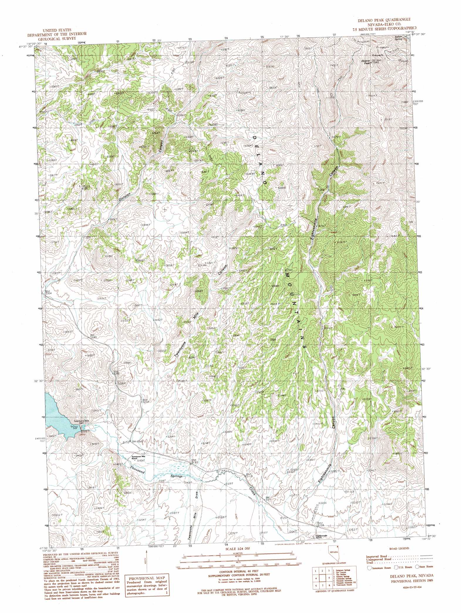
Delano Peak Topo Map Nevada
To zoom in, hover over the map of Delano Peak
USGS Topo Quad 41114e3 - 1:24,000 scale
| Topo Map Name: | Delano Peak |
| USGS Topo Quad ID: | 41114e3 |
| Print Size: | ca. 21 1/4" wide x 27" high |
| Southeast Coordinates: | 41.5° N latitude / 114.25° W longitude |
| Map Center Coordinates: | 41.5625° N latitude / 114.3125° W longitude |
| U.S. State: | NV |
| Filename: | o41114e3.jpg |
| Download Map JPG Image: | Delano Peak topo map 1:24,000 scale |
| Map Type: | Topographic |
| Topo Series: | 7.5´ |
| Map Scale: | 1:24,000 |
| Source of Map Images: | United States Geological Survey (USGS) |
| Alternate Map Versions: |
Delano Peak NV 1989, updated 1989 Download PDF Buy paper map Delano Peak NV 2012 Download PDF Buy paper map Delano Peak NV 2014 Download PDF Buy paper map |
1:24,000 Topo Quads surrounding Delano Peak
Tijuana John Peak |
Devils Pass |
Mustang Draw |
Cedar Mountain Draw |
Judd Mountain |
Texas Spring |
Emigrant Springs |
Dry Canyon |
The Baldies |
Death Creek Reservoir |
Knoll Mountain Se |
Chicken Springs |
Delano Peak |
Crittenden Springs |
Dairy Valley |
Wine Cup Ranch Ne |
Ninemile Mountain |
Ninemile Mountain Ne |
Twelvemile Ranch |
Jackson Spring |
Wine Cup Ranch Se |
Ninemile Mountain Sw |
Montello Canyon |
Montello |
Tecoma |
> Back to 41114e1 at 1:100,000 scale
> Back to 41114a1 at 1:250,000 scale
> Back to U.S. Topo Maps home
Delano Peak topo map: Gazetteer
Delano Peak: Dams
Twentyone Mile Dam elevation 1586m 5203′Delano Peak: Ranges
Delano Mountains elevation 2345m 7693′Delano Peak: Reservoirs
23 Mile Reservoir elevation 1586m 5203′Delano Peak: Springs
Eighteen Mile Spring elevation 2012m 6601′Indian Spring elevation 2078m 6817′
Delano Peak: Summits
Delano Peak elevation 2390m 7841′Delano Peak: Valleys
Eighteenmile Canyon elevation 1573m 5160′Twentyone Mile Canyon elevation 1572m 5157′
Twentyone Mile Draw elevation 1566m 5137′
Delano Peak: Wells
Hill Well elevation 1707m 5600′Delano Peak digital topo map on disk
Buy this Delano Peak topo map showing relief, roads, GPS coordinates and other geographical features, as a high-resolution digital map file on DVD: