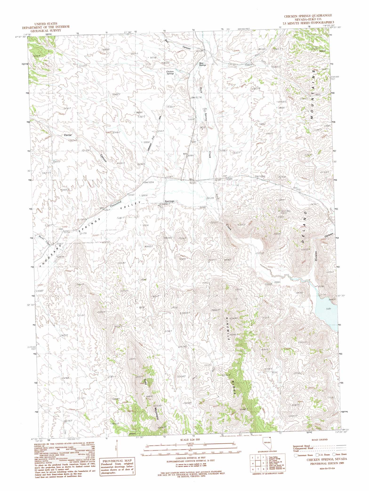
Chicken Springs Topo Map Nevada
To zoom in, hover over the map of Chicken Springs
USGS Topo Quad 41114e4 - 1:24,000 scale
| Topo Map Name: | Chicken Springs |
| USGS Topo Quad ID: | 41114e4 |
| Print Size: | ca. 21 1/4" wide x 27" high |
| Southeast Coordinates: | 41.5° N latitude / 114.375° W longitude |
| Map Center Coordinates: | 41.5625° N latitude / 114.4375° W longitude |
| U.S. State: | NV |
| Filename: | o41114e4.jpg |
| Download Map JPG Image: | Chicken Springs topo map 1:24,000 scale |
| Map Type: | Topographic |
| Topo Series: | 7.5´ |
| Map Scale: | 1:24,000 |
| Source of Map Images: | United States Geological Survey (USGS) |
| Alternate Map Versions: |
Chicken Springs NV 1989, updated 1989 Download PDF Buy paper map Chicken Springs NV 2012 Download PDF Buy paper map Chicken Springs NV 2014 Download PDF Buy paper map |
1:24,000 Topo Quads surrounding Chicken Springs
Middle Stack Mountain |
Tijuana John Peak |
Devils Pass |
Mustang Draw |
Cedar Mountain Draw |
Blanchard Mountain |
Texas Spring |
Emigrant Springs |
Dry Canyon |
The Baldies |
Knoll Mountain |
Knoll Mountain Se |
Chicken Springs |
Delano Peak |
Crittenden Springs |
Wine Cup Ranch |
Wine Cup Ranch Ne |
Ninemile Mountain |
Ninemile Mountain Ne |
Twelvemile Ranch |
Wine Cup Ranch Sw |
Wine Cup Ranch Se |
Ninemile Mountain Sw |
Montello Canyon |
Montello |
> Back to 41114e1 at 1:100,000 scale
> Back to 41114a1 at 1:250,000 scale
> Back to U.S. Topo Maps home
Chicken Springs topo map: Gazetteer
Chicken Springs: Flats
Well Spring Valley elevation 1604m 5262′Chicken Springs: Springs
Chicken Springs elevation 1628m 5341′Mud Springs elevation 1615m 5298′
Chicken Springs: Streams
Burnt Creek elevation 1610m 5282′Rock Spring Creek elevation 1593m 5226′
Sulphur Creek elevation 1617m 5305′
Chicken Springs: Valleys
Bell Canyon elevation 1617m 5305′Corral Canyon elevation 1604m 5262′
Division Canyon elevation 1588m 5209′
Thousand Springs Valley elevation 1595m 5232′
Chicken Springs: Wells
Rock Springs Well elevation 1673m 5488′Sims Well elevation 1670m 5479′
Chicken Springs digital topo map on disk
Buy this Chicken Springs topo map showing relief, roads, GPS coordinates and other geographical features, as a high-resolution digital map file on DVD: