Texas Spring Topo Map Nevada
To zoom in, hover over the map of Texas Spring
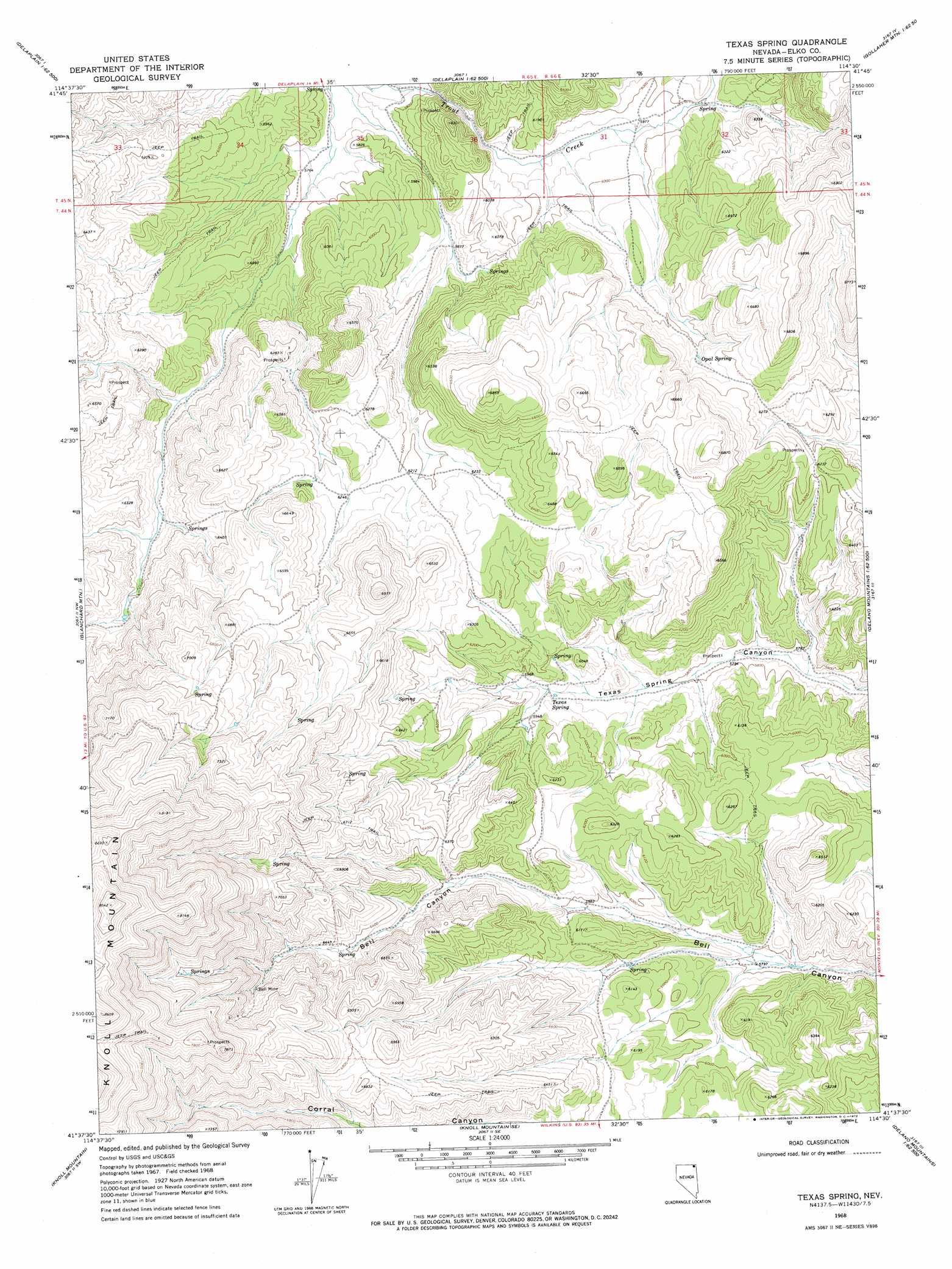
USGS Topo Quad 41114f5 - 1:24,000 scale
| Topo Map Name: | Texas Spring |
| USGS Topo Quad ID: | 41114f5 |
| Print Size: | ca. 21 1/4" wide x 27" high |
| Southeast Coordinates: | 41.625° N latitude / 114.5° W longitude |
| Map Center Coordinates: | 41.6875° N latitude / 114.5625° W longitude |
| U.S. State: | NV |
| Filename: | o41114f5.jpg |
| Download Map JPG Image: | Texas Spring topo map 1:24,000 scale |
| Map Type: | Topographic |
| Topo Series: | 7.5´ |
| Map Scale: | 1:24,000 |
| Source of Map Images: | United States Geological Survey (USGS) |
| Alternate Map Versions: |
Texas Spring NV 1968, updated 1972 Download PDF Buy paper map Texas Spring NV 2012 Download PDF Buy paper map Texas Spring NV 2014 Download PDF Buy paper map |
1:24,000 Topo Quads surrounding Texas Spring
Browns Bench Ranch |
Jackpot |
East Of Jackpot |
Gollaher Mountain |
Stratton Spring |
Contact |
Middle Stack Mountain |
Tijuana John Peak |
Devils Pass |
Mustang Draw |
Henry |
Blanchard Mountain |
Texas Spring |
Emigrant Springs |
Dry Canyon |
Harris Canyon |
Knoll Mountain |
Knoll Mountain Se |
Chicken Springs |
Delano Peak |
Wilkins |
Wine Cup Ranch |
Wine Cup Ranch Ne |
Ninemile Mountain |
Ninemile Mountain Ne |
> Back to 41114e1 at 1:100,000 scale
> Back to 41114a1 at 1:250,000 scale
> Back to U.S. Topo Maps home
Texas Spring topo map: Gazetteer
Texas Spring: Mines
Bell Mine elevation 2067m 6781′Texas Spring: Springs
Opal Spring elevation 1912m 6272′Texas Spring elevation 1808m 5931′
Texas Spring digital topo map on disk
Buy this Texas Spring topo map showing relief, roads, GPS coordinates and other geographical features, as a high-resolution digital map file on DVD: