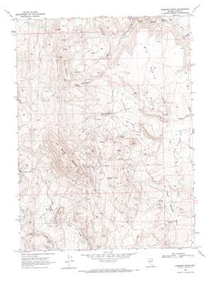
Hubbard Basin Topo Map Nevada
To zoom in, hover over the map of Hubbard Basin
USGS Topo Quad 41114f8 - 1:24,000 scale
| Topo Map Name: | Hubbard Basin |
| USGS Topo Quad ID: | 41114f8 |
| Print Size: | ca. 21 1/4" wide x 27" high |
| Southeast Coordinates: | 41.625° N latitude / 114.875° W longitude |
| Map Center Coordinates: | 41.6875° N latitude / 114.9375° W longitude |
| U.S. State: | NV |
| Filename: | o41114f8.jpg |
| Download Map JPG Image: | Hubbard Basin topo map 1:24,000 scale |
| Map Type: | Topographic |
| Topo Series: | 7.5´ |
| Map Scale: | 1:24,000 |
| Source of Map Images: | United States Geological Survey (USGS) |
| Alternate Map Versions: |
Hubbard Basin NV 1968, updated 1971 Download PDF Buy paper map Hubbard Basin NV 2012 Download PDF Buy paper map Hubbard Basin NV 2014 Download PDF Buy paper map |
1:24,000 Topo Quads surrounding Hubbard Basin
> Back to 41114e1 at 1:100,000 scale
> Back to 41114a1 at 1:250,000 scale
> Back to U.S. Topo Maps home
Hubbard Basin topo map: Gazetteer
Hubbard Basin: Basins
Hubbard Basin elevation 1917m 6289′Lower Hubbard Basin elevation 1817m 5961′
Hubbard Basin: Flats
Big Devils Table elevation 2007m 6584′Burnt Meadow elevation 1690m 5544′
Hubbard Basin: Reservoirs
Corner Reservoir elevation 1935m 6348′Hubbard Basin: Springs
Antelope Spring elevation 1955m 6414′Dynamite Spring elevation 2054m 6738′
Hillside Spring elevation 2155m 7070′
Leo Spring elevation 2229m 7312′
Twin Ledge Spring elevation 1824m 5984′
Wrist Spring elevation 2147m 7043′
Hubbard Basin: Summits
Black Mountain elevation 2372m 7782′Cold Springs Mountain elevation 2466m 8090′
Little Devils Table elevation 2047m 6715′
Hubbard Basin: Valleys
Bonanza Canyon elevation 1682m 5518′Hubbard Basin digital topo map on disk
Buy this Hubbard Basin topo map showing relief, roads, GPS coordinates and other geographical features, as a high-resolution digital map file on DVD:


