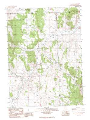
Nile Spring Topo Map Nevada
To zoom in, hover over the map of Nile Spring
USGS Topo Quad 41114h1 - 1:24,000 scale
| Topo Map Name: | Nile Spring |
| USGS Topo Quad ID: | 41114h1 |
| Print Size: | ca. 21 1/4" wide x 27" high |
| Southeast Coordinates: | 41.875° N latitude / 114° W longitude |
| Map Center Coordinates: | 41.9375° N latitude / 114.0625° W longitude |
| U.S. States: | NV, UT, ID |
| Filename: | o41114h1.jpg |
| Download Map JPG Image: | Nile Spring topo map 1:24,000 scale |
| Map Type: | Topographic |
| Topo Series: | 7.5´ |
| Map Scale: | 1:24,000 |
| Source of Map Images: | United States Geological Survey (USGS) |
| Alternate Map Versions: |
Nile Spring NV 1989, updated 1989 Download PDF Buy paper map Nile Spring NV 2011 Download PDF Buy paper map Nile Spring NV 2015 Download PDF Buy paper map |
| FStopo: | US Forest Service topo Nile Spring is available: Download FStopo PDF Download FStopo TIF |
1:24,000 Topo Quads surrounding Nile Spring
> Back to 41114e1 at 1:100,000 scale
> Back to 41114a1 at 1:250,000 scale
> Back to U.S. Topo Maps home
Nile Spring topo map: Gazetteer
Nile Spring: Springs
Mud Spring elevation 1647m 5403′Nile Spring elevation 1555m 5101′
Nile Spring: Streams
Bottom Creek elevation 1594m 5229′Hardesty Creek elevation 1546m 5072′
Hardesty Creek elevation 1546m 5072′
Jay Creek elevation 1547m 5075′
Jay Creek elevation 1544m 5065′
Meadow Creek elevation 1565m 5134′
Meadow Creek elevation 1564m 5131′
Spring Creek elevation 1579m 5180′
Trout Creek elevation 1567m 5141′
Trout Creek elevation 1567m 5141′
Nile Spring: Valleys
Fivemile Gulch elevation 1597m 5239′Nile Spring: Wells
Gambles Hole elevation 1573m 5160′Nile Spring digital topo map on disk
Buy this Nile Spring topo map showing relief, roads, GPS coordinates and other geographical features, as a high-resolution digital map file on DVD:


