Dinner Station Topo Map Nevada
To zoom in, hover over the map of Dinner Station
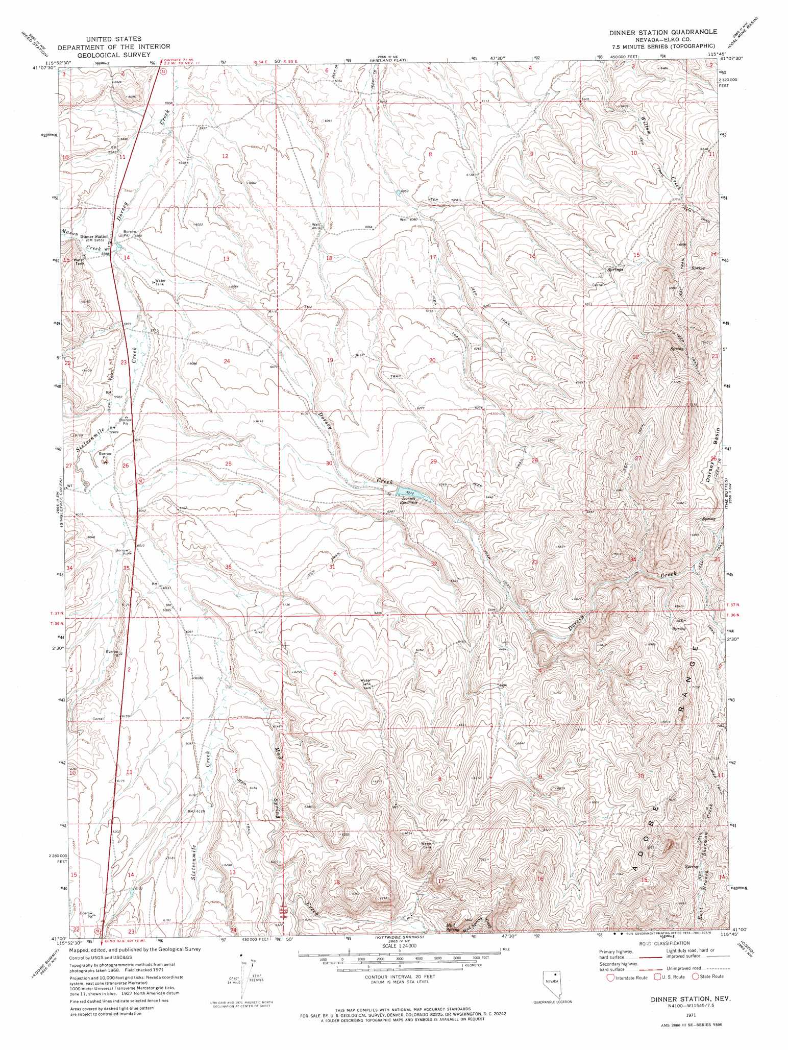
USGS Topo Quad 41115a7 - 1:24,000 scale
| Topo Map Name: | Dinner Station |
| USGS Topo Quad ID: | 41115a7 |
| Print Size: | ca. 21 1/4" wide x 27" high |
| Southeast Coordinates: | 41° N latitude / 115.75° W longitude |
| Map Center Coordinates: | 41.0625° N latitude / 115.8125° W longitude |
| U.S. State: | NV |
| Filename: | o41115a7.jpg |
| Download Map JPG Image: | Dinner Station topo map 1:24,000 scale |
| Map Type: | Topographic |
| Topo Series: | 7.5´ |
| Map Scale: | 1:24,000 |
| Source of Map Images: | United States Geological Survey (USGS) |
| Alternate Map Versions: |
Dinner Station NV 1971, updated 1974 Download PDF Buy paper map Dinner Station NV 2012 Download PDF Buy paper map Dinner Station NV 2014 Download PDF Buy paper map |
1:24,000 Topo Quads surrounding Dinner Station
Water Pipe Canyon |
Mahala Creek West |
Mahala Creek East |
Tule Valley |
Double Mountain Se |
Stampede Ranch |
Reed Station |
Wieland Flat |
Coal Mine Basin |
The Narrows |
Blue Basin |
Singletree Creek |
Dinner Station |
The Buttes |
Coal Mine Canyon Se |
Swales Mountain |
Adobe Summit |
Kittridge Springs |
Osino |
Ryndon |
Huntsman Ranch |
Hunter |
Elko West |
Elko East |
Boyd Reservoir |
> Back to 41115a1 at 1:100,000 scale
> Back to 41114a1 at 1:250,000 scale
> Back to U.S. Topo Maps home
Dinner Station topo map: Gazetteer
Dinner Station: Dams
Dorsey Creek Dam elevation 1895m 6217′Dinner Station: Populated Places
Dinner Station elevation 1817m 5961′Dinner Station: Post Offices
Weiland Station Post Office (historical) elevation 1817m 5961′Dinner Station: Reservoirs
Dorsey Reservoir elevation 1895m 6217′Dinner Station: Springs
Mud Spring elevation 1990m 6528′Dinner Station: Streams
Mason Creek elevation 1817m 5961′Mud Spring Creek elevation 1848m 6062′
Sixteenmile Creek elevation 1817m 5961′
Dinner Station digital topo map on disk
Buy this Dinner Station topo map showing relief, roads, GPS coordinates and other geographical features, as a high-resolution digital map file on DVD: