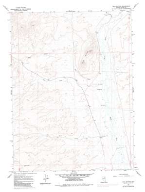
Twin Buttes Topo Map Nevada
To zoom in, hover over the map of Twin Buttes
USGS Topo Quad 41115b3 - 1:24,000 scale
| Topo Map Name: | Twin Buttes |
| USGS Topo Quad ID: | 41115b3 |
| Print Size: | ca. 21 1/4" wide x 27" high |
| Southeast Coordinates: | 41.125° N latitude / 115.25° W longitude |
| Map Center Coordinates: | 41.1875° N latitude / 115.3125° W longitude |
| U.S. State: | NV |
| Filename: | o41115b3.jpg |
| Download Map JPG Image: | Twin Buttes topo map 1:24,000 scale |
| Map Type: | Topographic |
| Topo Series: | 7.5´ |
| Map Scale: | 1:24,000 |
| Source of Map Images: | United States Geological Survey (USGS) |
| Alternate Map Versions: |
Twin Buttes NV 1967, updated 1971 Download PDF Buy paper map Twin Buttes NV 1967, updated 1983 Download PDF Buy paper map Twin Buttes NV 2012 Download PDF Buy paper map Twin Buttes NV 2014 Download PDF Buy paper map |
1:24,000 Topo Quads surrounding Twin Buttes
> Back to 41115a1 at 1:100,000 scale
> Back to 41114a1 at 1:250,000 scale
> Back to U.S. Topo Maps home
Twin Buttes topo map: Gazetteer
Twin Buttes: Springs
Hot Spring elevation 1662m 5452′Hot Spring elevation 1661m 5449′
Hot Spring elevation 1656m 5433′
Twin Buttes: Streams
Allen Creek elevation 1656m 5433′Gopher Creek elevation 1658m 5439′
Hot Springs Creek elevation 1675m 5495′
Pole Creek elevation 1661m 5449′
Twin Buttes: Summits
Skinners Point elevation 1668m 5472′Twin Buttes elevation 1892m 6207′
Twin Buttes: Wells
Gopher Creek Well elevation 1699m 5574′Salt Block Well elevation 1763m 5784′
Twin Buttes digital topo map on disk
Buy this Twin Buttes topo map showing relief, roads, GPS coordinates and other geographical features, as a high-resolution digital map file on DVD:


