Hanks Creek Sw Topo Map Nevada
To zoom in, hover over the map of Hanks Creek Sw
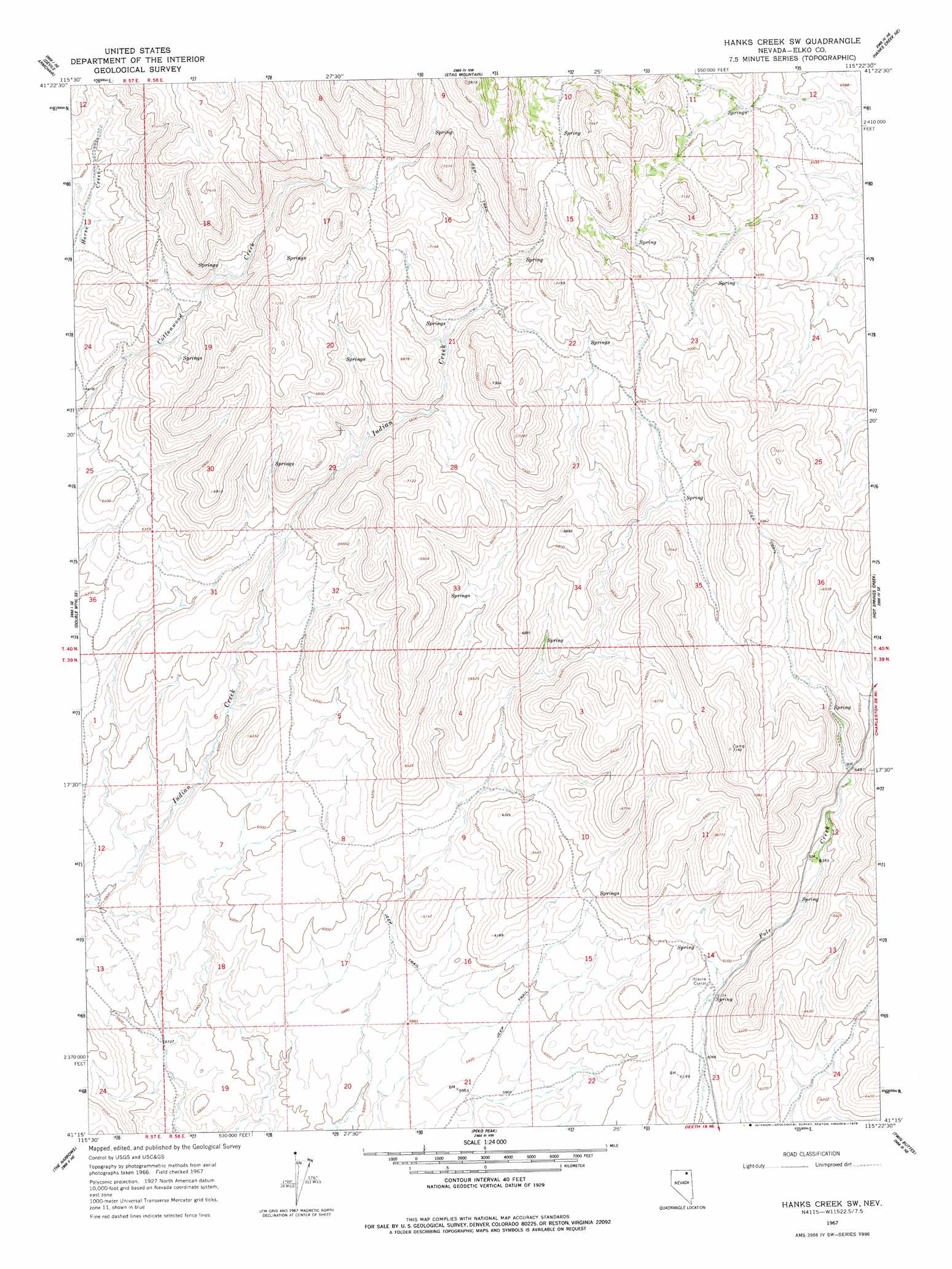
USGS Topo Quad 41115c4 - 1:24,000 scale
| Topo Map Name: | Hanks Creek Sw |
| USGS Topo Quad ID: | 41115c4 |
| Print Size: | ca. 21 1/4" wide x 27" high |
| Southeast Coordinates: | 41.25° N latitude / 115.375° W longitude |
| Map Center Coordinates: | 41.3125° N latitude / 115.4375° W longitude |
| U.S. State: | NV |
| Filename: | o41115c4.jpg |
| Download Map JPG Image: | Hanks Creek Sw topo map 1:24,000 scale |
| Map Type: | Topographic |
| Topo Series: | 7.5´ |
| Map Scale: | 1:24,000 |
| Source of Map Images: | United States Geological Survey (USGS) |
| Alternate Map Versions: |
Hanks Creek SW NV 1967, updated 1971 Download PDF Buy paper map Hanks Creek SW NV 1967, updated 1978 Download PDF Buy paper map Hanks Creek SW NV 2012 Download PDF Buy paper map Hanks Creek SW NV 2014 Download PDF Buy paper map |
1:24,000 Topo Quads surrounding Hanks Creek Sw
Wagon Springs |
Mount Ichabod |
Charleston Reservoir |
Marys River Basin Se |
Hot Creek |
Double Mountain |
Devils Armchair |
Stag Mountain |
Hanks Creek Ne |
Buena Vista Ranch |
Tule Valley |
Double Mountain Se |
Hanks Creek Sw |
Hot Springs Creek |
Black Butte Sw |
Coal Mine Basin |
The Narrows |
Peko Peak |
Twin Buttes |
Tabor Flats |
The Buttes |
Coal Mine Canyon Se |
Morgan Hill |
Deeth |
Herder Creek |
> Back to 41115a1 at 1:100,000 scale
> Back to 41114a1 at 1:250,000 scale
> Back to U.S. Topo Maps home
Hanks Creek Sw topo map: Gazetteer
Hanks Creek Sw: Ranges
Mallard Hills elevation 2052m 6732′Hanks Creek Sw: Springs
Horse Creek Spring elevation 2050m 6725′Union Spring elevation 1936m 6351′
Union Spring Two elevation 2001m 6564′
Hanks Creek Sw digital topo map on disk
Buy this Hanks Creek Sw topo map showing relief, roads, GPS coordinates and other geographical features, as a high-resolution digital map file on DVD: