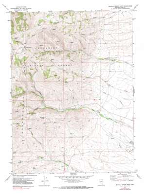
Mahala Creek West Topo Map Nevada
To zoom in, hover over the map of Mahala Creek West
USGS Topo Quad 41115c8 - 1:24,000 scale
| Topo Map Name: | Mahala Creek West |
| USGS Topo Quad ID: | 41115c8 |
| Print Size: | ca. 21 1/4" wide x 27" high |
| Southeast Coordinates: | 41.25° N latitude / 115.875° W longitude |
| Map Center Coordinates: | 41.3125° N latitude / 115.9375° W longitude |
| U.S. State: | NV |
| Filename: | o41115c8.jpg |
| Download Map JPG Image: | Mahala Creek West topo map 1:24,000 scale |
| Map Type: | Topographic |
| Topo Series: | 7.5´ |
| Map Scale: | 1:24,000 |
| Source of Map Images: | United States Geological Survey (USGS) |
| Alternate Map Versions: |
Mahala Creek West NV 1971, updated 1974 Download PDF Buy paper map Mahala Creek West NV 1971, updated 1980 Download PDF Buy paper map Mahala Creek West NV 2012 Download PDF Buy paper map Mahala Creek West NV 2015 Download PDF Buy paper map |
| FStopo: | US Forest Service topo Mahala Creek West is available: Download FStopo PDF Download FStopo TIF |
1:24,000 Topo Quads surrounding Mahala Creek West
> Back to 41115a1 at 1:100,000 scale
> Back to 41114a1 at 1:250,000 scale
> Back to U.S. Topo Maps home
Mahala Creek West topo map: Gazetteer
Mahala Creek West: Basins
Burns Basin elevation 2195m 7201′Mahala Creek West: Ranges
Independence Mountains elevation 2112m 6929′Mahala Creek West: Reservoirs
Ross Reservoir elevation 2038m 6686′Saval Reservoir elevation 1862m 6108′
Mahala Creek West: Springs
Bills Spring elevation 1995m 6545′Italian Spring elevation 2350m 7709′
Pattani Spring elevation 2241m 7352′
Spaghetti Spring elevation 2330m 7644′
Van Wyper Spring elevation 2148m 7047′
Warm Springs elevation 2041m 6696′
Mahala Creek West: Streams
Warm Creek elevation 2020m 6627′Mahala Creek West: Valleys
Road Canyon elevation 2060m 6758′Spaghetti Canyon elevation 2222m 7290′
Mahala Creek West digital topo map on disk
Buy this Mahala Creek West topo map showing relief, roads, GPS coordinates and other geographical features, as a high-resolution digital map file on DVD:


